Hawaiʻi Guide
A Hawaiian field guide · 137 islands, east to west

The Hawaiian Archipelago

137 named islands, including 8 main islands, stretch across a single volcanic chain—shaped by deep time, voyaging, chiefly kingdoms, global contact, plantation economies, war, migration and living Hawaiian culture.

Full Hawaiian archipelago. Real satellite imagery of the 137-island chain, labeled at major islands and key Northwestern Hawaiian Islands, framed tightly from Hawaiʻi Island to Kure Atoll.Hawaiʻi Island → Kure Atoll

A chain of 137 islands, now shown in real satellite view.

The State of Hawaiʻi’s official count recognizes 137 named islands. Most are tiny offshore islets, reef islets or remote Northwestern Hawaiian Islands; the larger story of the chain is most legible through the eight main islands featured below, ordered from east to west.
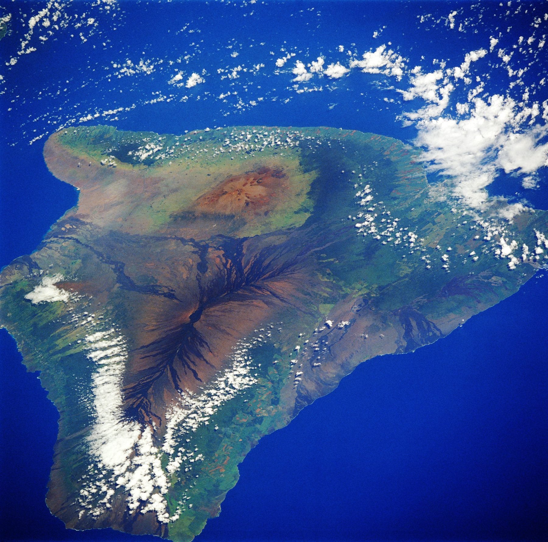
NASA satellite view of Hawaiʻi Island
NASA Johnson Space Center · public domain
01 · Easternmost

Hawaiʻi

The youngest island, still being made.

Hawaiʻi is the largest and geologically youngest of the main islands. Its mass is built from five great shield volcanoes; Mauna Loa and Kīlauea remain among the most active volcanic systems on Earth. Long before written records, Hawaiian communities developed extensive farming, fishing and religious landscapes across its districts.

The island also became the stage for pivotal events in the formation of the Hawaiian Kingdom. Captain James Cook’s first recorded contact with Hawaiians on this island came at Kealakekua Bay in 1779. Kamehameha, born in North Kohala, later defeated his rivals on Hawaiʻi and used the island as the base from which he expanded his rule across the archipelago.

  • CharacterVolcanically active
  • Historic centerKohala · Kona
  • Kingdom storyKamehameha’s home island
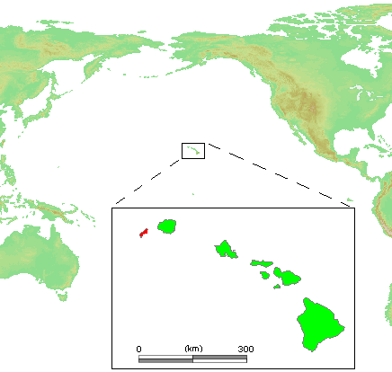
Locator map highlighting Maui in the Hawaiian Islands
Public-domain locator map · Wikimedia Commons
02

Maui

Two volcanic masses joined into one island.

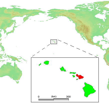
Maui grew from the older West Maui volcano and the immense Haleakalā shield, joined by the low central isthmus. In the centuries before unification, Maui was one of Hawaiʻi’s strongest political centers and repeatedly contested by rival chiefly lines.

Kamehameha invaded Maui in 1790, defeating defenders in the ʻĪao region during his campaign to unite the islands. After the kingdom was established, Lahaina became a royal residence and served as the capital of the Hawaiian Kingdom from 1820 to 1845. During the nineteenth century it also became a major Pacific whaling port, layering a global maritime town over an older Hawaiian royal landscape.

  • LandformWest Maui + Haleakalā
  • Royal eraLahaina capital, 1820–1845
  • 19th centuryWhaling crossroads
Locator map highlighting Kahoʻolawe in the Hawaiian Islands
Public-domain locator map · Wikimedia Commons
03

Kahoʻolawe

A cultural reserve marked by damage and restoration.

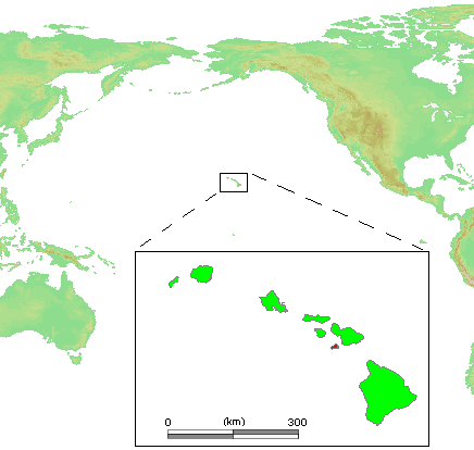
Kahoʻolawe was never an empty island. Archaeological surveys have documented thousands of cultural and historical features associated with fishing villages, agriculture, adze production, voyaging and ceremony. In the nineteenth century it was used as a penal colony and later for ranching, which accelerated erosion on the dry island.

After the attack on Pearl Harbor, Kahoʻolawe became a U.S. military bombing range. Native Hawaiian activists and the Protect Kahoʻolawe ʻOhana pushed for an end to bombing; live-fire use stopped in 1990, and the island was conveyed back to the State of Hawaiʻi in 1994. Restoration continues, while unexploded ordnance means access remains controlled.

  • Traditional roleVoyaging · ceremony · fishing
  • Military eraBombing range
  • TodayCultural & natural reserve
Kahoʻolawe is not a conventional visitor island; access is managed for cultural, stewardship and restoration purposes.
Locator map highlighting Lānaʻi in the Hawaiian Islands
Public-domain locator map · Wikimedia Commons
04

Lānaʻi

From fishing communities and pineapple to an unusually concentrated modern landholding.

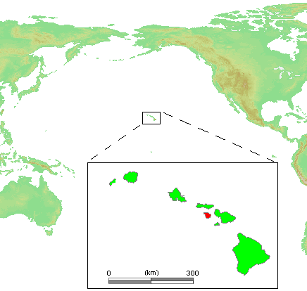
Hawaiian settlement on Lānaʻi reaches back centuries. Kaunolū, occupied since at least the 1400s, preserves the remains of a major fishing community, religious structures, petroglyphs and a place of refuge. Kamehameha I later used the area as a favored fishing retreat. Ranching followed in the nineteenth century, and in the 1920s James Dole’s Hawaiian Pineapple Company transformed much of the island into a vast plantation centered on Lānaʻi City.

Commercial pineapple production ended in 1992. In 2012 Oracle co-founder Larry Ellison purchased about 98% of Lānaʻi; the remaining land is held by the State of Hawaiʻi, Maui County and other private owners. His land-management company, Pūlama Lānaʻi, oversees much of the island’s property, utilities, conservation work and agricultural projects. Tourism is now the principal economic driver, centered on the island’s two Four Seasons resorts, while greenhouse agriculture, conservation and community services also occupy parts of the former plantation landscape.

  • Ownership≈98% Larry Ellison
  • Main economyTourism
  • Other usesAgriculture · conservation
Access: Lānaʻi is open to visitors, unlike Niʻihau, but most of the island is privately owned. Visitors should obey posted signs and avoid roads, trails or cultural sites beyond areas clearly open to the public. Only about 30 miles of road are paved, and many remote destinations require four-wheel drive or may be limited by road conditions.
NASA satellite view of Molokaʻi
NASA Johnson Space Center · public domain
05

Molokaʻi

Fishponds, valleys and a history of endurance.

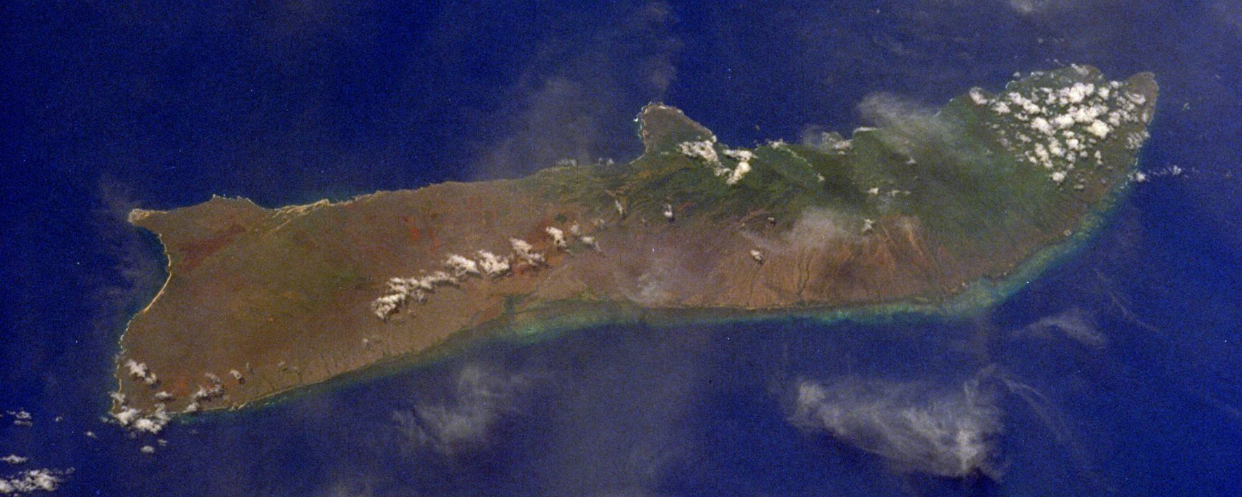
Molokaʻi’s south shore, upland valleys and isolated north coast preserve unusually visible traces of traditional Hawaiian life: habitation sites, irrigated agriculture, stone walls, heiau and fishponds. At Kalaupapa, archaeological evidence shows Hawaiian communities lived on the peninsula for many centuries before the place acquired its later, internationally known history.

Beginning in the nineteenth century, Kalaupapa was used as an isolation settlement for people affected by Hansen’s disease, creating a difficult history intertwined with the work of patients, families, caregivers and religious figures. Elsewhere, Molokaʻi remained comparatively rural, and community identity has often centered on land, subsistence, fishpond restoration and resistance to development that would overwhelm local ways of life.

  • LandscapeSea cliffs · valleys · fishponds
  • Historic placeKalaupapa
  • Modern characterStrong rural continuity
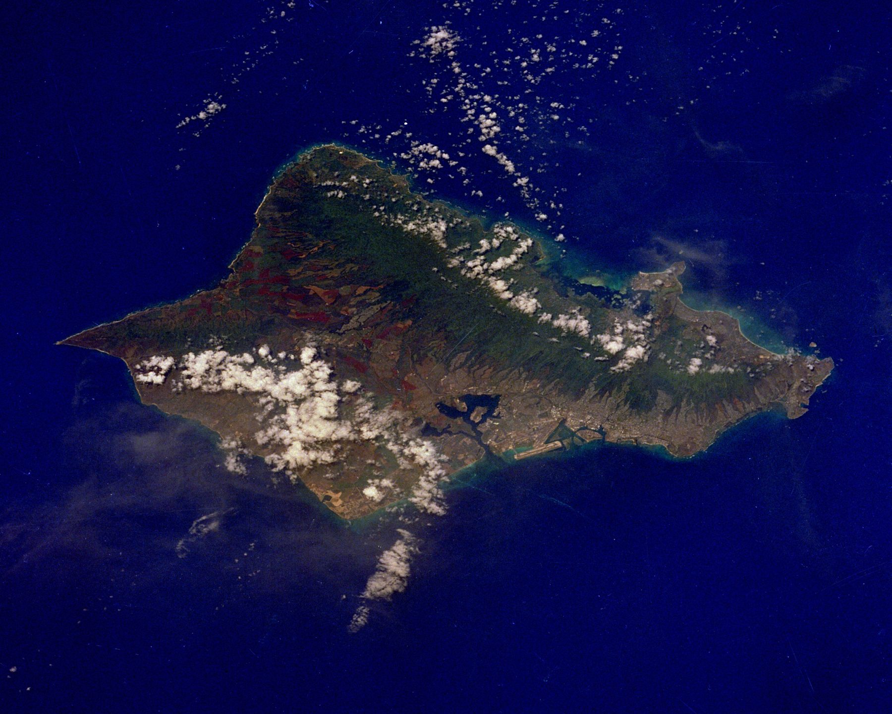
NASA satellite view of Oʻahu
NASA Johnson Space Center · public domain
06

Oʻahu

The political and urban center of modern Hawaiʻi.

Oʻahu’s broad central plain lies between the Waiʻanae and Koʻolau volcanic ranges. In 1795, Kamehameha’s forces defeated the army of Kalanikūpule in the Battle of Nuʻuanu, bringing Oʻahu under his control. Honolulu soon grew from the traditional district of Kona and harbor settlement of Kou into the kingdom’s principal port and, eventually, its permanent capital.

Oʻahu became the center of the Hawaiian monarchy, foreign commerce and later American political power. ʻIolani Palace embodies the kingdom’s nineteenth-century modernity and the 1893 overthrow of Queen Liliʻuokalani. Pearl Harbor, developed as a major U.S. naval base, then placed the island at the center of the Pacific War after the attack of December 7, 1941.

  • CapitalHonolulu
  • 1795Battle of Nuʻuanu
  • 20th centuryPearl Harbor & urban growth
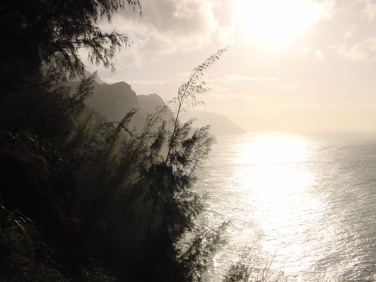
Nā Pali Coast on Kauaʻi
Nā Pali Coast · Steve Brogdon · public domain
07

Kauaʻi

An older island that held its independence longest.

Kauaʻi is deeply eroded and geologically older than the islands to its east, with great valleys and the fluted Nā Pali coast cut into ancient volcanic rock. Captain James Cook made the first well-documented European landing in Hawaiʻi at Waimea in 1778, beginning a period of increasingly frequent foreign contact.

Kauaʻi also followed a different political path during Kamehameha’s rise. Its ruler, Kaumualiʻi, avoided successful invasion and retained local rule until 1810, when he acknowledged Kamehameha’s sovereignty by agreement rather than battlefield conquest. The island later developed major sugar plantations and a multiethnic plantation society, while older Hawaiian landscapes remained visible in places such as Waimea and the north-shore valleys.

  • Recorded contactWaimea, 1778
  • Last independent rulerKaumualiʻi
  • GeologyDeeply eroded volcanic island
Locator map highlighting Niʻihau in the Hawaiian Islands
Public-domain locator map · Wikimedia Commons
08 · Westernmost

Niʻihau

A privately owned island where Hawaiian remains a community language and outside access is tightly controlled.

Niʻihau lies beyond the Kaulakahi Channel west of Kauaʻi. Elizabeth Sinclair purchased the island from the Hawaiian Kingdom in 1864 for $10,000, and ownership passed to her descendants. Today the island remains owned and operated by members of the Robinson family, principally brothers Bruce and Keith Robinson. A small Native Hawaiian community lives there, and fishing, gathering, ranch-related activity, controlled hunting and the celebrated craft of Niʻihau shell lei remain part of island life.

General public access is not permitted. Entry normally requires permission from the owners or participation in a limited authorized excursion, such as a helicopter beach visit or hunting safari; ordinary visitors cannot simply travel inland or enter the residential community. The restrictions, isolation and continuing family ties with Kauaʻi helped preserve a distinctive Niʻihau Hawaiian speech community and cultural traditions.

The island was also the site of the Niʻihau Incident of December 7–13, 1941. Japanese naval pilot Shigenori Nishikaichi, returning from the attack on Pearl Harbor, crash-landed on Niʻihau and was initially disarmed and held by residents. With help from resident Yoshio Harada, he later armed himself, took hostages and tried to recover military papers from his aircraft.

  • OwnershipRobinson family
  • AccessInvitation or authorized tour
  • 1941Niʻihau Incident
Present-day use remains deliberately limited: the island is a private home community and working landscape rather than a normal visitor destination. Offshore sightseeing does not by itself grant permission to land.
The chain beyond Niʻihau

The Northwestern Hawaiian Islands

The same volcanic ridge continues northwest for more than a thousand miles through isolated basalt islands, coral atolls and reefs. The sections below add every major Northwestern Hawaiian landform for which a useful government or public-domain photograph or satellite image is available.

About the numbers: Hawaiʻi’s official 137-island total is based on a historical state geographic-names count: 8 main islands, 96 named offshore islets around them, and 33 Northwestern Hawaiian islets. That puts Nihoa at #105. Atolls are shown as ranges because the official count treats their individual islets separately; low sand islets can appear, disappear or merge over time, so today’s physical island count is not always identical to the older 137-island convention.
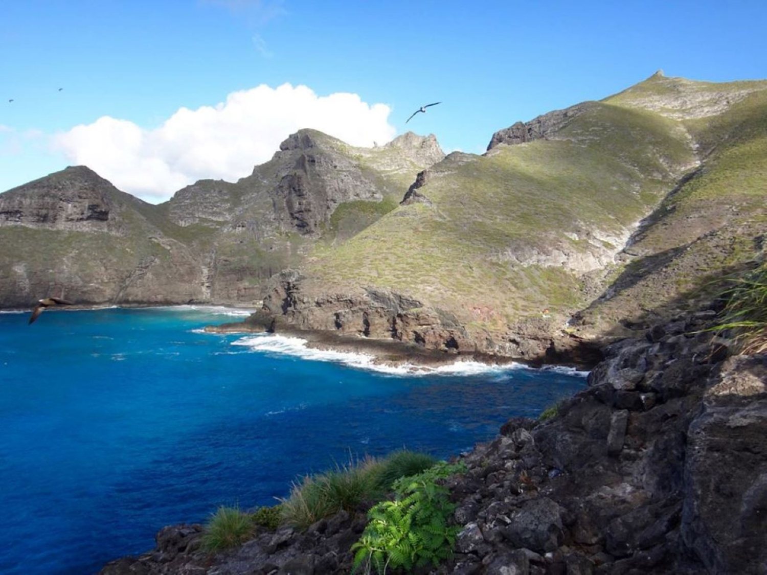
Nihoa Island rising steeply from the Pacific Ocean
Nihoa · U.S. Fish & Wildlife Service · public domain
105 · of 137

Nihoa

The first high island beyond the main chain — steep, green and archaeologically rich.

About 150 miles northwest of Kauaʻi, Nihoa is a wedge of basalt with sea cliffs rising to roughly 900 feet. Unlike the low coral islands farther northwest, it still looks unmistakably volcanic. Native Hawaiians lived and worked here before Western contact; surveys have documented more than 80 cultural sites, including terraces, house platforms, agricultural features and ceremonial places.

Its isolation also produced an unusually concentrated set of endemic species. The Nihoa finch and Nihoa millerbird occur nowhere else, and the island supports rare native plants including a loulu fan palm and ʻohai. Landing is tightly restricted to permitted cultural and scientific work because the ecosystem and archaeological landscape are exceptionally fragile.

  • Hawaiian nameNihoa
  • LandformBasalt island
  • AccessPermit only
The official 137-island sequence reaches Nihoa only after the 8 main islands and 96 named offshore islets around them — making it #105 in an east-to-west ordering.
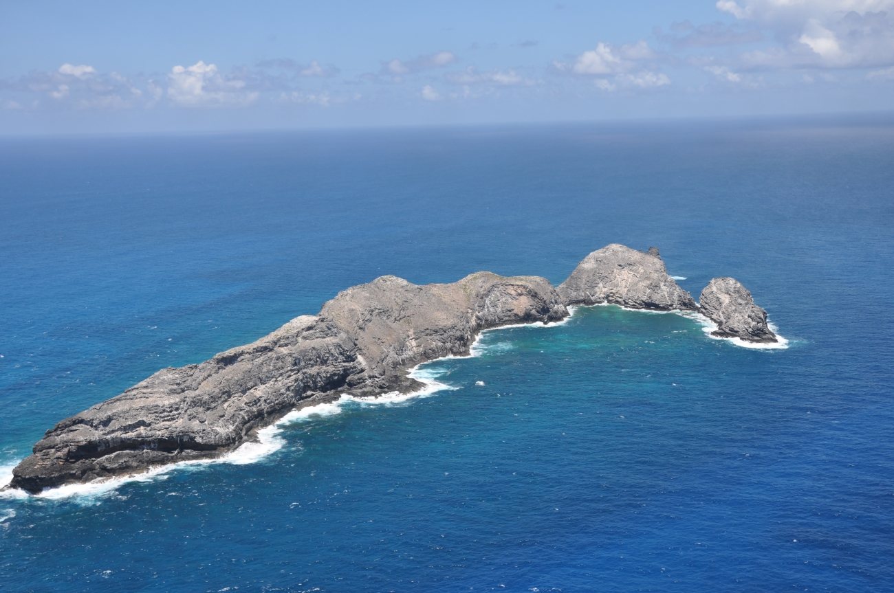
Aerial photograph of Mokumanamana in the Northwestern Hawaiian Islands
Mokumanamana · U.S. Fish & Wildlife Service · public domain
106 · of 137

Mokumanamana

A barren basalt island near the Tropic of Cancer with an extraordinary ceremonial landscape.

Mokumanamana, historically called Necker Island in English, is only about 46 acres and has almost no soil, fresh water or agricultural potential. Yet Native Hawaiian cultural sites run along its rocky spine. Archaeologists have documented 33 heiau or ceremonial structures, many with upright stones — the densest concentration of such shrines anywhere in the Hawaiian archipelago.

The island lies just north of the Tropic of Cancer, along the traditional pathway called Ke Ala Polohiwa a Kāne. Hawaiian cultural interpretation connects this latitude and Mokumanamana with the transition between Ao, the realm of light and the living, and Pō, the realm of darkness, ancestors and origins. Today access is limited to permitted research and cultural practice.

  • Hawaiian nameMokumanamana
  • Ceremonial sites33 heiau
  • SettingNear Tropic of Cancer
Its lack of water makes long-term settlement difficult; the archaeological record points strongly toward repeated ceremonial and voyaging-related use.
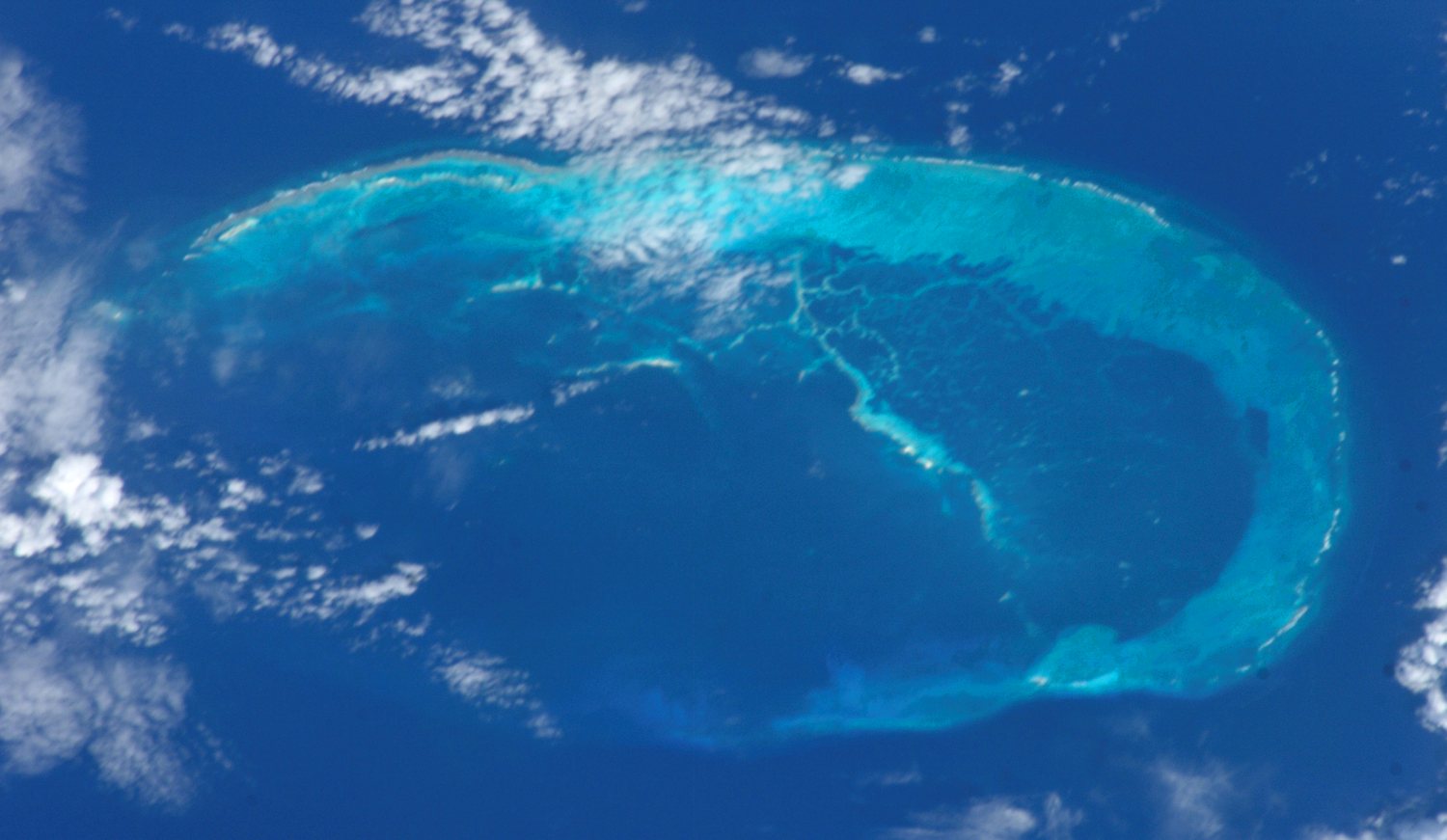
Satellite view of French Frigate Shoals in the Northwestern Hawaiian Islands
French Frigate Shoals · NASA / ISS imagery · public domain
107–119 · 13-islet cluster

French Frigate Shoals

Lalo — a broad crescent reef where volcanic rock, shifting sand and wildlife meet.

French Frigate Shoals, known today in Hawaiian as Lalo and also associated historically with Kānemilohaʻi, is an open crescent-shaped atoll roughly 20 miles across. Almost the entire volcano has sunk beneath the sea; La Pérouse Pinnacle, a steep basalt spire, is the last conspicuous remnant. The historical 137-island count assigns 13 named islets or rock islands to this cluster.

The shoals are among Hawaiʻi’s most important wildlife habitats. For decades more than 90 percent of the Hawaiian green turtle population nested here, and the atoll remains critical monk-seal habitat. Tern Island was enlarged into a World War II airfield and later supported a research station. In 2018 Hurricane Walaka nearly erased low-lying East Island, a vivid example of how quickly atoll geography can change.

  • Hawaiian nameLalo
  • Historic count13 islets
  • WildlifeHonu · monk seals
Because its sand islets shift with storms, a historical “13-island” count should not be read as a promise that 13 stable pieces of dry land exist at any given moment.
Gardner Pinnacles rising from the ocean
Gardner Pinnacles · Andy Collins / NOAA · public domain
120–121 · two pinnacles

Gardner Pinnacles

Pūhāhonu — two exposed basalt summits above an immense drowned volcano.

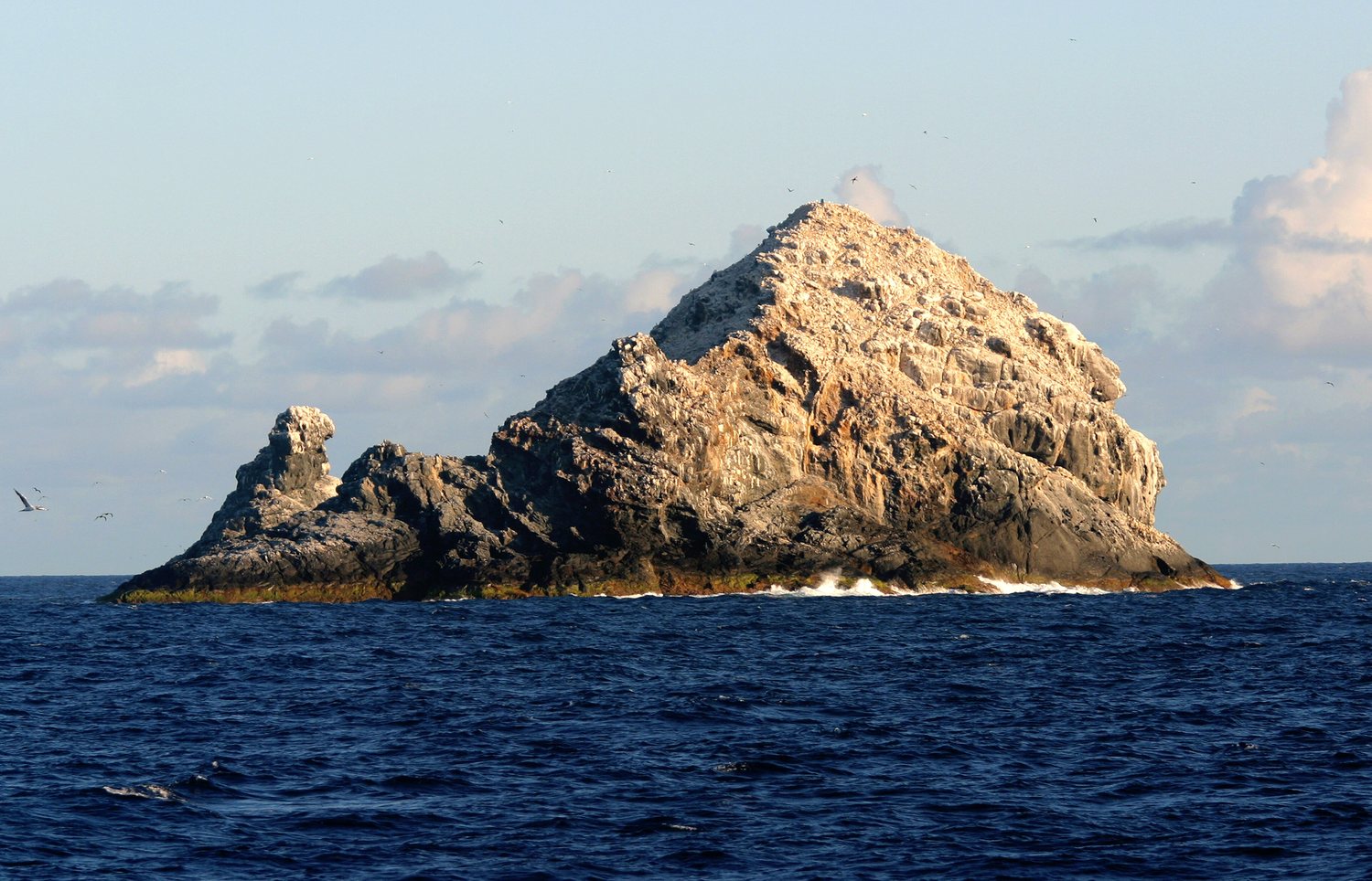
Gardner Pinnacles consists of two jagged volcanic rocks totaling only about five acres of dry land. Their Hawaiian name, Pūhāhonu, is commonly translated as “turtle surfacing for air.” The rocks are the visible summit of a huge extinct shield volcano surrounded by broad underwater shelves and reef habitat.

A 2020 geologic reassessment estimated that Pūhāhonu contains about 150,000 cubic kilometers of volcanic rock, making it a contender for the world’s largest shield volcano by volume. On the tiny exposed rocks, seabirds dominate; sea purslane is essentially the only vascular plant, while giant ʻopihi cling to the wave-washed margins.

  • Hawaiian namePūhāhonu
  • Dry land≈5 acres
  • Official count2 pinnacles
The two exposed rocks occupy #120 and #121 in the historical 137-island convention.
NOAA true-color satellite mosaic of Maro Reef
Maro Reef · NOAA NCCOS satellite mosaic · public domain
Between #121 and #122 · reef feature

Maro Reef

Koʻanakoʻa — the volcanic chain dips completely beneath the ocean before land reappears at Laysan.

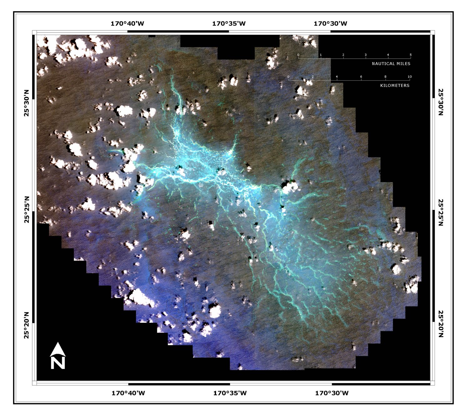
Maro Reef is not a durable island, so it does not receive its own number in the 137 named-island sequence. Geographically, however, it is too important to skip: it is the largest coral reef system in the Northwestern Hawaiian Islands, spreading across roughly 746 square miles between Gardner Pinnacles and Laysan.

Instead of forming a clean circular atoll, its reefs radiate outward like spokes from the center of a wheel. The maze of shallow coral, sandy lagoons, patch reefs and ocean pinnacles is exceptionally rich but difficult to navigate and study. At very low water a little rubble may break the surface, but Maro has no lasting terrestrial ecosystem.

  • Hawaiian nameKoʻanakoʻa
  • TypeSubmerged reef
  • NumberNot a durable island
Maro explains one of the gaps in the visual story: the Hawaiian Ridge remains continuous underwater even where no stable named island rises above sea level.
Aerial view of Laysan Island and its central hypersaline lake
Laysan Island · Dan Polhemus / U.S. Fish & Wildlife Service · public domain
122 · of 137

Laysan

Kamole — a low coral island wrapped around one of Hawaiʻi’s rare natural lakes.

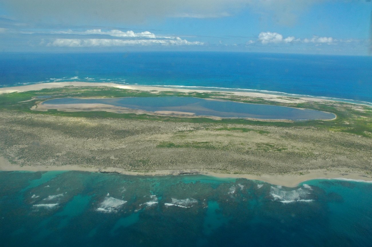
Laysan is one of the largest pieces of dry land in the Northwestern Hawaiian Islands, about 1,000 acres, with a broad hypersaline lake occupying its center. The lake is unique in the Hawaiian archipelago and rare across the Pacific. The island is now a major seabird and waterbird sanctuary, including habitat for the endangered Laysan duck and endemic Laysan finch.

Its recovery followed one of the chain’s worst ecological collapses. Guano mining, feather hunting and introduced rabbits stripped away vegetation in the late nineteenth and early twentieth centuries. Several endemic birds disappeared, including the Laysan rail, honeycreeper and millerbird. After rabbits were eliminated, native vegetation and wildlife slowly rebounded under long-term protection.

  • Hawaiian nameKamole / Kauō
  • Signature featureHypersaline lake
  • EndemicsLaysan duck · finch
The island remains closed to ordinary visitation; entry within the Hawaiian Islands National Wildlife Refuge is by permit.
Field camp and beach on Lisianski Island
Lisianski Island · NOAA Fisheries · public domain
123 · of 137

Lisianski

Kapou — a low sandy island beside the enormous reef platform of Neva Shoals.

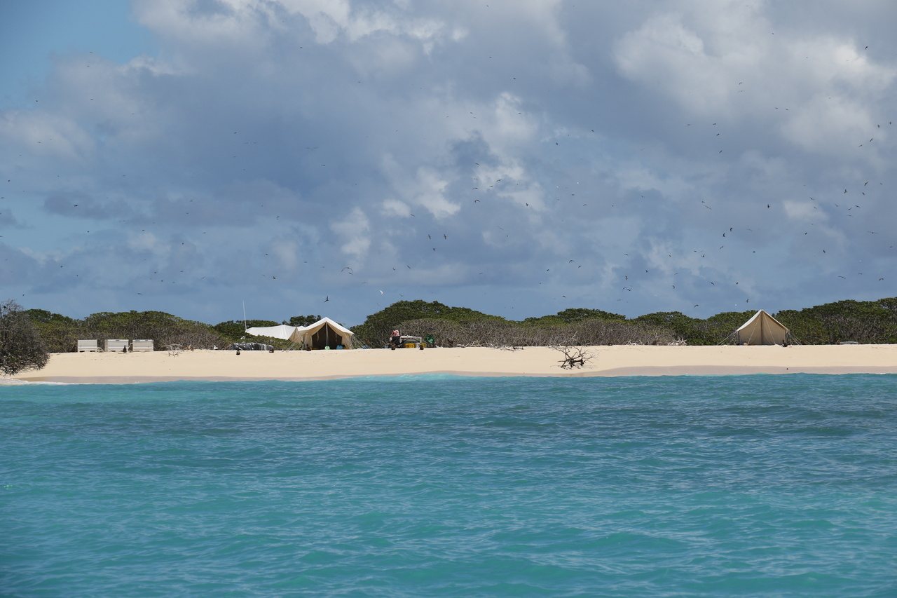
Lisianski is only about 381 acres and rises to roughly 40 feet at its highest dune, but the surrounding Neva Shoals reef is enormous — nearly the size of Oʻahu. Russian captain Yuri Lisianskii encountered the island after grounding nearby in 1805, giving rise to the modern English name.

The nineteenth and early twentieth centuries brought mice, rabbits and catastrophic feather hunting; more than a million birds were killed before stronger federal protection arrived. Today the beaches are used by Hawaiian monk seals and green turtles, while immense seabird colonies occupy the interior. Scientists have called its nearby reefs “coral gardens” for their abundance and diversity.

  • Hawaiian nameKapou / Papaʻāpoho
  • Dry land≈381 acres
  • Nearby reefNeva Shoals
Like Laysan, Lisianski is uninhabited and normally accessible only through permitted conservation, scientific or cultural work.
Southeast Island at Pearl and Hermes Atoll
Pearl and Hermes Atoll · U.S. Fish & Wildlife Service · public domain
124–130 · seven-islet historic count

Pearl and Hermes Atoll

Manawai — a huge living reef with a handful of low, mobile sand islands.

Pearl and Hermes is a true atoll: almost all of it is underwater, with only small sand and coral-rubble islets rising above a vast reef and lagoon. The historical 137-island convention counted seven islets here, although modern surveys may show fewer persistent islands because storms continually reshape the sand. Current Hawaiian usage includes the name Manawai; Holoikauaua also appears in historical sources.

The English name comes from two whaling ships, Pearl and Hermes, wrecked on the reef in 1822. King Kamehameha III claimed the atoll in 1854. Its reefs support exceptionally high fish biomass and endemic reef fishes, along with monk seals, turtles and seabirds. Black-lipped pearl oysters were heavily harvested in the 1920s until the fishery was closed in 1929.

  • Hawaiian nameManawai
  • Historic count7 islets
  • English name1822 shipwrecks
Modern USGS work has documented fewer persistent islands than the old seven-islet count — another reason the “137” total is best treated as a historical naming convention.
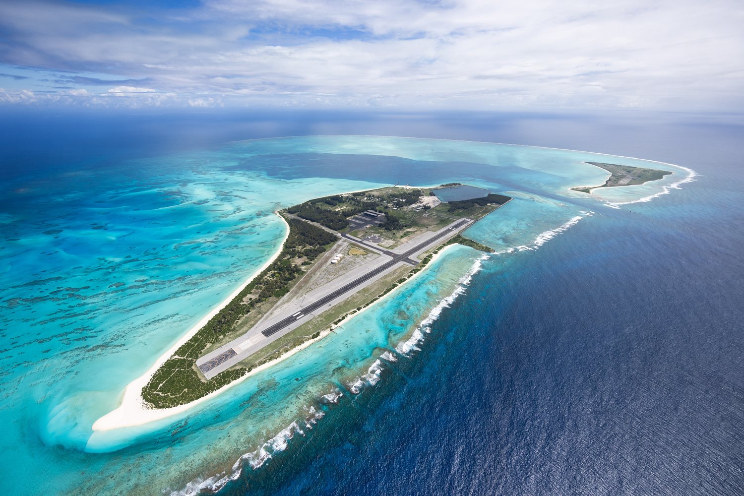
Aerial view of Midway Atoll with Sand Island and Eastern Island
Midway Atoll · Jon Brack / U.S. Fish & Wildlife Service · public domain
131–135 · five-island historic count

Midway Atoll

Kuaihelani / Pihemanu — wildlife refuge, aviation landmark and one of the decisive sites of World War II.

Midway’s modern landscape is dominated by Sand, Eastern and Spit islands, but the older state count behind the 137-island convention lists five Midway islands. Midway is geographically part of the Hawaiian archipelago but is not part of the State of Hawaiʻi; it is an unincorporated U.S. territory administered through the U.S. Fish & Wildlife Service.

Before World War II, Midway served as a trans-Pacific cable station and a Pan American Clipper stop. The Battle of Midway, June 4–6, 1942, became a turning point in the Pacific War. Today the atoll is both a National Wildlife Refuge and the Battle of Midway National Memorial. It also holds the world’s largest Laysan albatross colony. Wisdom, the oldest known wild bird at about 75 years old, was still returning to Midway in 2026.

  • Hawaiian namesKuaihelani · Pihemanu
  • Political statusNot part of Hawaiʻi state
  • TodayRefuge · national memorial
The refuge and memorial are currently closed to ordinary public visitation; access is limited to permitted activities supporting conservation and operations.
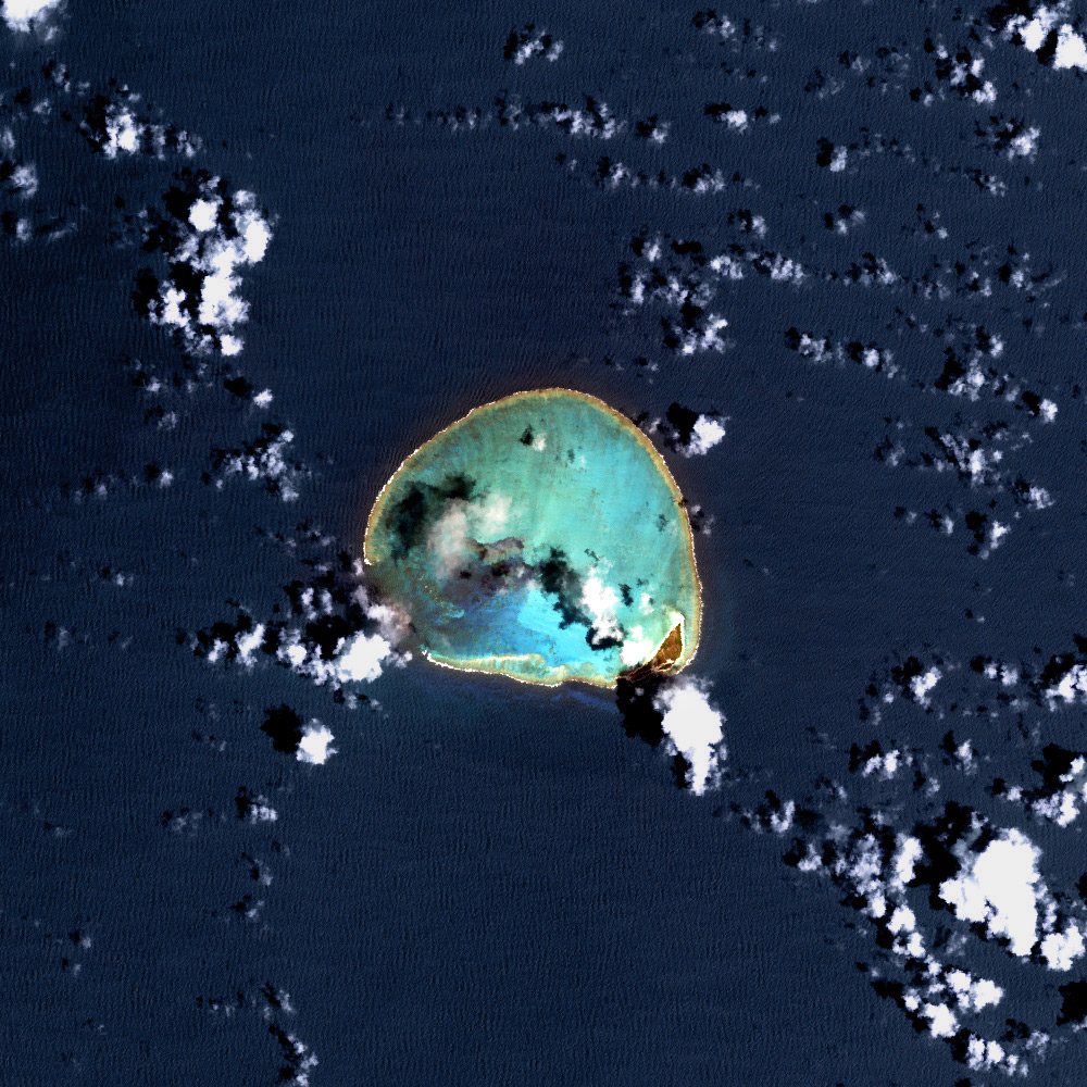
Satellite image of Kure Atoll at the northwestern end of the Hawaiian archipelago
Kure Atoll · NASA / USGS Landsat imagery · public domain
136–137 · end of the 137 count

Kure Atoll

Hōlanikū — the northwestern end of the exposed Hawaiian chain and the northernmost coral atoll on Earth.

Kure lies about 55 miles west-northwest of Midway and forms the last emergent atoll in the Hawaiian chain. Its reef sits near the “Darwin Point,” the latitude where cooler water makes coral growth barely able to keep pace with the gradual sinking of the underlying volcano. Farther northwest, the older Hawaiian-Emperor volcanoes have already drowned into seamounts.

Green Island, the atoll’s permanent island, once supported a U.S. Coast Guard LORAN navigation station and a 4,000-foot runway; the station closed in the early 1990s. Today it is managed as the State of Hawaiʻi’s Kure Atoll Wildlife Sanctuary, with Kure Atoll Conservancy supporting habitat restoration, seabird and monk-seal monitoring, invasive-species control and field operations.

  • Hawaiian nameHōlanikū / Moku Pāpapa
  • PositionNorthwesternmost
  • ManagementState wildlife sanctuary
The old 137-island convention reaches its final two count positions at Kure; only Green Island is a permanent substantial island today, while small sand features can change with waves and storms.