Hawaiʻi Guide
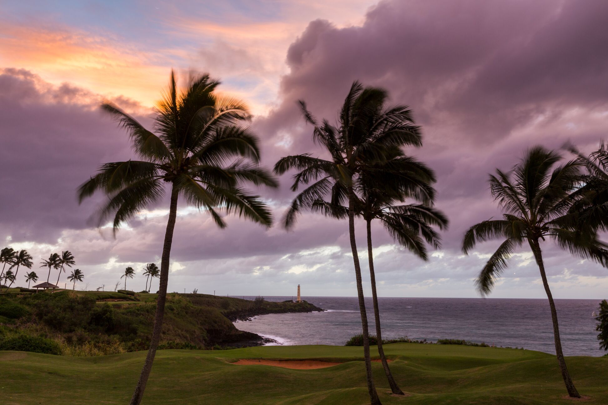
Silhouetted palm trees on a manicured lawn at twilight, with the white tower of the Ninini Point lighthouse on a dark headland across the bay under purple and orange clouds

Kauaʻi · County seat · East Side

Līhuʻe

Kauaʻi’s county seat, airport and harbor town. Most visitors land here, pick up a car and head somewhere else. This guide covers the town itself and what lies within about 30 minutes, from Wailua in the north-east to Poʻipū in the south.

Ninini Point lighthouse at twilight · Photo: Hawaii Tourism Authority (HTA) / Tor Johnson

The town

Where Kauaʻi does its paperwork

Līhuʻe is the seat of Kauaʻi County and the island’s commercial hub. It has the airport, the island’s main deep-water harbor and its largest shopping center, and it is a working town rather than a resort.

Its name is usually translated “cold chill,” for the cool winds across the land. The town grew around the Līhuʻe Plantation sugar mill, established in 1849, and Rice Street, its main thoroughfare, still holds the Kauaʻi Museum and the county’s civic buildings.

Nothing here needs more than a day. The town’s value is position: Wailua and Kapaʻa lie a short drive north, Kōloa and Poʻipū a little farther south-west, and most of the island is an easy day trip.

  • 1849year the Līhuʻe Plantation was founded
  • ≈ 7 mito Kapaʻa on Route 56
  • ≈ 12 mito Kalāheo on Route 50
  • ≈ 1.5 mifrom town to the airport, east along Ahukini Road

Sources: Hawaiian Encyclopedia, Līhuʻe · Wikipedia, Līhuʻe · Hawaiʻi Airports, LIH. Route mileage is from the Wikipedia article; the airport distance is from Hawaiʻi Airports.

The hub

What’s within reach of the airport

Rough driving times from Līhuʻe Airport in light traffic. They are approximate and run longer at rush hour, especially on the Kapaʻa side.

  1. 6min
    Līhuʻe town

    Airport to the downtown core

  2. 15min
    Wailua

    River, Fern Grotto, ʻOpaekaʻa

  3. 25min
    Kōloa

    Old town and the Tree Tunnel

  4. 30min
    Poʻipū

    Beaches, Spouting Horn, Allerton

  5. 1hour
    Princeville

    The start of the north shore

Sources: Hawaii-guide.com, Līhuʻe · Līhuʻe Airport FAQ (unofficial site). Third-party figures; use a routing app for live times.

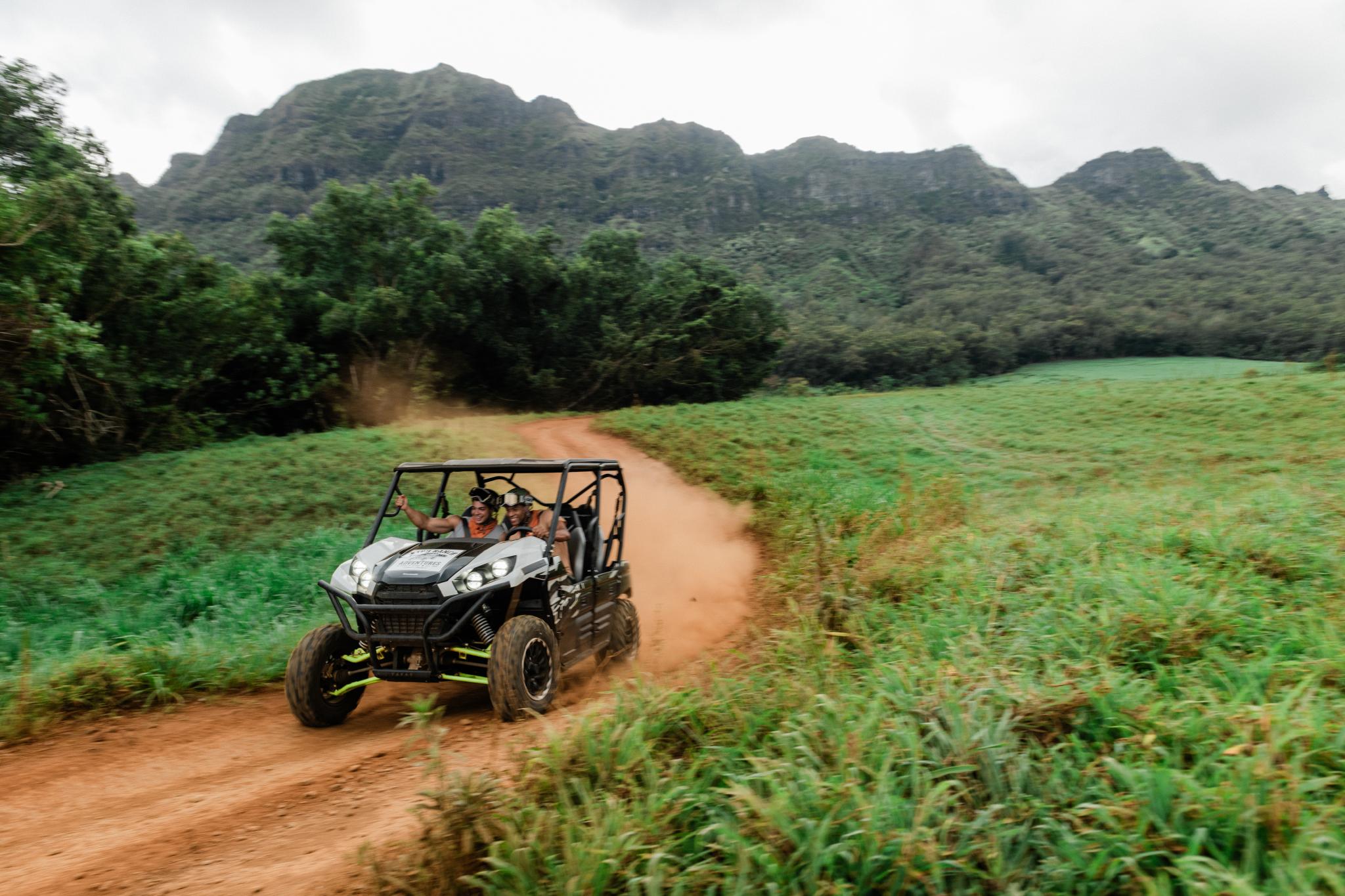
Two people laughing in an ATV kicking up red dust on a dirt track through green pasture, with a steep forested mountain ridge behindPhoto: Hawaii Tourism Authority (HTA) / John Hook

Downtown

Kauaʻi Museum and Rice Street

A short walk along Rice Street takes in the museum, the old county buildings and a few places to eat.

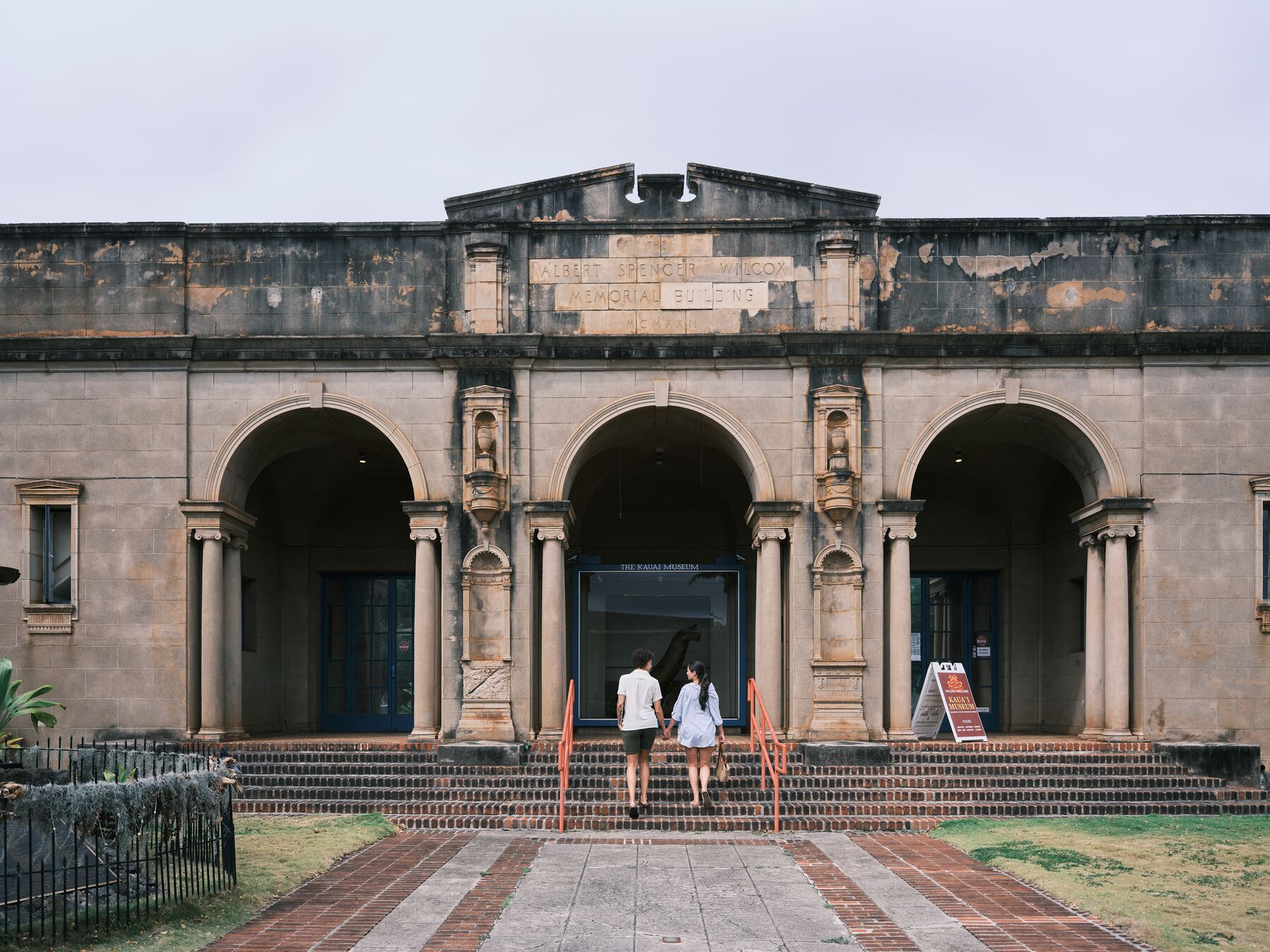
The stone front of the Kauaʻi Museum in Līhuʻe, with three arched entries and two visitors walking up the stepsPhoto: Hawaii Tourism Authority (HTA) / Ben Ono
The Wilcox Building’s arched front, on Rice Street. HTA lists this as the Kauaʻi Museum.
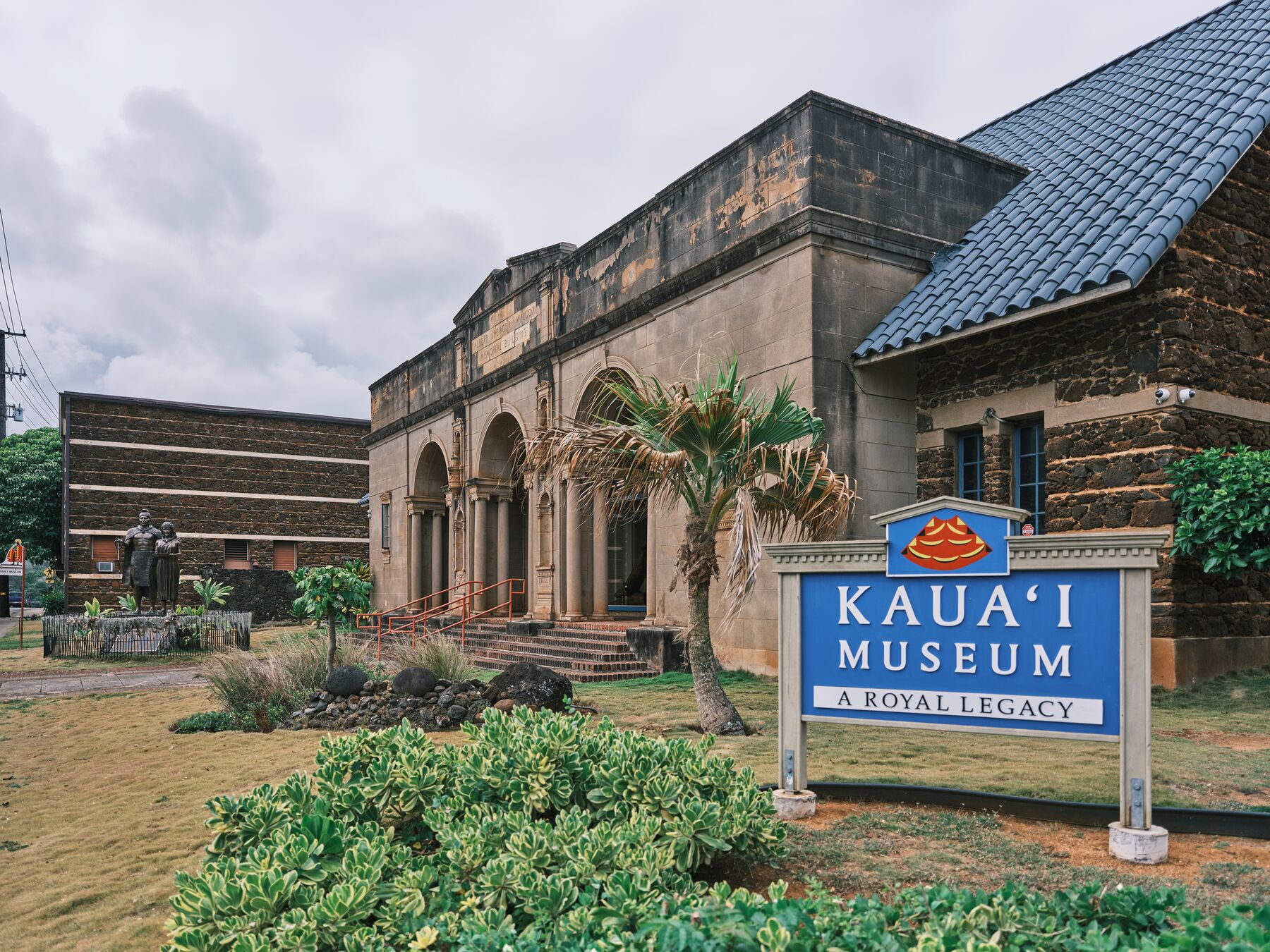
The blue “Kauaʻi Museum – A Royal Legacy” sign in front of the museum’s dark stone arches and blue roof, under an overcast skyPhoto: Hawaii Tourism Authority (HTA) / Ben Ono
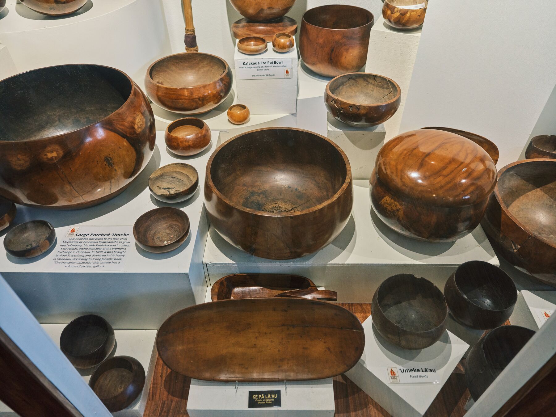
A display of polished wooden ʻumeke bowls in a museum casePhoto: Hawaii Tourism Authority (HTA) / Ben Ono

The museum

The Kauaʻi Museum is at 4428 Rice Street. It opened in 1960 and occupies the Albert Spencer Wilcox Building, a 1924 former library, and the newer Rice Building. Its galleries cover Hawaiian culture and the island’s history, including a royal-legacy theme, and it makes a good orientation to the island before you start driving.

Hours, admission and tour times change, so check the museum’s website before you go.

Around it

Rice Street is the town’s main thoroughfare. Kukui Grove Center, on Route 50 just west of downtown, is the island’s largest shopping center, with supermarkets and everyday stores.

The county’s Līhuʻe civic center is here too, which is why the town fills with local business on weekdays and empties out in the evenings.

Sources: Kauaʻi Museum · Hawaiian Encyclopedia, Līhuʻe · Hawaii-guide.com, Līhuʻe.

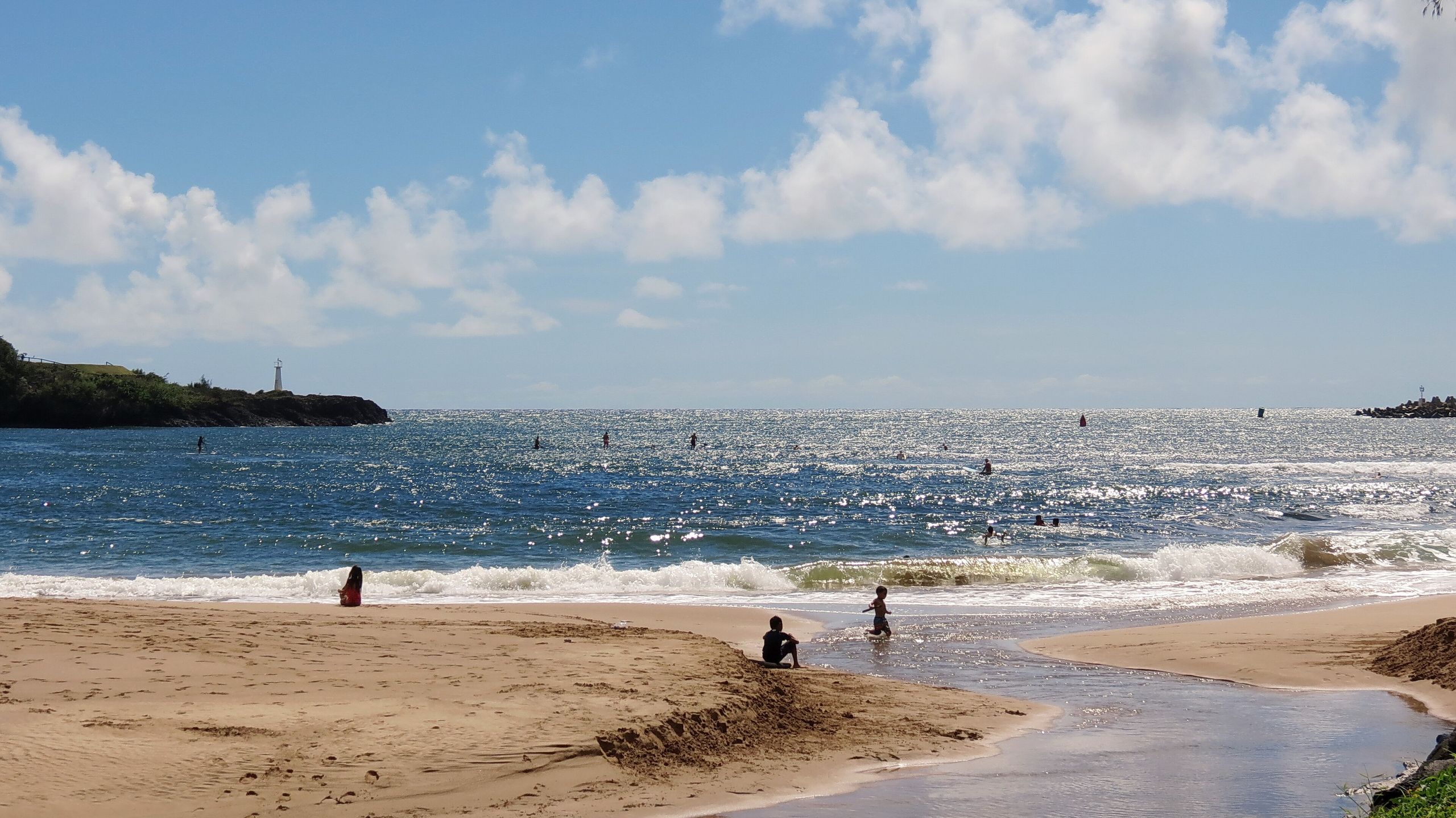
Nāwiliwili Beach Park: a small stream crosses the sand into the bay, with paddleboarders offshore and the Ninini Point lighthouse on the headland at left Photo: Bob Linsdell / Wikimedia Commons · CC BY 3.0

02 · The waterfront

Nāwiliwili and Kalapaki

The island’s working harbor, a small bay beside it, and the lighthouse on the next point.

Nāwiliwili Bay lies south-east of downtown and holds Kauaʻi’s main deep-water harbor. A long breakwater shelters cargo ships and fishing boats, and the harbor, which opened in 1930, is also the island’s cruise-ship port.

Kalapaki Beach is the small, sheltered beach at the head of the bay, in front of a hotel. It is a pleasant place to sit and watch the harbor. Water conditions vary. If you go in, choose a spot with a lifeguard on duty, read the flags, and stay out of murky water and stream mouths, especially after rain.

Ninini Point is the headland to the north, topped by a 72-foot concrete lighthouse built in 1932 and owned by the U.S. Coast Guard. Older guides describe driving in by a gate beside the runway and a golf course, and public access has varied over the years, so confirm before you go. The lighthouse is also visible from the golf-course grounds nearby, as in the twilight photo at the top of this page.

  • The harbor is a working port. Cargo, fishing boats and cruise ships share it.
  • Kalapaki has a hotel, shops and restaurants next to the sand, so it is an easy stop from the airport.
  • Beach conditions and safety information: kauai.gov/Visitors/Beaches.

Sources: Hawaiian Encyclopedia, Līhuʻe · Lighthouse Friends, Nāwiliwili · State Ocean Safety.

Plantation Līhuʻe

Kilohana and Grove Farm

Two estates that show what sugar built here.

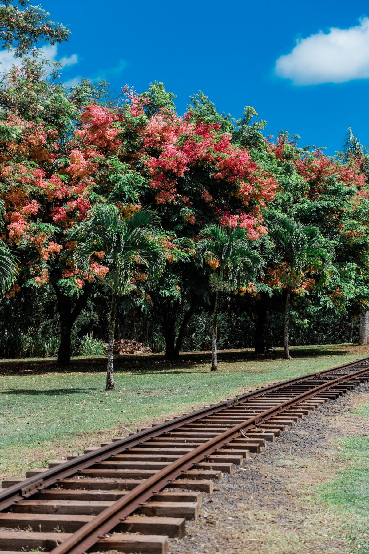
Narrow-gauge railway tracks curving through a green lawn beside flowering treesPhoto: Hawaii Tourism Authority (HTA) / John Hook
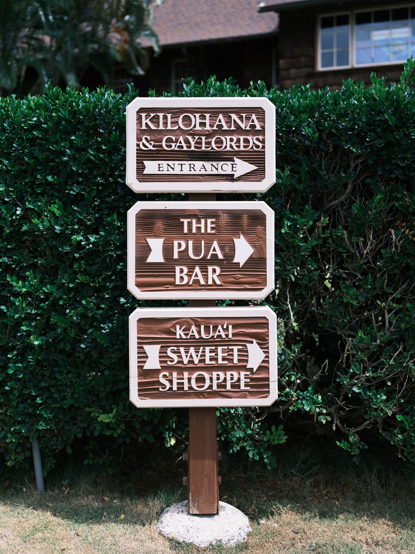
A wooden signpost at the Kilohana and Gaylord’s entrance, with arrows for The Pua Bar and Kauaʻi Sweet ShoppePhoto: Hawaii Tourism Authority (HTA) / Ben Ono
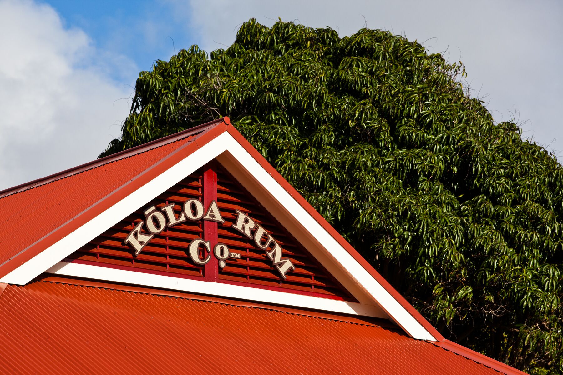
The red-roofed gable of the Kōloa Rum Co. building against a large green treePhoto: Hawaii Tourism Authority (HTA) / Tor Johnson
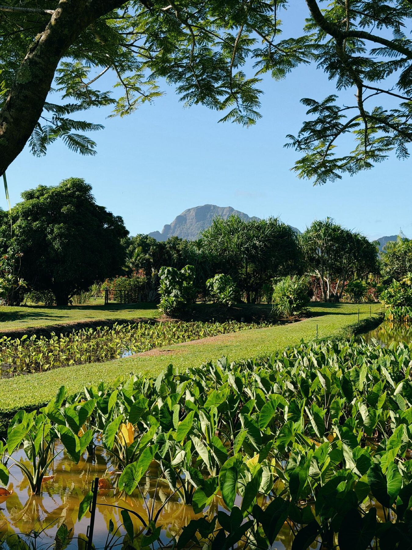
A flooded taro patch with heart-shaped leaves and grassy banks, with a jagged green peak behindPhoto: Hawaii Tourism Authority (HTA) / Blake Abes

Kilohana Plantation

A 105-acre estate on Kaumualiʻi Highway, centered on a 1935 mansion built for Gaylord Wilcox. Over the years it has included shops, a restaurant, a rum tasting room, a railway tour and taro fields. Its rail line, lawns and old buildings make it the most polished of the island’s plantation sites.
Kōloa Rum Company

A rum maker whose Līhuʻe tasting room sits on the Kilohana grounds, in the red-roofed building pictured above. The rum is made from Hawaiian-grown sugarcane.

Grove Farm Museum

A preserved sugar-plantation homestead at 4050 Nāwiliwili Road. It has typically been visited on guided tours arranged in advance, so contact them to ask about visiting.

Sources: Kilohana · Grove Farm Museum · Hawaii-guide.com, Līhuʻe. Visiting arrangements change, so check with each site.

Inland from the harbor

Hulēʻia, Alakoko and Kipu

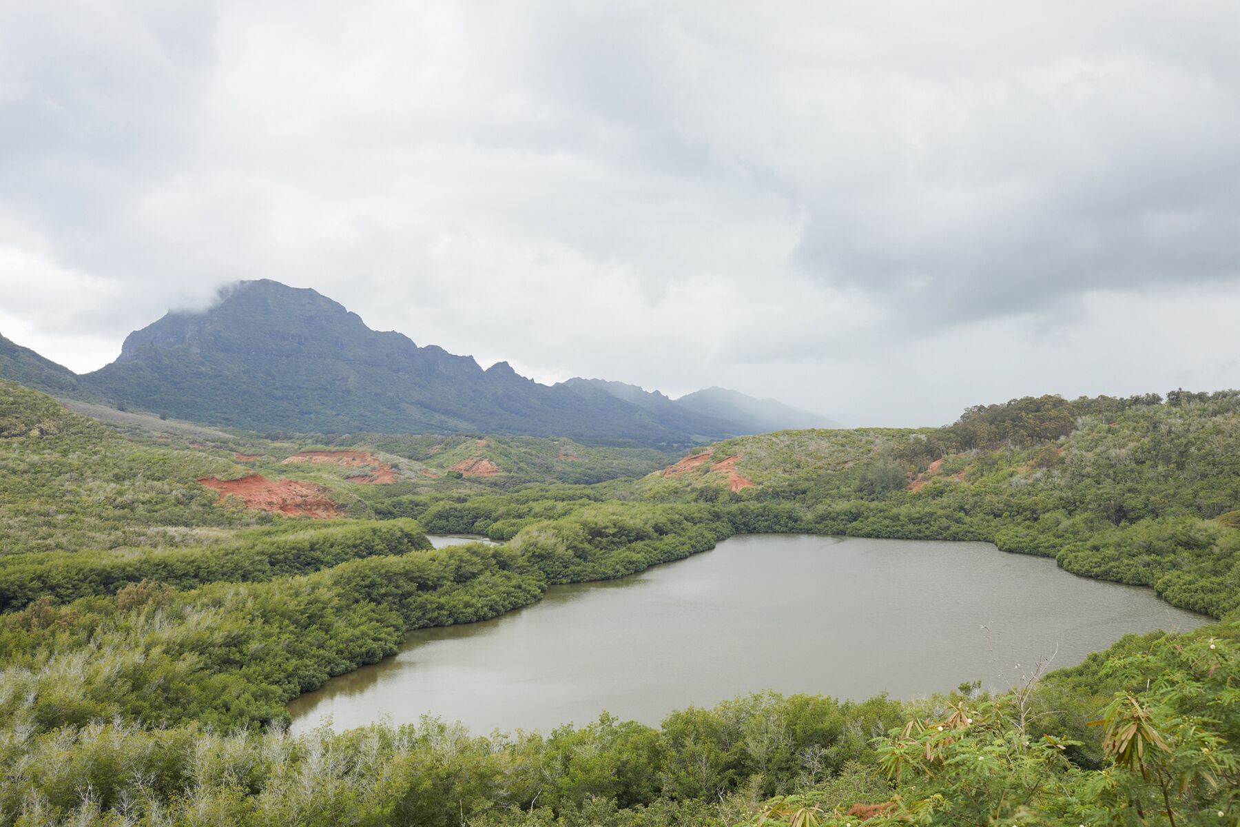
A quiet river valley just behind Nāwiliwili, with an ancient fishpond and a ranch below the Hāʻupu ridge.

Alakoko (Menehune) Fishpond seen from above, with green hills under a cloudy skyPhoto: Hawaii Tourism Authority (HTA) / Daeja Fallas
Alakoko (Menehune) Fishpond, in the Hulēʻia valley.
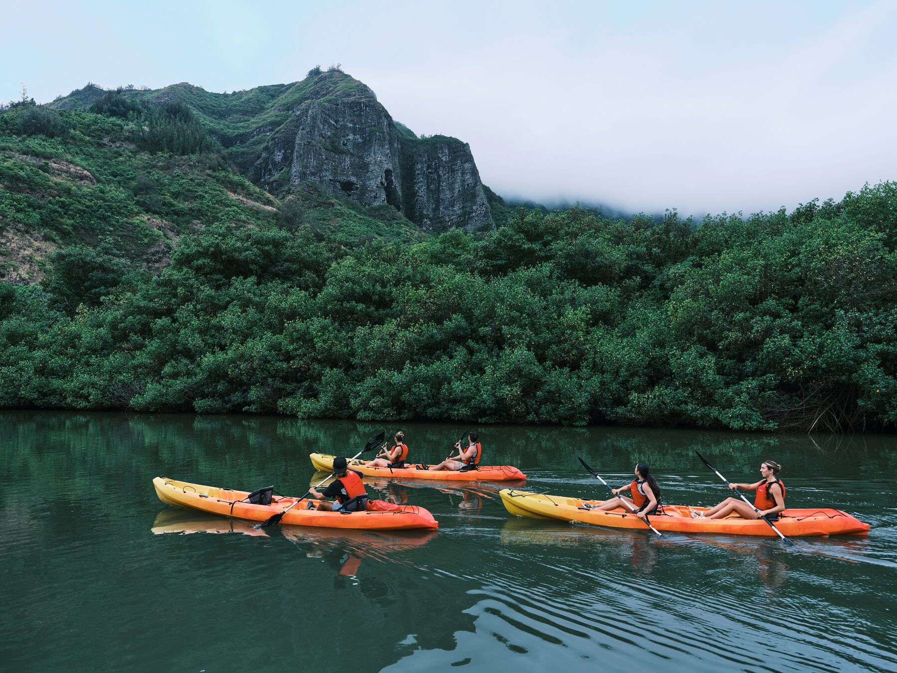
Two orange tandem kayaks on the still, dark water of Hulēʻia Stream, with a misty green peak behindPhoto: Hawaii Tourism Authority (HTA) / Ben Ono
A guided kayak tour on Hulēʻia Stream.
A woman beside a small waterfall at the foot of a rocky green cliffPhoto: Hawaii Tourism Authority (HTA) / John Hook
A waterfall on a Kipu Ranch Adventures ATV tour.

Alakoko (Menehune) Fishpond

Alakoko is an old walled fishpond on the Hulēʻia River. Legend credits the Menehune with building it in a single night. It is seen from a roadside overlook on Hulemalu Road, where parking is limited, and the pond itself is not a place to visit on foot. The valley is part of the Hulēʻia National Wildlife Refuge, which is not open to the public.

The valley’s outings

Guided kayak, zipline, tubing and ATV outings have long been based in this valley and on Kipu Ranch land below the Hāʻupu range. These are run by private operators, so check each one directly for availability and to book.

Sources: U.S. Fish & Wildlife Service, Hulēʻia NWR.

Eating

Food and markets

Līhuʻe is where locals shop and eat, so the food is plain, good value and worth a stop. Hamura Saimin, on Kress Street, is the town’s best-known noodle-soup counter. Saimin is the island-style noodle soup that grew out of Hawaiʻi’s plantation-era mix of cultures.

Kukui Grove Center has the main supermarkets and everyday stores, and a bakery. For fresh produce, Kauaʻi’s county farmers markets rotate around the island through the week, including Līhuʻe, Kapaʻa and Poʻipū; the county publishes the current schedule.

Restaurants and markets change their days and hours, so check before you go.

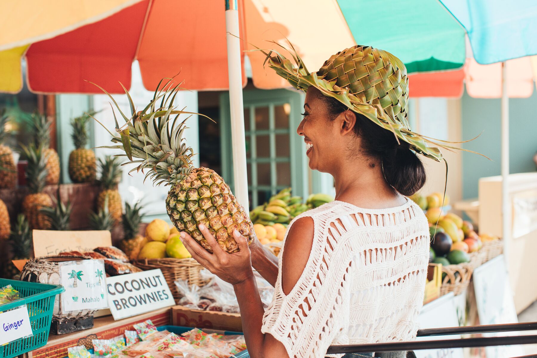
A smiling woman in a palm-frond hat holding a large pineapple at a farmers-market stall with a colorful umbrellaPhoto: Hawaii Tourism Authority (HTA) / Mark Kushimi

Sources: County of Kauaʻi · Hawaii-guide.com, Līhuʻe. The farmers-market photo is labeled Kapaʻa by HTA.

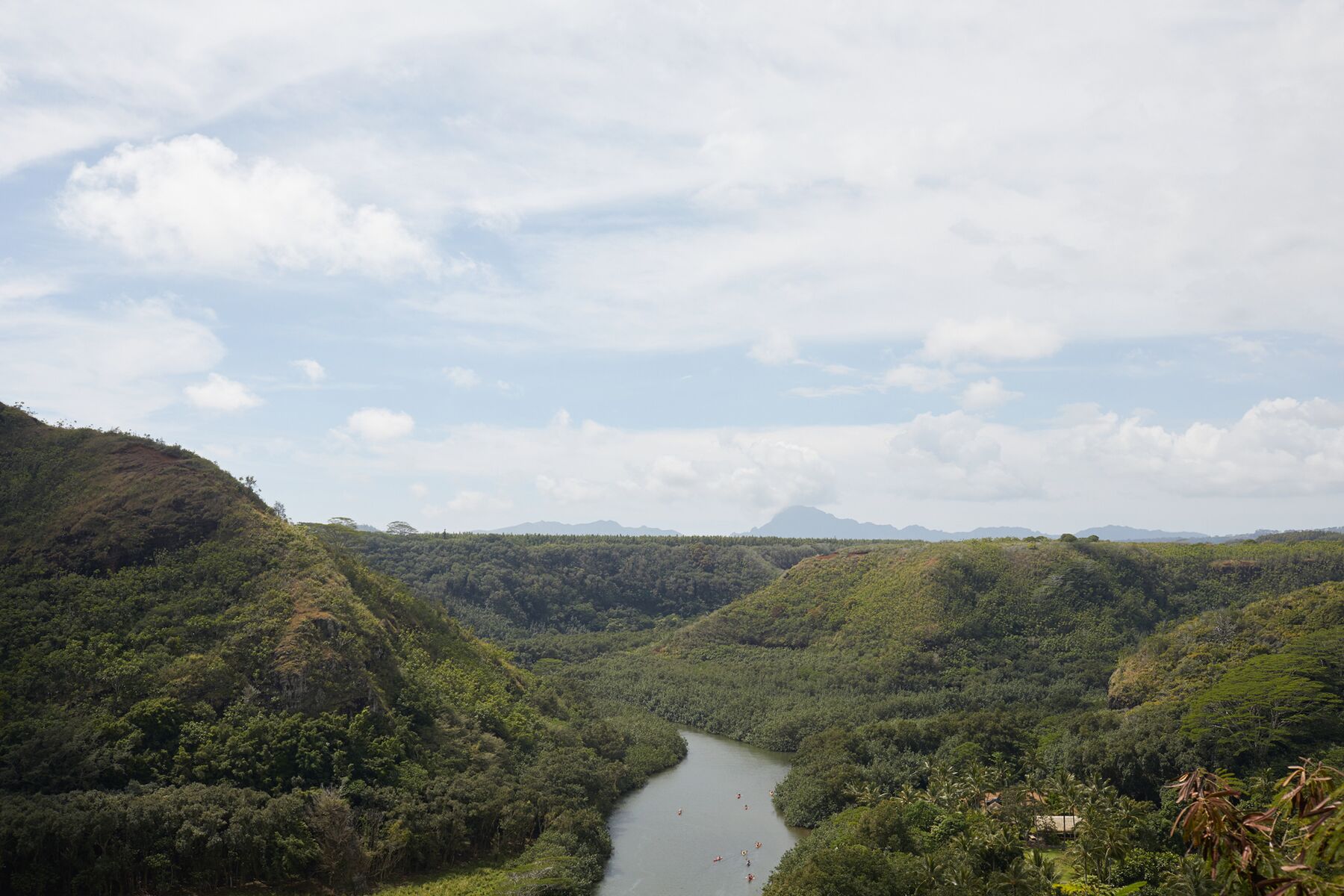
Looking down on the Wailua River winding through a deep green valley under soft cloud Photo: Hawaii Tourism Authority (HTA) / Daeja Fallas

06 · Next door to the north

Wailua and Kapaʻa

Wailua is the closest real landscape to Līhuʻe: a wide river, a fern-hung grotto and two waterfalls. Kapaʻa is the next town up the highway.

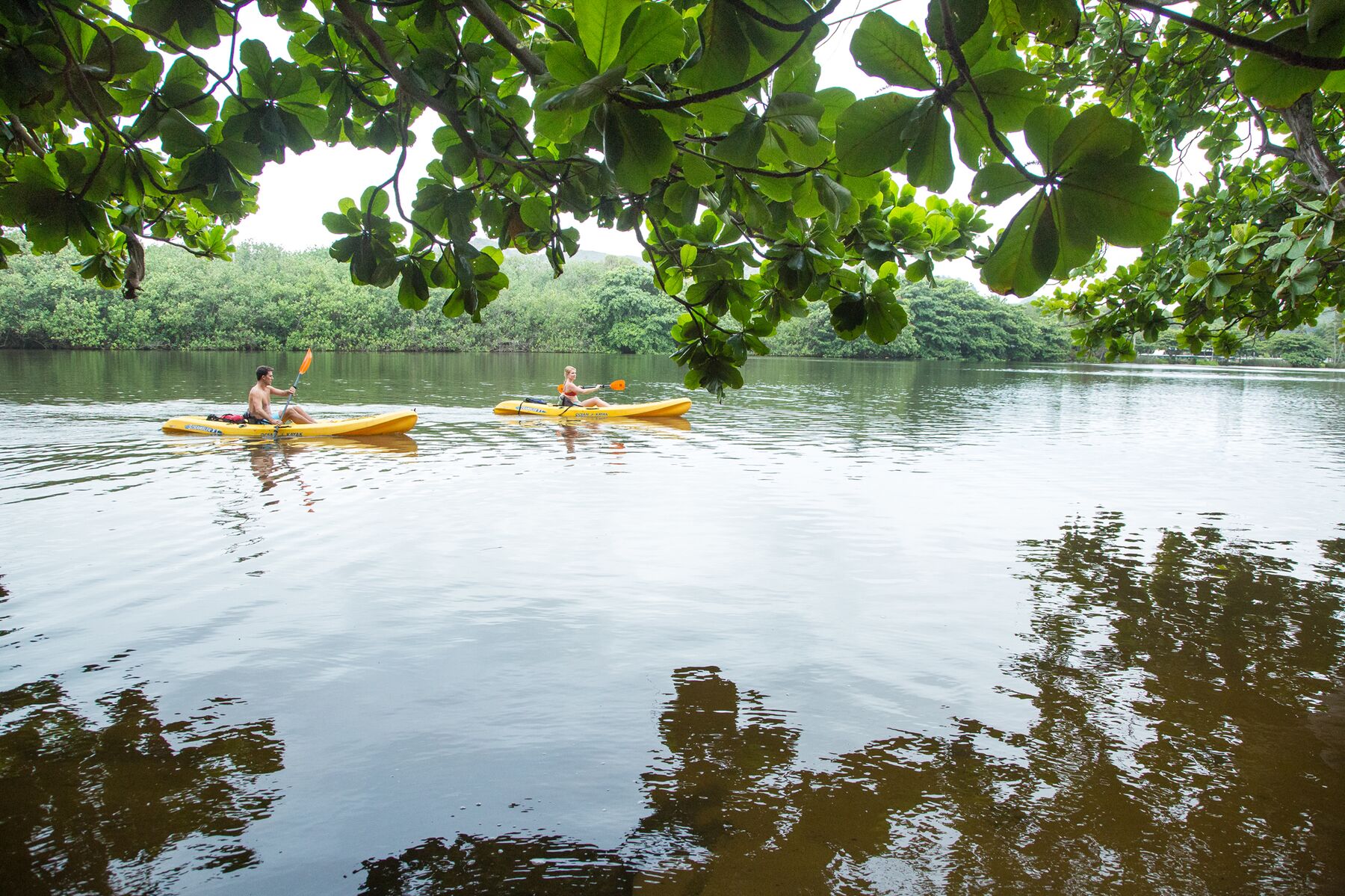
The Wailua River is reached about 15 minutes north of the airport, off Route 56. Kayakers paddle upstream, and riverboat tours run to the Fern Grotto, a wet rock wall under hanging ferns. Wailua River State Park is managed by the state, and the landing and trails at the grotto have rules of their own, so read the park’s notices before you plan on it.

ʻOpaekaʻa Falls is seen from a roadside lookout on Kuamoʻo Road (Route 580), a short drive inland from the highway. The lookout and the river are part of the same state park, so check DLNR for fees and access before you go.

Stay out of the river mouth, and out of the water after heavy rain. Rivers here can rise fast and carry strong currents.

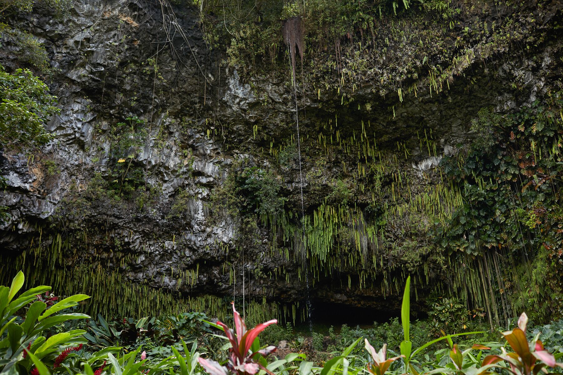
Wet rock wall draped in hanging ferns, with red bromeliads below, at the Fern GrottoPhoto: Hawaii Tourism Authority (HTA) / Daeja Fallas
The Fern Grotto, as seen on the riverboat visit.
Two people in yellow kayaks on the calm Wailua River, framed by overhanging branchesPhoto: Hawaii Tourism Authority (HTA) / Tor Johnson

Sources: Wailua River State Park, DLNR · State Parks notices.

Inland from Līhuʻe

Wailua Falls

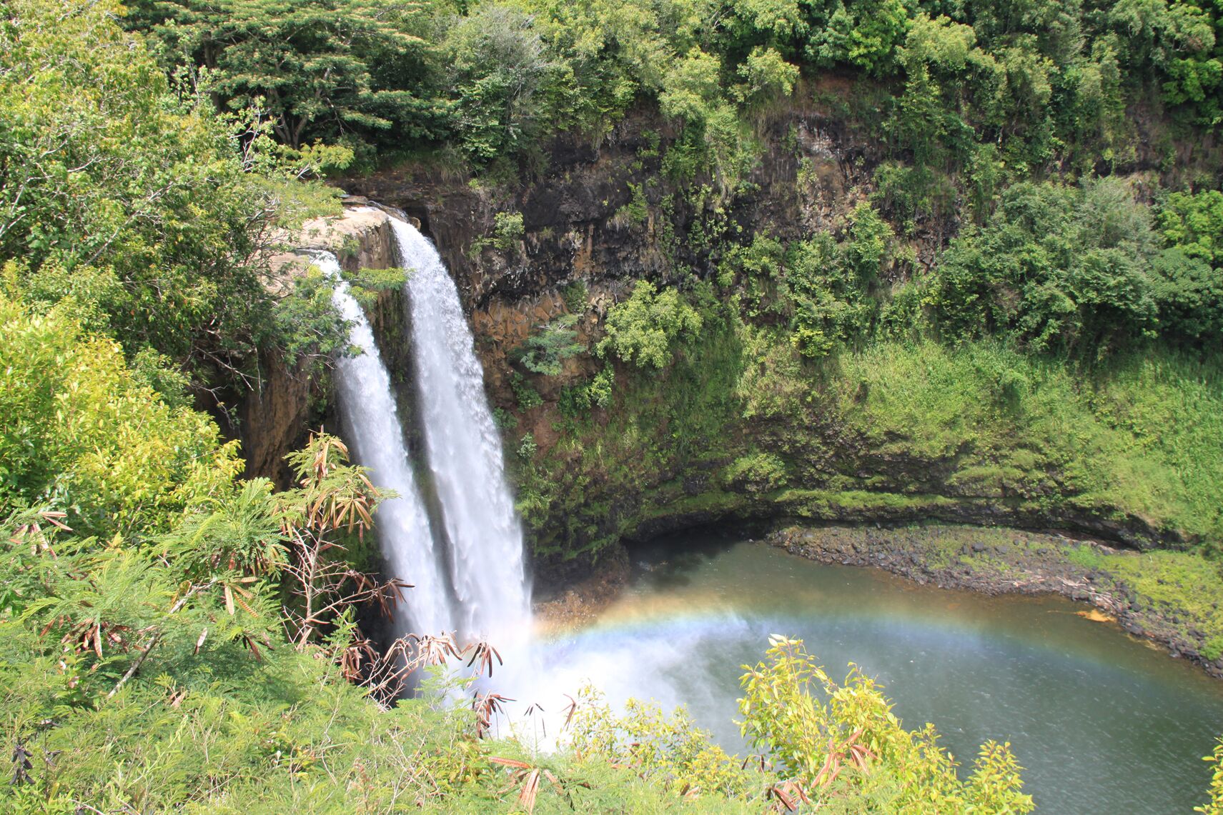
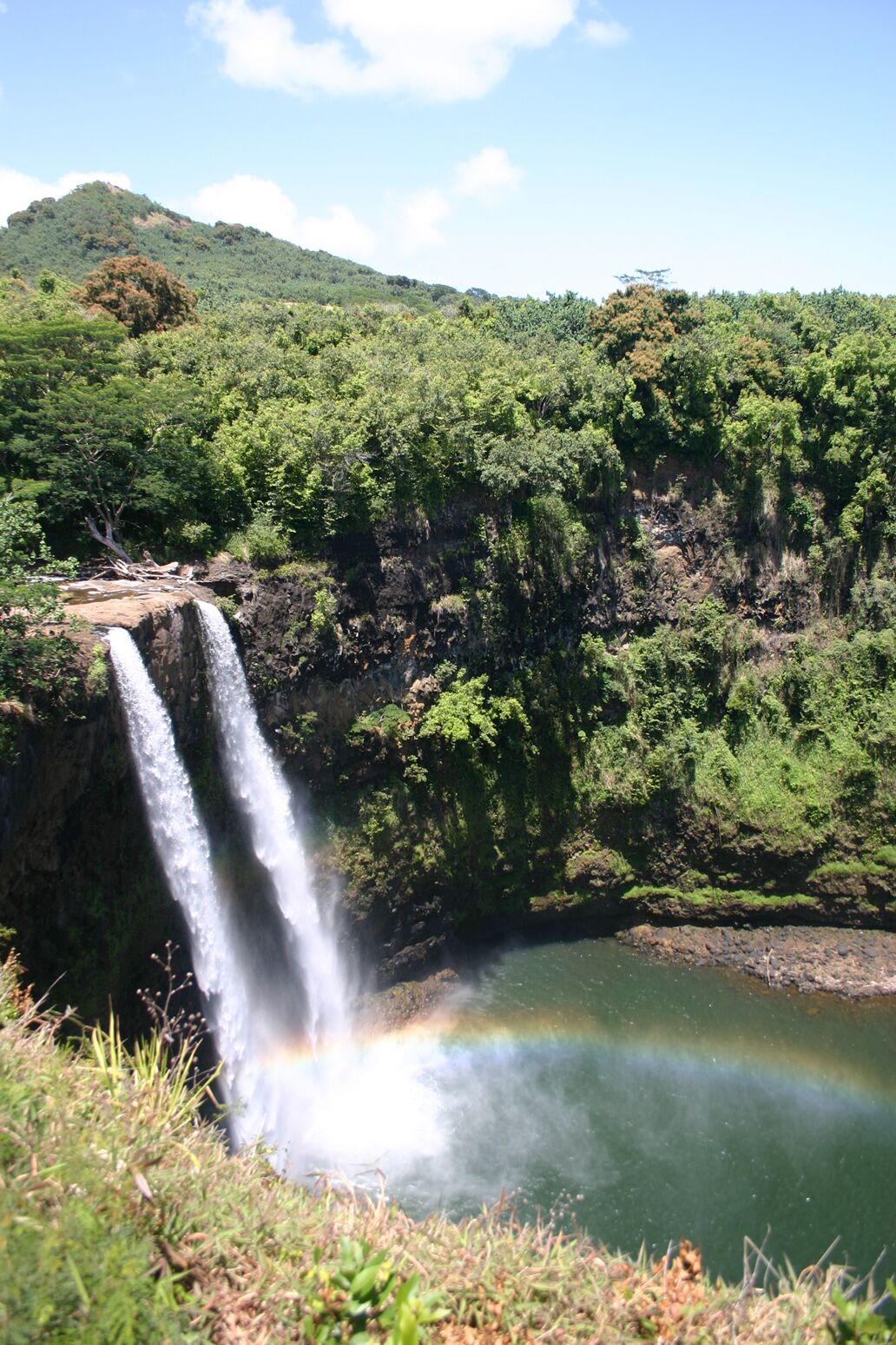
Wailua Falls is a twin-stranded waterfall on the Wailua River. You reach it from Kūhiō Highway at Kapaia by following Māʻalo Road (Route 583) to its end, about 4 miles. The last stretch is narrow. The view is from a lookout above the falls, with a small parking area nearby.

Don’t try to climb down to the pool: the slopes are steep and slippery, and the river can rise quickly. The falls are fullest after rain, when the approach road is also at its wettest.

  • Road: Māʻalo Road, Route 583, from Kapaia.
  • Distance: about 4 miles from the highway to the lookout.
  • Access and conditions: see DLNR’s notices.
Wailua Falls, twin streams dropping down a tall green cliff into a pool, with a faint rainbow in the mistPhoto: Hawaii Tourism Authority (HTA) / Kenji Abe
Wailua Falls, at the end of Māʻalo Road (Route 583).
Wailua Falls from a different angle in bright sun, white water against dark rock and a turquoise poolPhoto: Hawaii Tourism Authority (HTA) / Kirk Lee Aeder

Sources: Hawaii Highways, Kauaʻi route log · Wailua River State Park, DLNR. Route mileage is from the route log.

The next town

Kapaʻa

About 7 miles up Route 56, Kapaʻa is the east side’s main town: old storefronts, a coastal path and the road to the north shore.

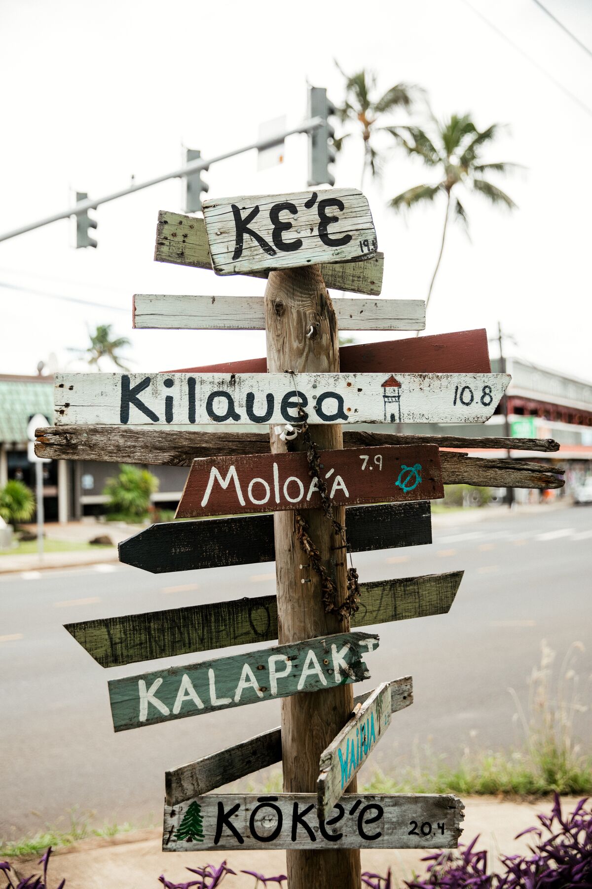
A weathered wooden signpost with hand-painted arrows for Keʻe, Kīlauea, Moloʻa, Kalapaki and KōkeʻePhoto: Hawaii Tourism Authority (HTA) / Heather Goodman / @hbgoodie

The road north

Kapaʻa is where Route 56 turns toward Kīlauea, Hanalei and Hāʻena, and a signpost like this one shows how many of the island’s places are within reach.

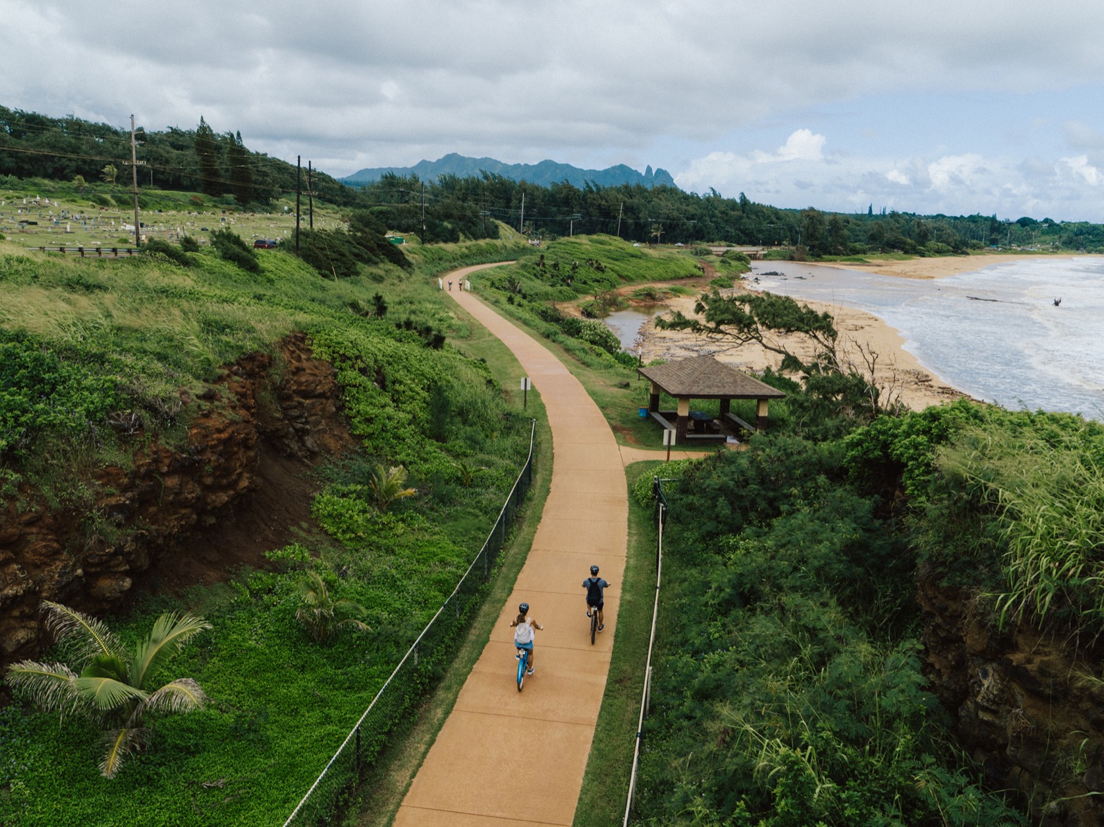
Aerial view of two cyclists on the coastal path, between a green hillside and a beach, with a small pavilion on the shorePhoto: Hawaii Tourism Authority (HTA)

Ke Ala Hele Makalae

A coastal path for walking and cycling that follows the shore in and around Kapaʻa, past beaches and small parks.

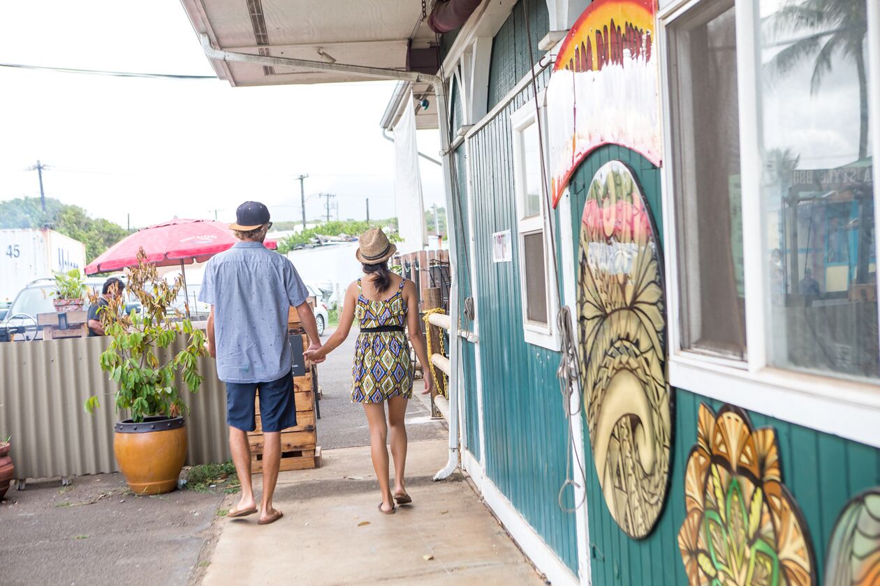
A couple walking past a teal wooden building with round murals, small shops and a red market umbrellaPhoto: Hawaii Tourism Authority (HTA)

Shops and murals

Small shops, cafés and painted walls line Kapaʻa’s main street, which is best explored on foot once you’ve parked.

Sources: County of Kauaʻi · Hawaii Highways, Kauaʻi route log.

South · the sunny side

Kōloa and Poʻipū

Take Route 50, then Maluhia Road, for the island’s old sugar town and its resort coast, about half an hour from the airport. The south shore is usually the drier, sunnier side of the island.

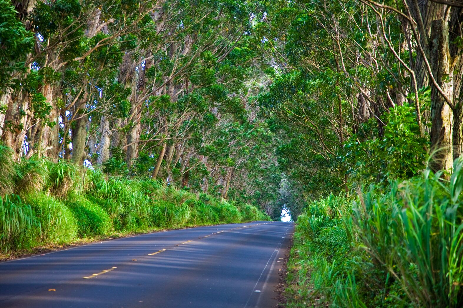
A paved road with double yellow lines running under a tunnel of tall leaning treesPhoto: Hawaii Tourism Authority (HTA) / Tor Johnson
Trees arching over Maluhia Road, the “Tree Tunnel” on the way to Kōloa.
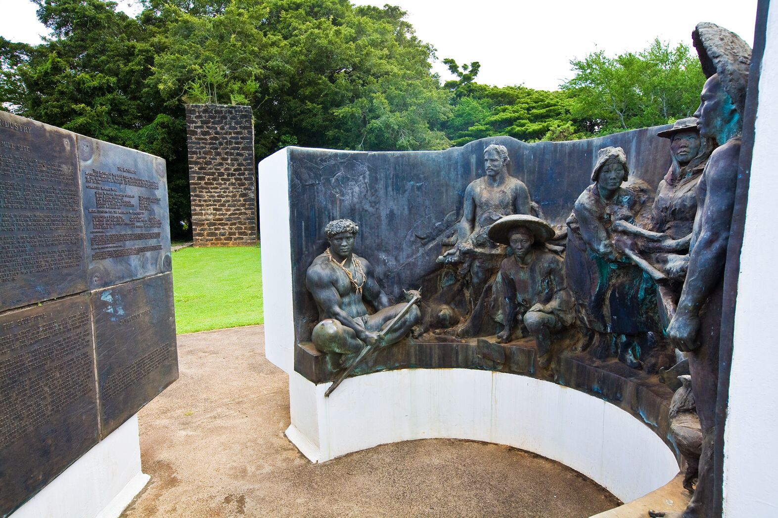
A bronze sculpture of several figures in period dress before a curved white wall, with a tall plaque to one side and a sugar-mill chimney in the backgroundPhoto: Hawaii Tourism Authority (HTA) / Tor Johnson
The monument to Kōloa’s sugar workers, with the old mill chimney behind.
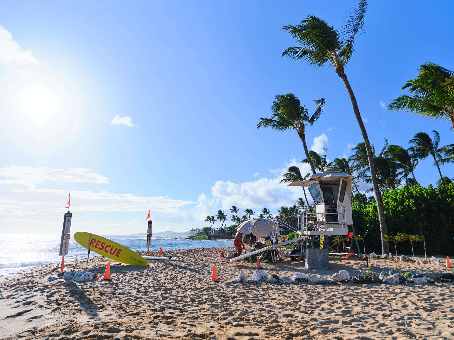
A tan lifeguard tower and a yellow “RESCUE” board on a sunny beach, with palm trees blowing on the rightPhoto: Hawaii Tourism Authority (HTA) / Ben Ono
A lifeguard tower at Poʻipū Beach.

Tree Tunnel

A mile of Maluhia Road (Route 520) lined with more than 500 eucalyptus trees planted around 1911. Kauaʻi County has recognized it as an exceptional tree resource since 1976.

Old Kōloa Town

Site of Hawaiʻi’s first successful sugar mill. Its old plantation buildings now hold small shops and restaurants, and a monument honors the workers who came from many countries.

Poʻipū Beach Park

The south shore’s best-known beach, a county park with lifeguard towers. Surf and currents vary from day to day, so check the flags and ask the lifeguard before you swim.

Spouting Horn and Allerton

Spouting Horn is a lava-rock blowhole on the coast near Poʻipū. Allerton Garden, part of the National Tropical Botanical Garden’s Lāwaʻi valley gardens, is visited by guided tour.

Sources: Historic Hawaiʻi Foundation, Tree Tunnel · NTBG, Allerton Garden · State lifeguarded beaches · County of Kauaʻi beaches. The monument photo shows the old Kōloa sugar-mill chimney behind it.

Getting around

Airport, roads and the bus

You arrive at Līhuʻe Airport, and most people need a car from there.

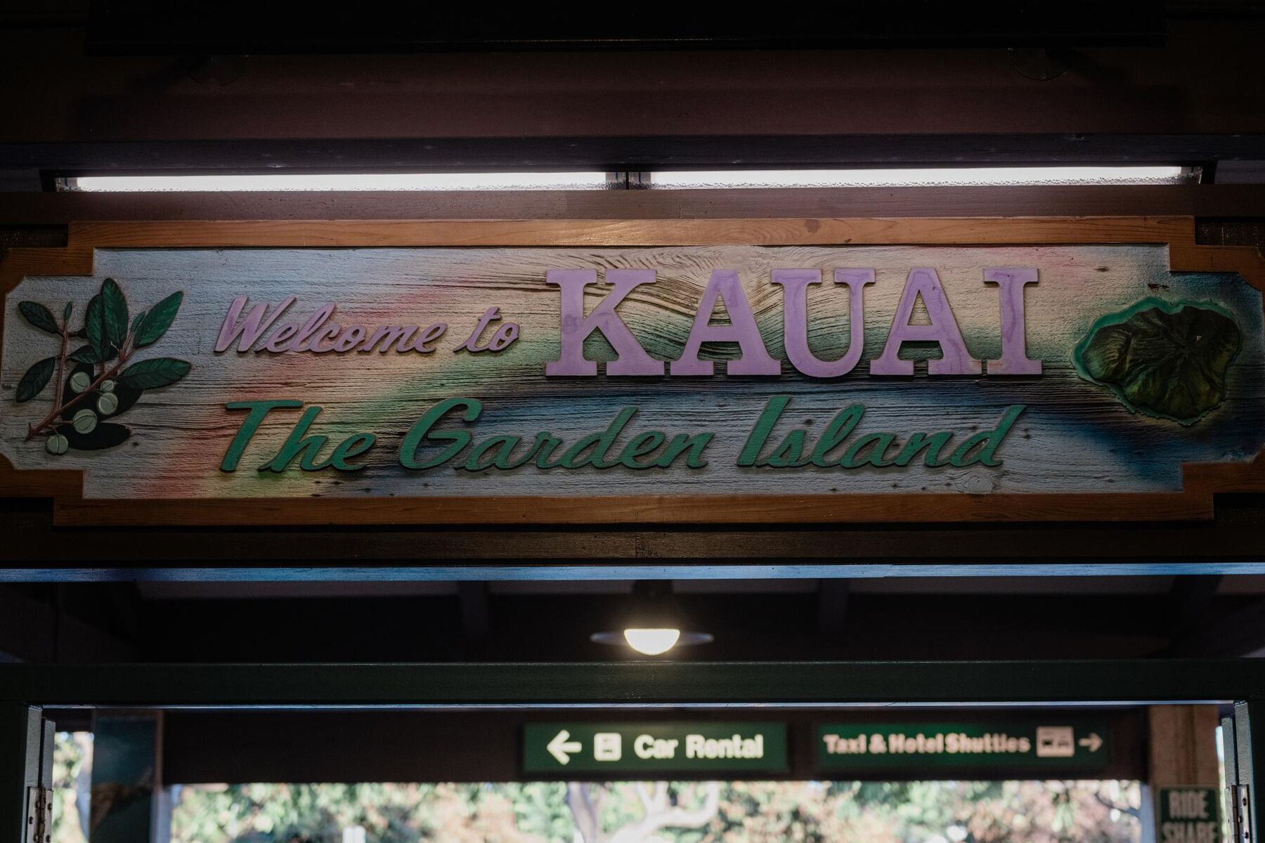
A “Welcome to Kauaʻi – The Garden Island” sign at the airport, with directional signs below pointing to car rental and to taxis and hotel shuttlesPhoto: Hawaii Tourism Authority (HTA) / John Hook
Arrival signage at Līhuʻe Airport.

Līhuʻe Airport (LIH) is Kauaʻi’s main commercial airport, about 1.5 miles east of town. You reach it by Ahukini Road from Kapule Highway. Ground transport listed by the airport includes shuttles, tours and the county bus, which stops in the median in front of the terminal.

Rental cars are the usual way to get around, since distances are long and public transport is limited. Book ahead, especially in busy seasons.

The roads. Kaumualiʻi Highway (Route 50) runs west from Līhuʻe to Kekaha. Kūhiō Highway (Route 56, then 560) runs north through Wailua and Kapaʻa to the north shore, and it ends at Hāʻena. Maluhia Road (Route 520) branches off Route 50 for Kōloa. There is no road all the way around the island.

The Kapaʻa corridor

  • Kūhiō Highway between Līhuʻe and Kapaʻa is the island’s busiest stretch, and it backs up at morning and evening commute hours.
  • Traffic measures such as contraflow lanes and the Kapaʻa Bypass Road, a shortcut around the center of Kapaʻa, have been used to ease it. Their layout and schedules change, so check the Hawaiʻi Department of Transportation.
  • Plan longer trips north or south for the middle of the day, and leave extra time before flights.

Kauaʻi Bus

  • The county runs a fixed-route bus linking Līhuʻe with Kōloa, Kapahi, Kekaha and Hanalei.
  • Buses are small, with limited room for large luggage.
  • It suits a simple trip between towns better than sightseeing. Routes, schedules and fares are on the county’s transportation page.

Sources: Hawaiʻi Airports, LIH · LIH ground transportation · LIH, Kauaʻi Bus · Kauaʻi Bus · HDOT Kauaʻi roadwork · Hawaii Highways, Kauaʻi route log.

Before you go

Practical notes

Check before you go

Hours, fees, tours and access at parks, museums and businesses change. Check current conditions and opening times on the official sites linked below before you set out.

Weather and surf

Kauaʻi’s weather varies widely from one side of the island to the other. Heavy rain can close roads and parks and make rivers dangerous. Check the National Weather Service before you drive.

Water safety

Conditions vary by beach and by day. Swim only where there is a lifeguard, read the flags, and keep out of river and stream mouths and brown or murky water.

Leave time at the airport

The airport is only minutes from town, but the highways can back up. Allow extra time to return your car and check in.

Respect closures

Stay out of closed areas and off private land, and obey posted signs. Some sites mentioned here are on private or protected land.

Pack for rain and sun

Bring a light rain jacket, sun protection and sturdy shoes. Red dirt stains clothing, and trails and lookouts can be slick when wet.

Sources: NWS Honolulu · State Ocean Safety · County of Kauaʻi beaches.

Check current conditions and hours before you go

Say it right. The ʻokina (ʻ) is a glottal stop, a brief catch in the voice; the kahakō (macron, as in ī or ō) marks a long vowel. Approximate English renderings:
  • Līhuʻe lee-HOO-eh
  • Nāwiliwili NAH-vee-lee-VEE-lee
  • Kōloa KOH-loh-ah
  • Poʻipū poh-ee-POO
  • Kapaʻa kah-PAH-ah
  • Hulēʻia hoo-LEH-ee-ah