Hawaiʻi Guide
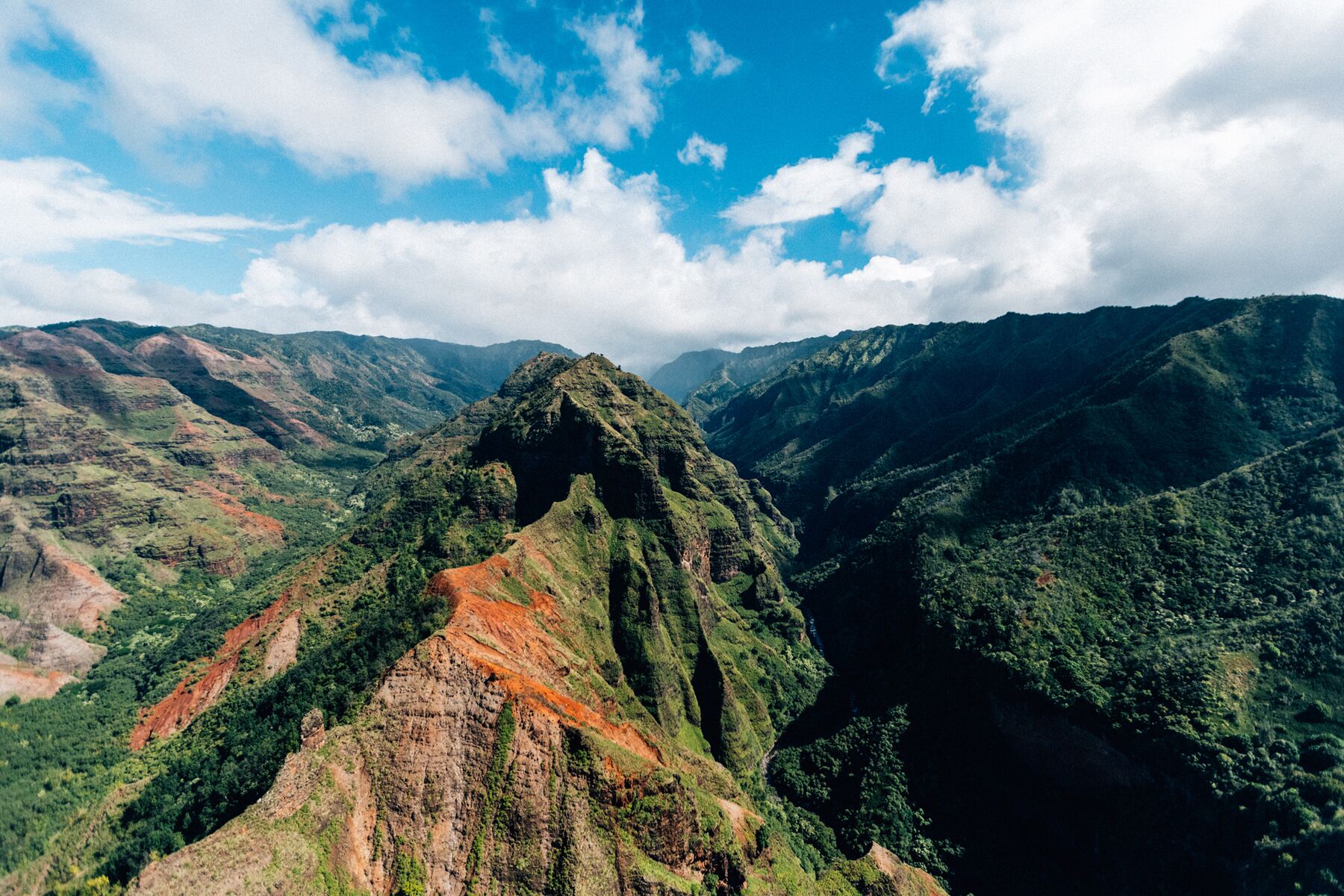
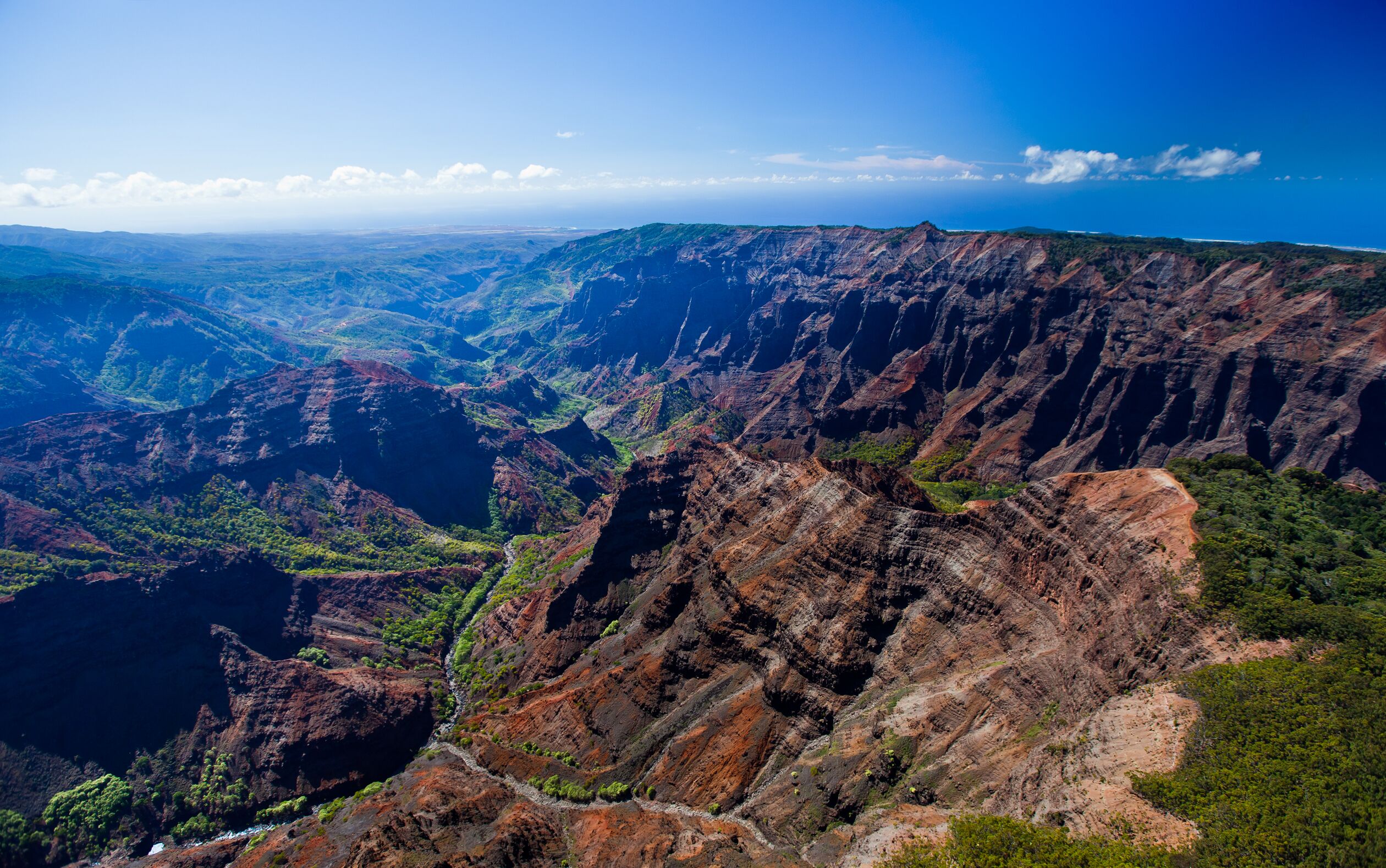
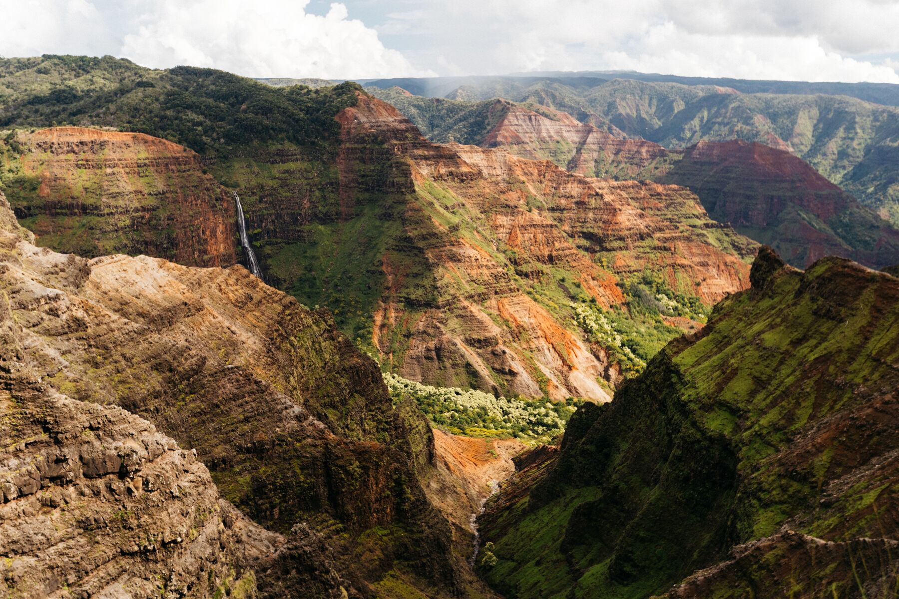
Looking across Waimea Canyon from a high rim viewpoint: rust-red and brown ridges streaked with green fall away into deep ravines, with a strip of ocean on the far horizon under a blue sky

Kauaʻi · Waimea Canyon & Kōkeʻe

Waimea Canyon

A gorge some 3,600 feet deep cut into the flank of Kauaʻi’s ancient volcano, and a mountain road that follows its rim up into the forests of Kōkeʻe and out to the edge of the Nāpali cliffs.

Waimea Canyon · Photo: Hawaii Tourism Authority (HTA) / Tor Johnson

The canyon

The “Grand Canyon of the Pacific”

Waimea Canyon is the great gorge of Kauaʻi’s West Side: about 3,600 feet deep, up to a mile wide, and 10 to 14 miles long, depending on who is measuring.

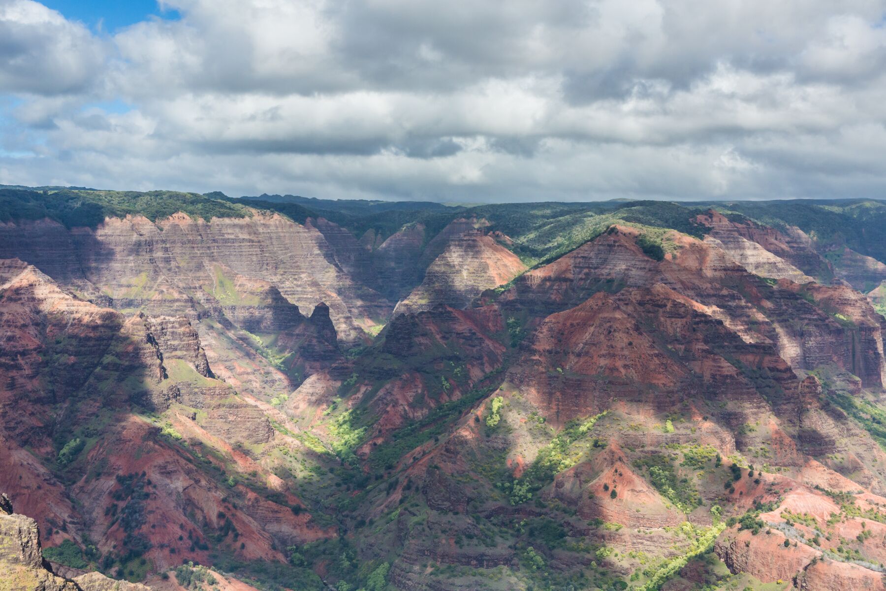
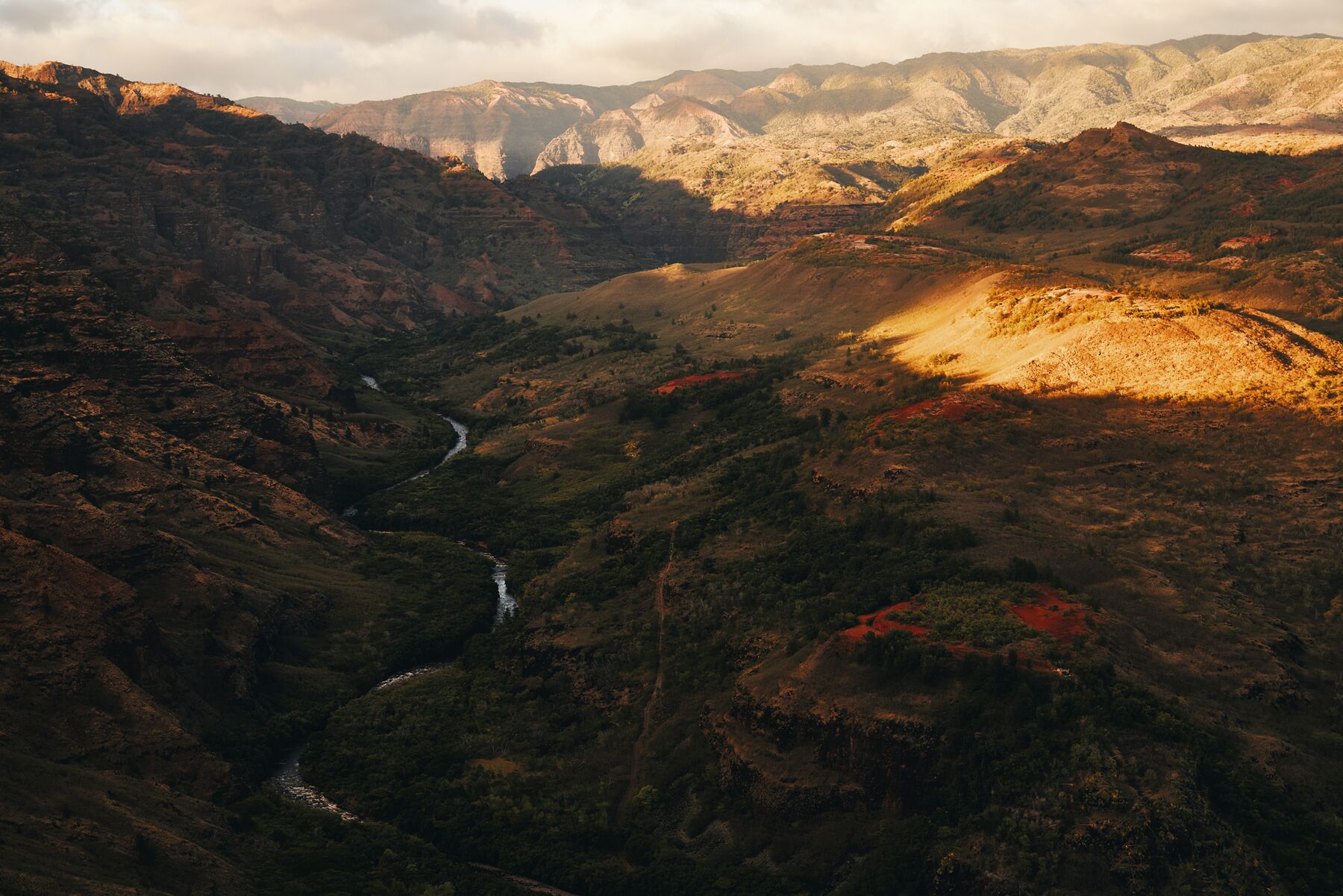
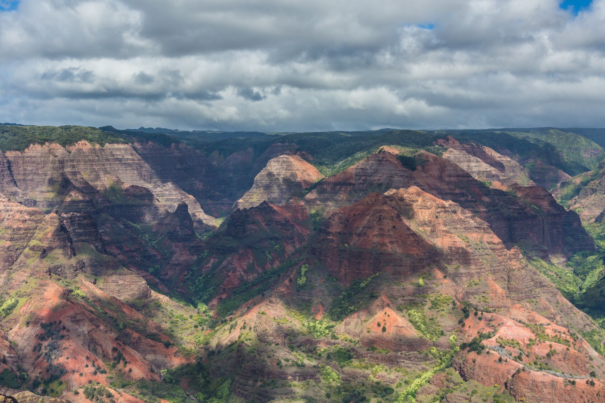
The nickname fits the view better than the scale. Arizona’s canyon is far bigger. What Waimea has is color: rust-red and ochre walls, green-furred ridges and gray rock in bands that shift as the clouds pass. The name itself means “reddish water,” for the red soil the river carries after rain.

You see it from above. Waimea Canyon Drive climbs from Waimea town along the canyon’s western rim, past a series of lookouts, into the cool upland forest of Kōkeʻe State Park. About 19 miles from the coast the road ends at two lookouts over Kalalau Valley on the Nāpali Coast, some 4,000 feet above the sea.

  • ≈ 3,600 ftdepth of the canyon
  • 10–14 milength, depending on the source
  • ≈ 19 miby road, Waimea town to the end of the road
  • 4,000 ftelevation of the Kalalau Lookout

Sources: NASA Earth Observatory (depth, ~10 mi) · Hawaiʻi Tourism Authority, Go Hawaii (14 mi, 1 mi wide) · DLNR, Kōkeʻe State Park (4,000 ft) · Hawaii Highways route log (road mileage) · Wehewehe dictionaries (“reddish water”)

A wide view across Waimea Canyon: rows of eroded red and brown ridges streaked with green, under a sky of white cumulus cloudsPhoto: Hawaii Tourism Authority (HTA) / Tor Johnson
Steep canyon walls in red, brown and green fall away from the Waimea Canyon Lookout, with a thin white waterfall on the far wall and soft clouds above the rimPhoto: Hawaii Tourism Authority (HTA) / Ben Ono
The view from the Waimea Canyon Lookout. The banding is stacked lava flows, weathered to red and brown.

In plain terms

Why it looks the way it does

Kauaʻi is the oldest of the main Hawaiian Islands. It is the top of one huge shield volcano, with lava flows dated to about 5 million years ago. According to the NASA Earth Observatory, roughly 4 million years ago, while the volcano was still erupting, part of it collapsed along a great fault, and later lava ponded in the sunken ground.

Since then, the Waimea River and its tributaries, fed by the very wet highlands around Waiʻaleʻale at the island’s center, have cut the canyon along the edge of that collapse. That is why the two sides don’t match. The west wall, where the road runs, is made of thin flows that once ran down the volcano’s slope. The east wall is built of thick, flat-lying flows that filled the collapsed basin.

The colors come from weathering. Fresh basalt is dark gray to black. Exposed to air and water, the iron in it rusts to reds and browns, and plants add the green.

Sources: NASA Earth Observatory · P. Reiners, geology of the Waimea Canyon area (archived)

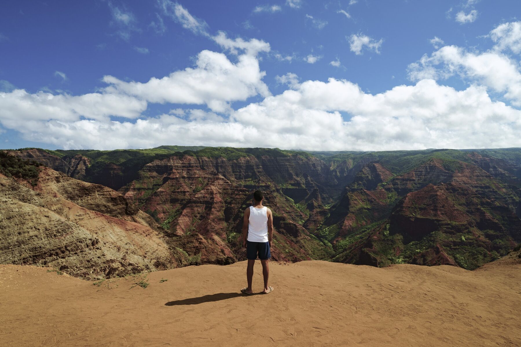
A man in a white tank top and dark shorts stands on a bare red-dirt viewpoint, looking out over the layered walls of Waimea Canyon under scattered cloudsPhoto: Hawaii Tourism Authority (HTA) / Blake Bronstad

The road

One road up the rim

Two roads climb from the coast and meet partway up. From there a single road follows the canyon’s western rim into Kōkeʻe and ends at the edge of Kalalau Valley.

Waimea Canyon Drive (Route 550) leaves Kaumualiʻi Highway in Waimea town and climbs steeply. After about 7 miles it meets Kōkeʻe Road, which comes up from Kekaha. Above the junction the route continues as Kōkeʻe Road, with the canyon lookouts first and then the park. Mile markers count up from Waimea.

The Kekaha road is the usual detour when Waimea Canyon Drive is closed for roadwork, as it was several times in 2026. Some people drive up one road and down the other. Either way, allow about an hour from the coast to Kalalau without stops.

Schematic road profile, Waimea town to Puʻu o Kila The road climbs steeply from sea level at Waimea for the first ten miles, then more gently to about 4,000 feet at the Kalalau and Puʻu o Kila lookouts. Numbered points match the list below. sea level · mile 0 ≈ 4,000 ft · mile ≈ 19 12345678910
Schematic profile. The shape of the climb is approximate and mile markers are rounded.
  1. 1Mile 0Waimea townKaumualiʻi Hwy (50) · last gas and groceries
  2. 2Mile ≈ 7Junction with Kōkeʻe Roadthe road up from Kekaha joins here
  3. 3Mile 8–9Iliau Nature Loopand the Kukui Trail, between miles 8 and 9
  4. 4Mile 10Waimea Canyon Lookoutthe main canyon overlook
  5. 5Mile 13Puʻu Hinahina Lookoutcanyon view, Niʻihau view, Canyon Trail
  6. 6Mile ≈ 14Kōkeʻe State Park entranceHalemanu Road: Canyon and Cliff trails
  7. 7Mile 15Kōkeʻe Museum & LodgeKanaloahuluhulu meadow, park headquarters
  8. 8Mile 17Awaʻawapuhi trailheadnear mile marker 17
  9. 9Mile 18Kalalau Lookoutabout 4,000 ft, over Kalalau Valley
  10. 10Mile ≈ 19Puʻu o Kila Lookoutend of the road · Pihea Trail

Sources: Hawaii Highways route log (Route 550: 6.8 mi to the Kōkeʻe Road junction, 7.3 mi to the park entrance, 5.1 mi to Kalalau) · DLNR Kōkeʻe trails map (trailheads) · Kōkeʻe Museum. Mile markers for the lookouts are as commonly given in guidebooks and may be off by a fraction.

The rim

The canyon lookouts

The canyon views come first on the way up, between miles 10 and 14. Two stops matter most. Smaller pullouts along the road, some without railings, are worth a look if you can park safely.

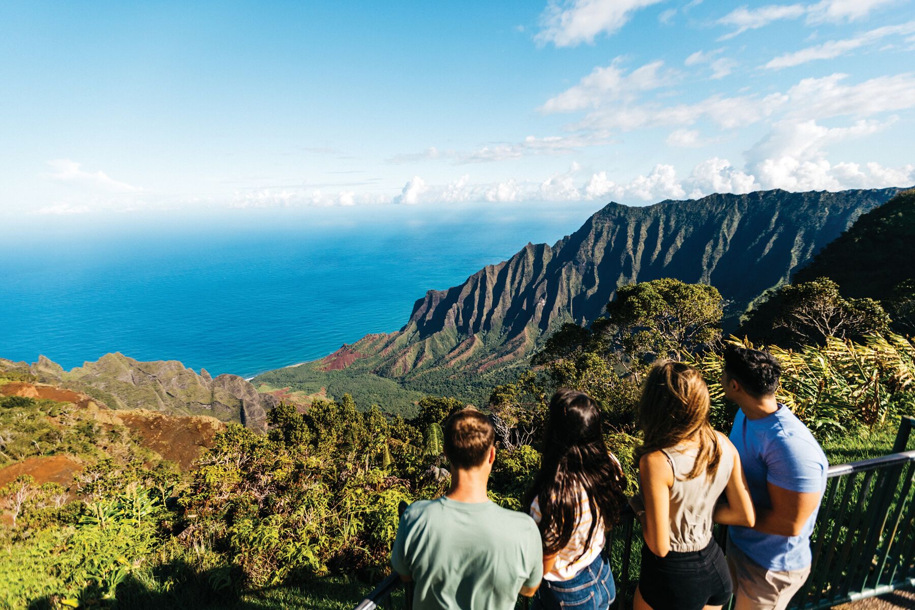
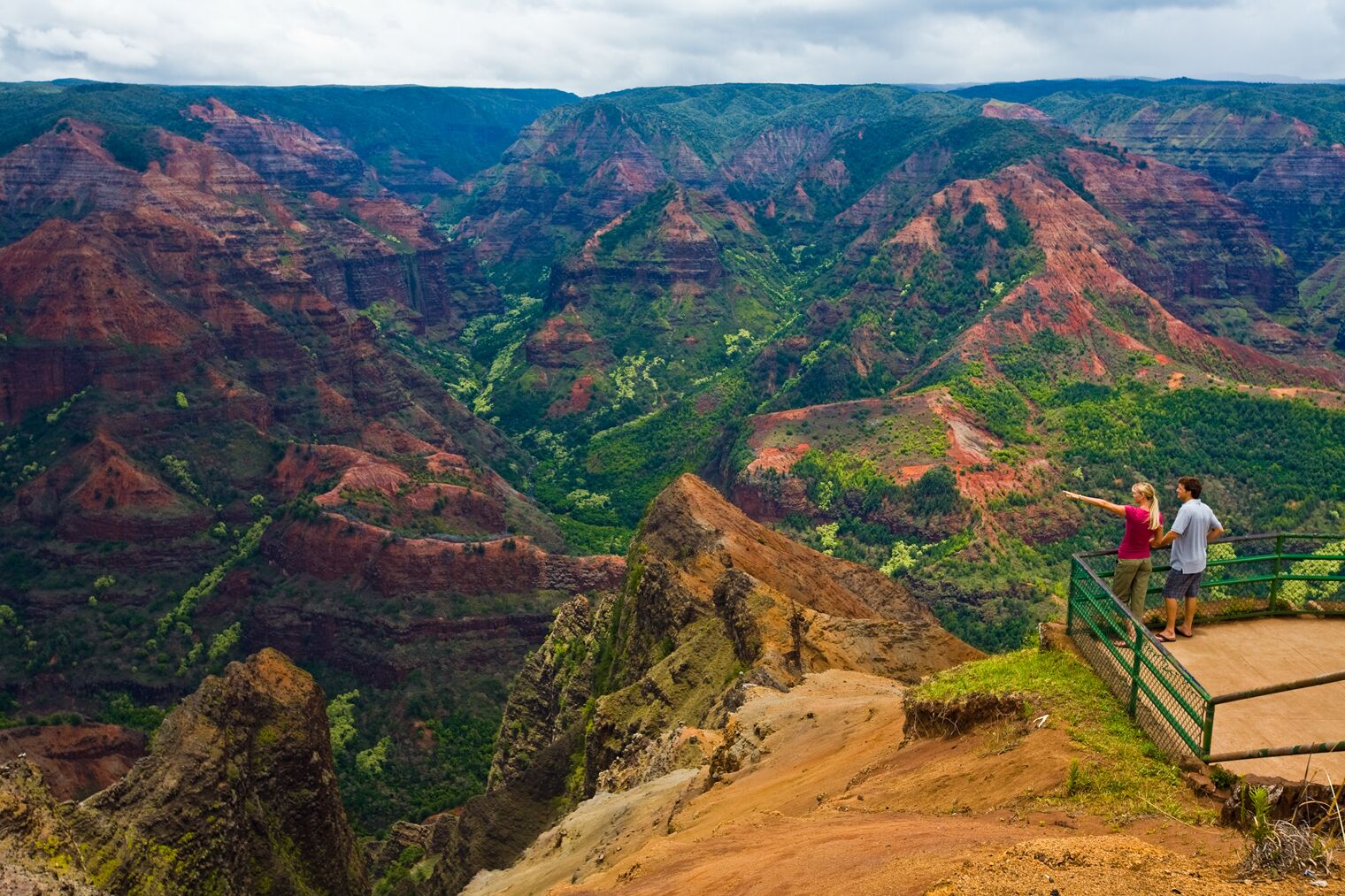
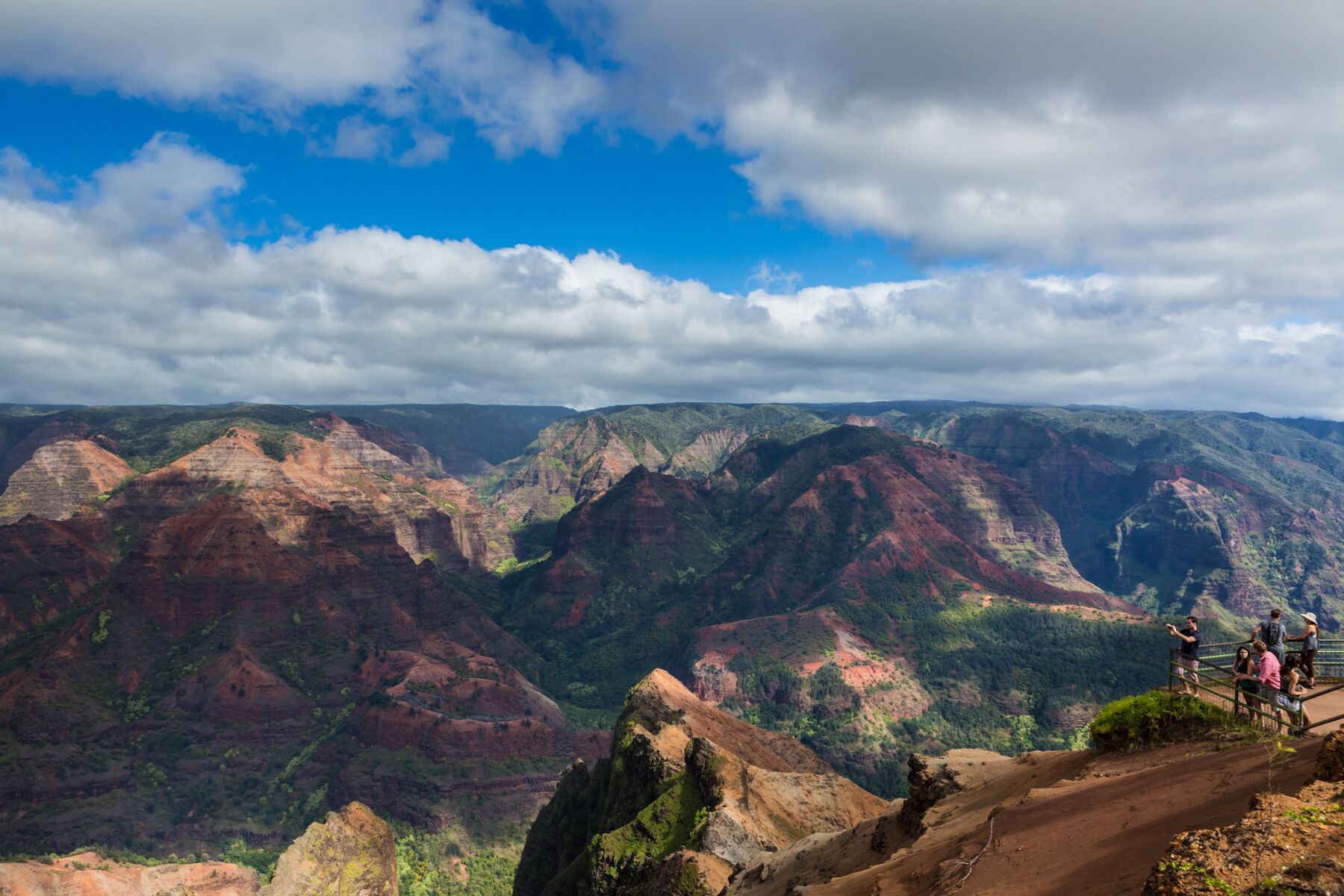
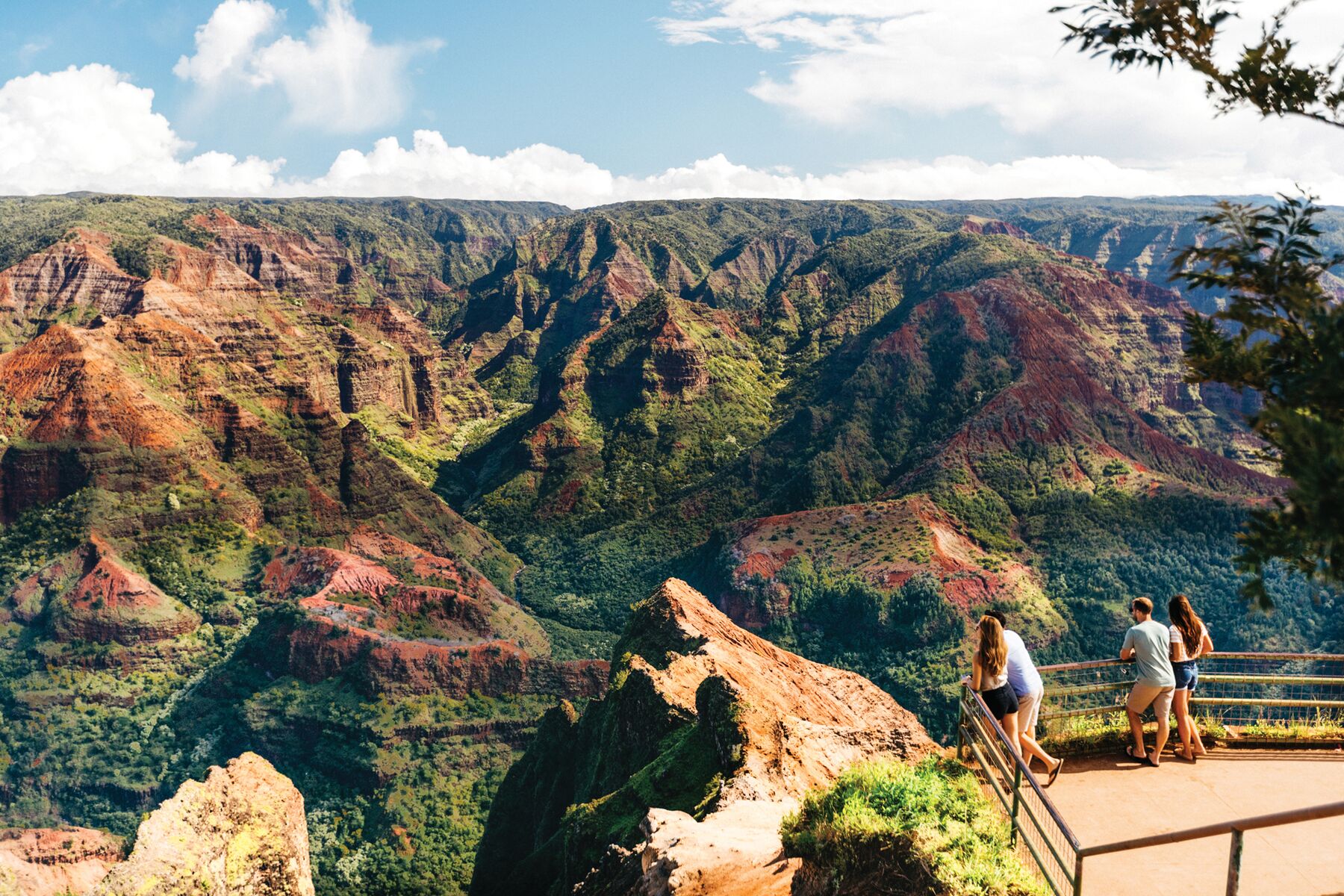
Four visitors stand at the railing of a paved lookout, looking across the red and green ridges of Waimea Canyon under a blue sky with white cloudsPhoto: Hawaii Tourism Authority (HTA) / Ben Ono
Waimea Canyon Lookout.
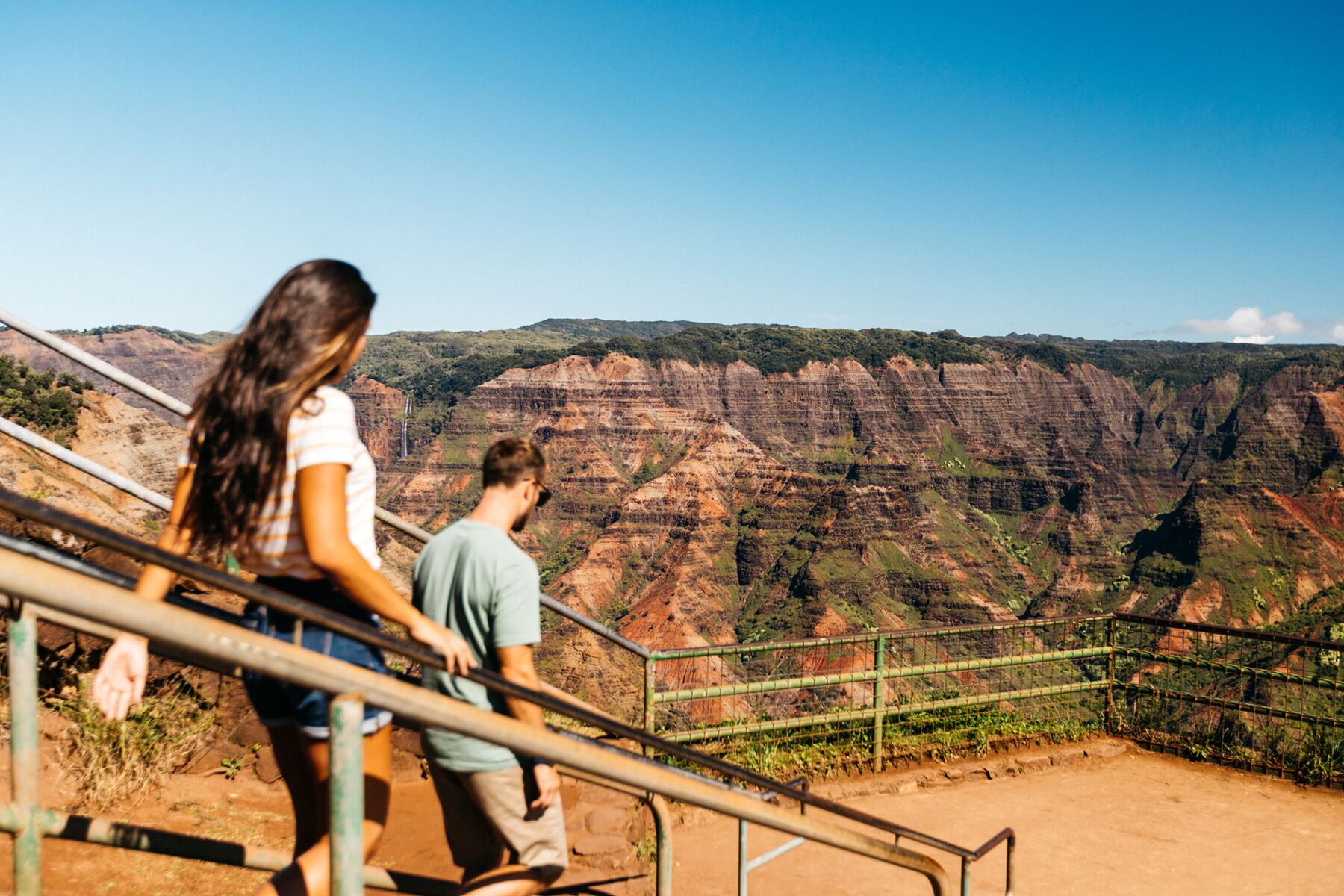
A woman and a man walk down steps with handrails toward the Waimea Canyon Lookout platform, with the canyon’s layered walls aheadPhoto: Hawaii Tourism Authority (HTA) / Ben Ono
The short walk from the parking lot.

Mile 10

Waimea Canyon Lookout

This is the main overlook and the view you’ve seen in photos. From the parking lot, a short, railed walk leads to a platform that looks up the canyon and across to its flat-banded east wall. There are restrooms. It’s also the busiest stop on the road, so come early or late in the day.

The lookout closed in July 2025 for safety improvements, with reopening scheduled for January 2026. DLNR’s park page never posted a confirmation, so check its status before you count on it.
Mile 13

Puʻu Hinahina Lookout

Higher up and usually calmer. One viewpoint looks down the length of the canyon toward the sea. On a clear day another looks west across the channel to Niʻihau, the privately owned island off Kauaʻi’s West Side. One end of the Canyon Trail starts here.

Sources: DLNR, Waimea Canyon State Park (lookouts, Niʻihau viewpoint) · Go Hawaii (restrooms) · DLNR notice on the 2025 lookout closure

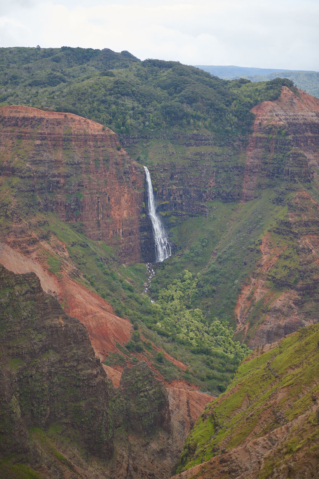
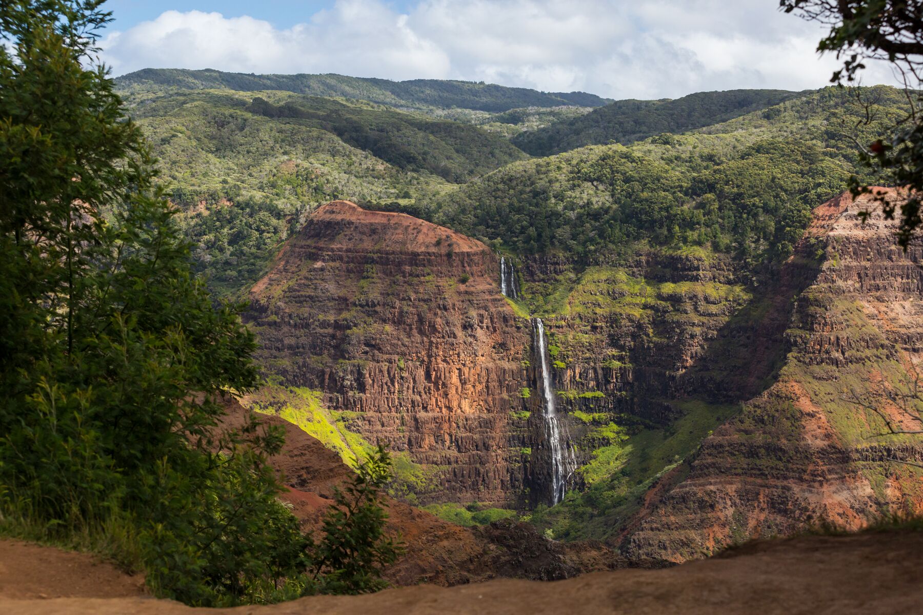
A thin white waterfall drops down a sheer, red-brown wall in Waimea Canyon, framed by trees at the canyon rim, with green forest on the ridges abovePhoto: Hawaii Tourism Authority (HTA) / Tor Johnson
A waterfall on the canyon wall, seen from the rim. HTA’s caption doesn’t name it.

The waterfall

Waipoʻo Falls

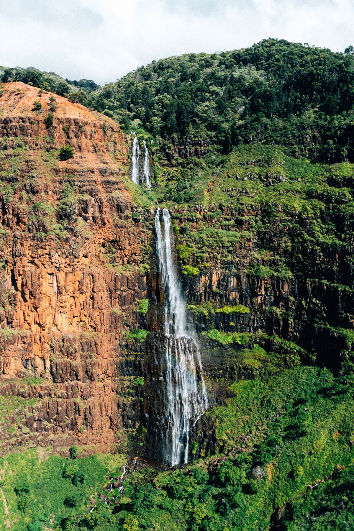
The canyon’s best-known waterfall spills off the Kōkeʻe plateau into a side canyon in two tiers. It is often said to be about 800 feet tall. You can pick it out across the canyon from the rim lookouts on a clear day. It flows hardest after rain and thins out in dry spells.

The hike reaches the top, not the bottom. The Canyon Trail (1.8 miles one way) crosses Kōkeʻe Stream just above the drop and ends at the falls, so you look down the waterfall rather than up at it. For the classic head-on view, the lookouts are better. The other way to see it head-on is from the air, since helicopter tours from elsewhere on the island routinely fly the canyon.

Trail length: DLNR Kōkeʻe trails map. Height: commonly cited figure, not an official measurement.

A tour helicopter flies past a tall, narrow waterfall pouring down a red, fern-covered cliff in Waimea CanyonPhoto: Hawaii Tourism Authority (HTA) / Ben Ono
A tour helicopter passes a waterfall in the canyon.
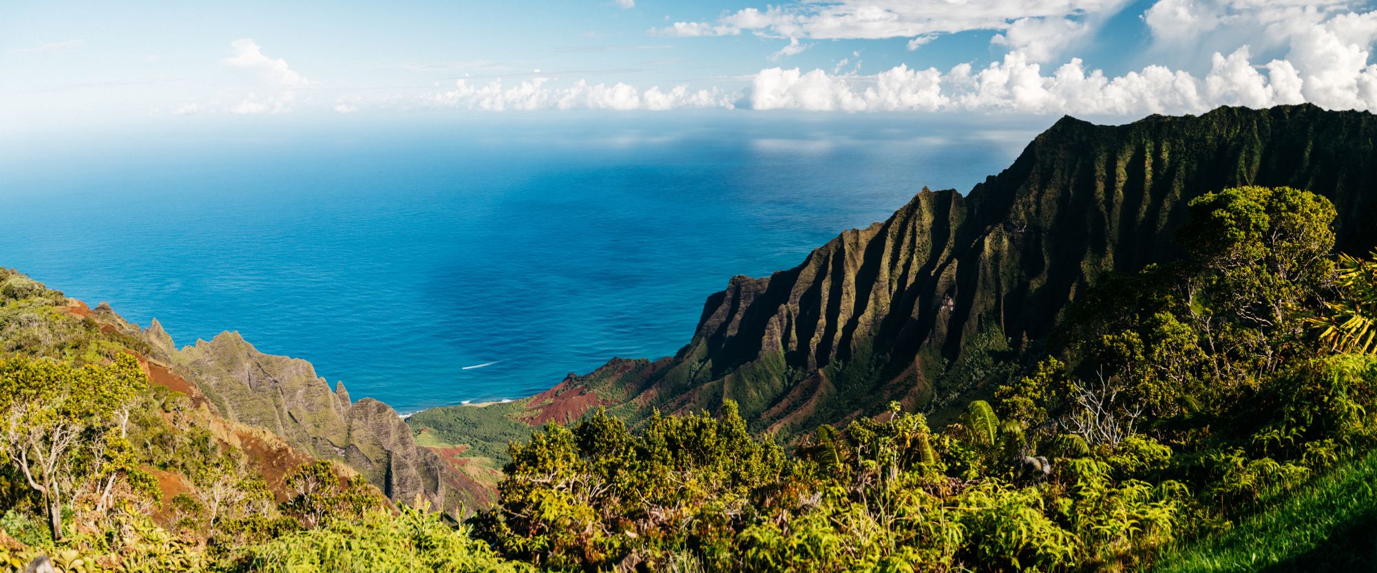
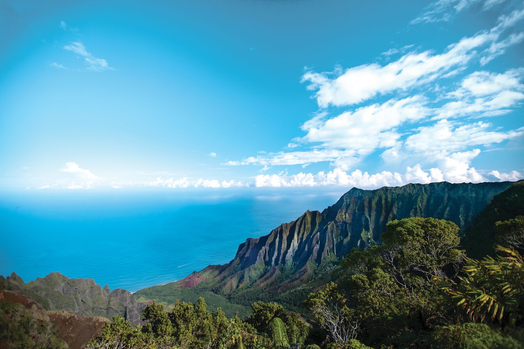
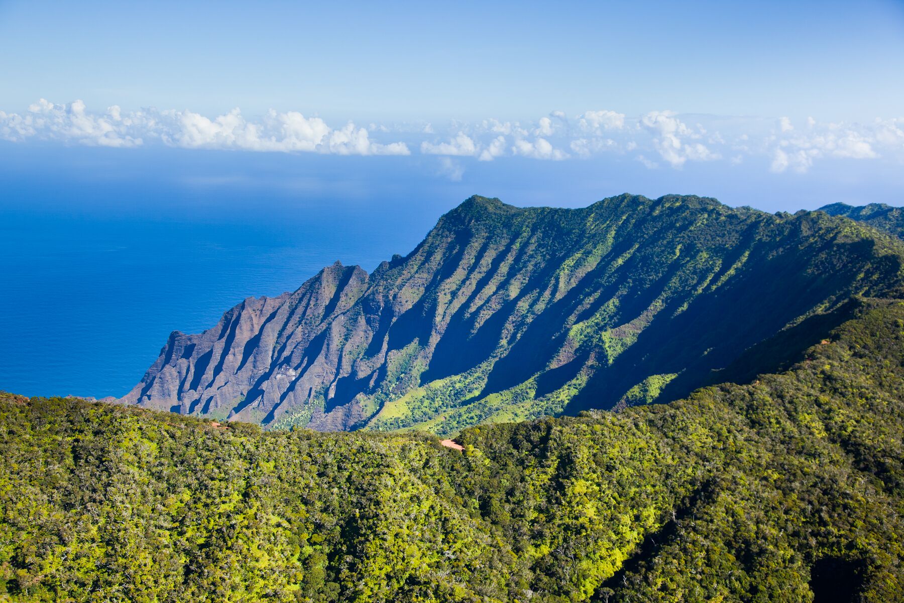
Panorama from the Kalalau Lookout: sharp, fluted green ridges of the Nāpali Coast drop to a deep blue ocean, with forest in the foreground and clouds on the horizon

The end of the road · miles 18–19

Kalalau

At the top of the road the canyon is behind you and the land falls away the other way, 4,000 feet down into Kalalau Valley and the Nāpali Coast.

Photo: Hawaii Tourism Authority (HTA) / Ben Ono

The Kalalau Lookout (mile 18) looks straight into the valley’s green, fluted amphitheater and out to sea. The Puʻu o Kila Lookout, a little farther on, is where the road ends. It has a similar view from a slightly different angle and is the start of the Pihea Trail. Puʻu o Kila was closed for a time during the 2025–26 roadwork and reopened in January 2026.

Expect cloud. Kalalau is often socked in, especially later in the day. It can clear in minutes, though, so if you arrive to a wall of white, give it some time before you drive down. Mornings are usually the best bet.

There is no trail from here down into the valley. The only foot route into Kalalau is the Kalalau Trail, which starts at the far end of the north shore.

Sources: DLNR, Kōkeʻe State Park (elevation, Puʻu o Kila reopening Jan. 14, 2026) · DLNR trails map

Four young visitors stand at the Kalalau Lookout, looking out at the green Nāpali ridges and the ocean belowPhoto: Hawaii Tourism Authority (HTA) / Ben Ono
Kalalau Lookout.
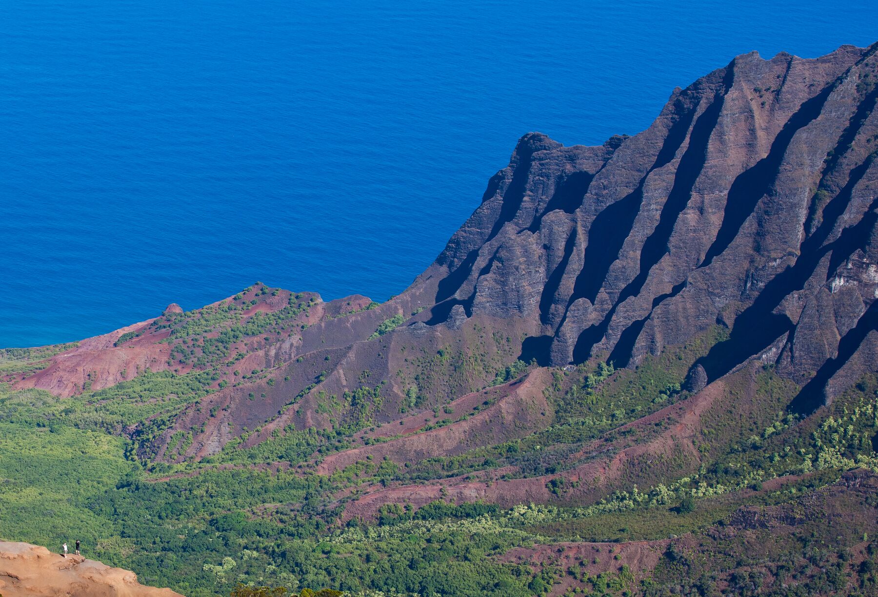
The steep, deeply fluted brown and green cliffs of Kalalau Valley on the right, with the blue Pacific beyond and two tiny figures on a rocky outcrop at lower leftPhoto: Hawaii Tourism Authority (HTA) / Tor Johnson
Kalalau Valley’s fluted walls.

On foot

Trails, honestly rated

Lengths are one way and ratings are DLNR’s, from the official Kōkeʻe trails map. Nearly every trail here starts high and goes down, so the hard part comes at the end, when you climb back out.

  • Stay on the trail. Pig trails and fog make it easy to get lost.
  • Start early. It gets dark early and quickly under the forest canopy.
  • Carry plenty of water, even on short hikes. The open stretches are hot.
  • Wear boots with grip. Trails are rocky, muddy and slippery.
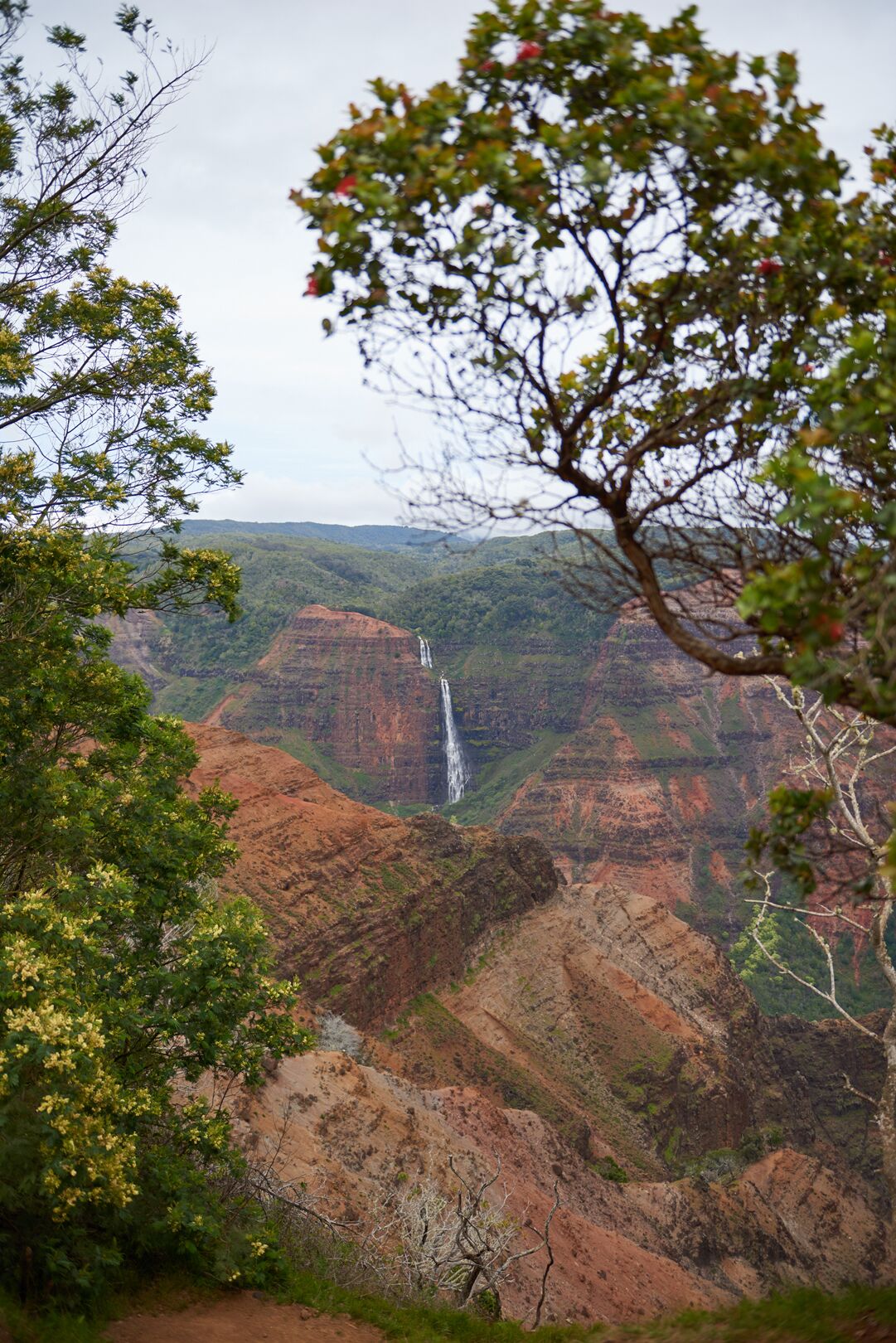
A thin white waterfall drops down a green cliff across the canyon, framed by the leaves and red blossoms of a tree on the rim, under an overcast skyPhoto: Hawaii Tourism Authority (HTA) / AJ Feducia
A waterfall across the canyon, framed by trees on the rim.

Cliff Trail

Easy

0.1 mi one way · Halemanu Road, at the entry to Kōkeʻe State Park

A short spur off the Canyon Trail to a canyon viewpoint. It’s the easiest way to get off the pavement. Halemanu Road is unpaved.

Canyon Trail

Moderate

1.8 mi one way · Puʻu Hinahina Lookout or Halemanu Road

The best rim hike. It follows the canyon edge with big views, then crosses Kōkeʻe Stream and ends at the top of Waipoʻo Falls. Expect exposed drop-offs, loose red dirt and a climb back out.

Iliau Nature Loop

Easy

0.3 mi loop · Route 550, between miles 8 and 9

A roadside loop through dry shrubland, with plant signs and views of Waimea and Waiʻalae canyons. It’s named for the iliau, a plant found only on Kauaʻi.

Kukui Trail

Difficult

2.5 mi one way · From the Iliau Nature Loop

A steep 2,000-foot drop to the canyon floor, where it meets the Waimea Canyon Trail, which runs another 11.5 miles to Waimea town. Going down is hard on the knees, and the climb back up, much of it in full sun, is one of the toughest in the area.

Pihea Trail

Difficult

3.8 mi one way · Puʻu o Kila Lookout, end of the road

DLNR describes it as a “slippery, muddy trail that can be dangerous.” The first stretch runs along the Kalalau rim with big views. After that it heads into forest and onto a boardwalk toward the Alakaʻi Swamp, where it links with the 3.5-mile Alakaʻi Swamp Trail.

Awaʻawapuhi Trail

Difficult

3.1 mi one way · Near mile marker 17 on Kōkeʻe Road

It drops about 1,300 feet through forest and ends at a lookout high above the Nāpali valleys. All of that elevation comes back on the return. It connects with the Nuʻalolo Trail to make a loop.

Nuʻalolo Trail

Difficult

3.8 mi one way · Near park headquarters

Views of Nuʻalolo Valley. DLNR says to allow 5 hours and warns that the trail can be open and hot, so bring plenty of water. The Nuʻalolo Cliff Trail links it to Awaʻawapuhi.

Source: DLNR, Waimea Canyon & Kōkeʻe trails map (lengths, trailheads, ratings, safety notes) · iliau: Native Plants of Hawaiʻi. Trail status changes often, especially after storms: check Nā Ala Hele and the park notices before any hike.

Above the canyon

Kōkeʻe State Park

Past mile 14 the road leaves the dry canyon rim and enters Kōkeʻe, a cool upland park of forest and meadow that runs out to the Kalalau lookouts. Its hub is the grassy Kanaloahuluhulu meadow, around mile 15, with the park headquarters, museum and lodge beside it.

  • Kōkeʻe Natural History Museum. The museum is run by the nonprofit Hui o Laka and has exhibits on the area’s plants, birds, geography and history, plus a book and gift shop. It’s the best place to ask about trail conditions. Hours: Mon–Fri 10:30 a.m.–3:30 p.m., Sat–Sun 10:30 a.m.–4 p.m.
  • Kōkeʻe Lodge. The park’s main place to eat, with a daytime restaurant and café. The kitchen closes at 4 p.m. It also rents cabins heated by wood stoves.
  • Kōkeʻe CCC Camp. A 1935 Civilian Conservation Corps camp that Hui o Laka runs as overnight lodging.
  • Camping requires a permit ($30 per site per night for non-residents), but the campground is closed for improvements from May 2026 until spring 2027.
  • Forest care. Rapid ʻŌhiʻa Death, a fungal disease, is killing the islands’ most common native tree. Clean mud off your boots before and after you hike, and don’t move ʻōhiʻa wood or plants.

Sources: Kōkeʻe Museum / Hui o Laka · Kōkeʻe Lodge · DLNR, Kōkeʻe State Park · park notices. Hours were checked before the hurricane closure.

Dense green forest on the rim above Kalalau Valley, with steep Nāpali ridges running down to a bright blue ocean under white cloudsPhoto: Hawaii Tourism Authority (HTA) / Ben Ono
Forest on the rim at the Kalalau Lookout, inside Kōkeʻe State Park.

Timing

When to go

Go in the morning

Clouds tend to build over the mountains as the day warms, and Kalalau is most often clear early. You’ll also find parking more easily at the main lookout before the midday rush. If Kalalau is fogged in, wait a while. Sometimes it opens up.

Any season, but check the rain

Rain can fall in any month up here, and heavy storms close roads and trails, as Hurricane Lowell showed in 2026. Waipoʻo Falls is at its best after rain. Hurricane season runs from June 1 to November 30.

Dress for the mountains

Kōkeʻe sits at 3,000 to 4,000 feet. The lodge says it’s typically about 20 degrees cooler than the coast, and it’s often damp. Bring a warm layer and a rain jacket, even on a hot beach day. The parks are open during daylight hours only.

Practical

Before you go

Fees

Waimea Canyon and Kōkeʻe State Parks, per DLNR. One parking ticket covers the lots in both parks.
Entry, non-residents$5 per person
Children 3 and underFree
Parking, non-resident car$10 per vehicle
Hawaiʻi residentsFree with Hawaiʻi ID or driver’s license
Commercial vehicles$25–$90 by size

You pay at self-service kiosks in the paved lots. Travel sites report that they take cards only.

Getting there

Approximate one-way driving, no stops.
Līhuʻe airport to Waimea town≈ 27 mi · about 1 hr
Waimea to Waimea Canyon Lookout≈ 10 mi · 30 min
Waimea to Kalalau Lookout≈ 18 mi · about 1 hr

The road is steep and winding with few places to pass. Pull over to let faster local traffic by. Coming down, use a low gear and go easy on the brakes.

Fuel, food & phone

  • There’s no gas on the mountain. Fill up in Waimea or earlier.
  • The main place to eat is Kōkeʻe Lodge, open during the day. Bring water and snacks.
  • Cell coverage can be patchy, so download maps before you go.

Mud, edges & safety

  • The red dirt stains for good. Wear old shoes and keep a towel or bag for the car.
  • Stay behind railings. Canyon edges are crumbly and the drops are enormous.
  • Streams can rise fast in rain. Don’t cross high water.
  • Parts of the area are public hunting grounds. Stay on marked trails.

Fees: DLNR, Waimea Canyon State Park and Kōkeʻe State Park, checked September 28, 2026. Kiosk payment: waimeacanyon.org (unofficial). Distances: route log and online routing; times are estimates.

On the way

Before you climb: Waimea town and Hanapēpē

Most people reach the canyon along Kaumualiʻi Highway from Līhuʻe or Poʻipū, through the West Side’s small towns. After Hurricane Lowell, check which businesses have reopened.

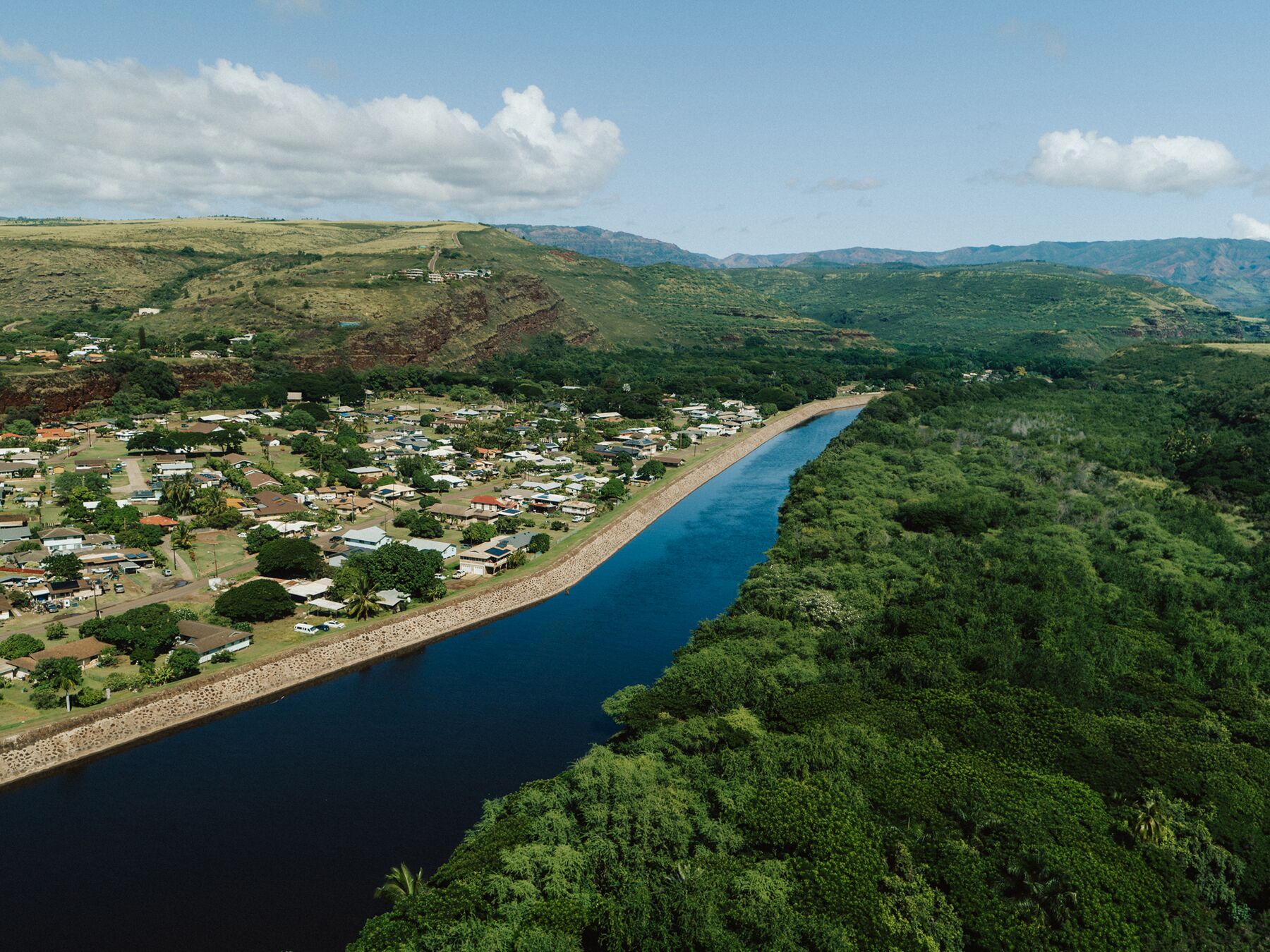
Aerial view of Waimea: houses and trees on one bank of a wide, dark-blue river, forest on the other, and green hills beyondPhoto: Hawaii Tourism Authority (HTA)

Waimea town

This is where Waimea Canyon Drive begins, and the place for your last gas and groceries. Captain James Cook made his first landfall in the Hawaiian Islands here in January 1778. Pāʻulaʻula, the state historic site at the river mouth also known as the Russian fort, is closed for construction.

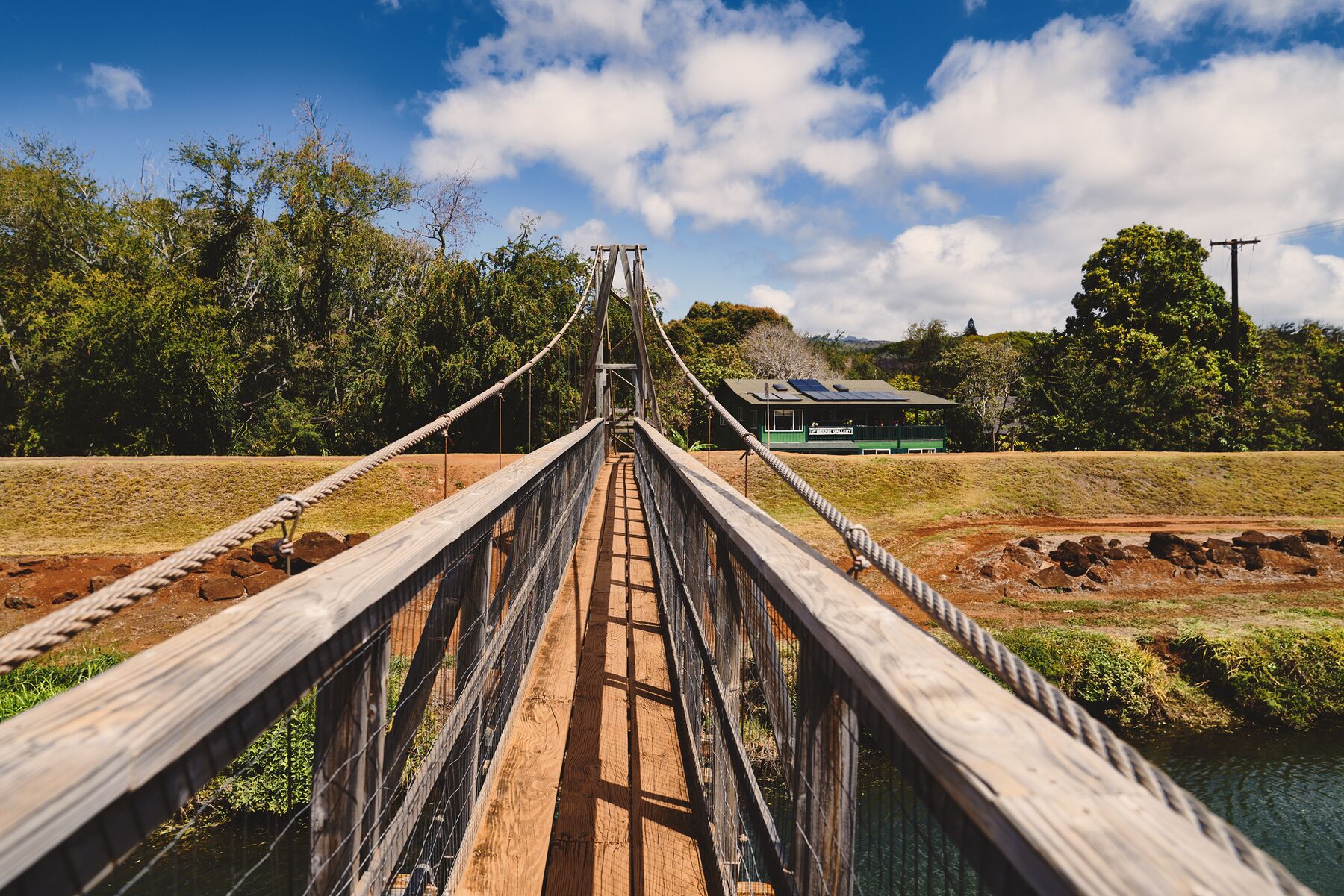
Looking along the wooden deck of Hanapēpē’s suspension footbridge, with cable railings leading to the far bank and trees under a blue skyPhoto: Hawaii Tourism Authority (HTA) / Jakob Owens

Hanapēpē swinging bridge

A short drive east of Waimea, Hanapēpē is a small old town of galleries and shops. Its footbridge across the Hanapēpē River sways as you cross.

The wooden false-front Talk Story Bookstore in Hanapēpē, with a red banner reading “The westernmost bookstore in the United States” below the roofline, and two people walking in the open doorPhoto: Hawaii Tourism Authority (HTA) / Ben Ono

Talk Story Bookstore

The bookstore on Hanapēpē’s main street bills itself, on the sign out front, as the westernmost bookstore in the United States.

Sources: NPS, Cook Landing Site · Pāʻulaʻula closure: DLNR park notices.

Check before you go

Say it right: the ʻokina (ʻ) is a glottal stop, a brief catch in the voice, as in Kauaʻi and Kōkeʻe. The kahakō (macron, as in ō) marks a long vowel. Nāpali means “the cliffs.”