Hawaiʻi Guide
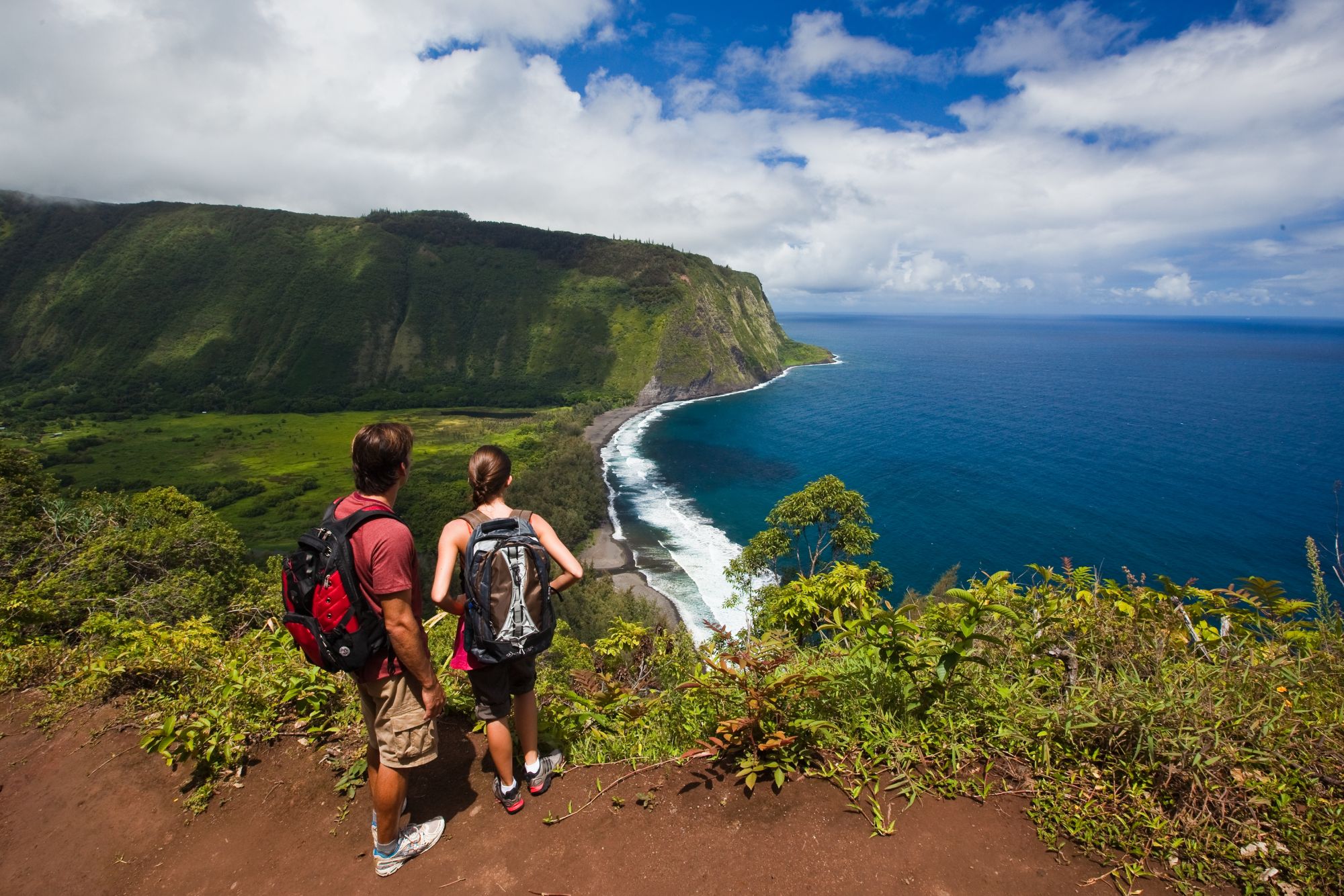
Two hikers with backpacks stand at the edge of the Waipiʻo Valley rim, looking down at the green valley floor, a curving black-sand beach and the tall sea cliffs beyond.

Hawaiʻi Island · Highway 19 north of Hilo

The Hāmākua Coast

About fifty miles of green gulches, plantation towns and sea cliffs on the windward side of Maunakea, from Hilo to the rim of Waipiʻo Valley. This guide takes the stops in order of distance from Hilo.

Waipiʻo Valley Lookout. Photo: Hawaii Tourism Authority (HTA) / Tor Johnson

North of Hilo, the Hawaiʻi Belt Road (Route 19) runs above the sea on the flank of Maunakea, crossing one stream gulch after another on old sugar-plantation land.

For more than a century this coast grew sugarcane. Hāmākua Sugar Company in Honokaʻa closed in 1994, the last of the big plantations up here. The camps and mills are mostly gone, but the small towns, the Japanese and Portuguese storefronts and the old railroad grade (much of today’s highway through North Hilo and Hāmākua was built on it after the 1946 tsunami) are still there to see. Allow a half day to drive to Waipiʻo and back with a few stops, or a full day if you stop everywhere.

Mileages are approximate distances from Hilo along Highway 19. They are meant for planning, not for exact navigation.

  • ≈ 51 miHilo to the Waipiʻo Valley Lookout, via Hwy 19 and Hwy 240
  • 442 ftʻAkaka Falls, a single free-falling plunge
  • 1946The tsunami that struck Laupāhoehoe Point and ended the coastal railroad
  • 1930Year the Honokaʻa People’s Theatre opened on Māmane Street

The route at a glance

Hilo to Waipiʻo, mile by mile

Approximate miles from Hilo along Highway 19. Waipiʻo is reached by turning onto Highway 240 at Honokaʻa.

Waipiʻo: about 43 miles to Honokaʻa on Hwy 19, then roughly 8–9 miles on Hwy 240 through town and Kukuihaele to the end of the road.

4mi from Hilo

Pāpaʻikou

Onomea Bay Scenic Drive

A 4-mile loop on the Old Māmalahoa Highway, signed “Scenic Route”

The first stop is a short detour off the highway. The Onomea Scenic Drive is a four-mile section of the Old Māmalahoa Highway. It leaves Route 19 a few miles north of Hilo and rejoins it farther north. The road is narrow and winding, with one-lane bridges over small streams, and trees close overhead in places. Take it slowly, since residents use it every day.

About halfway along is the Hawaiʻi Tropical Botanical Garden, a privately run garden in Onomea Valley that runs down to the bay. The late Dan Lutkenhouse cleared it by hand and opened it in 1984. A steep boardwalk leads down to trails past palms, heliconia, orchids, a lily lake and the tiered Onomea Falls. Older signs and listings may call it the “Hawaiʻi Tropical Bioreserve & Garden.”

Just north of the garden’s parking lot, a small brown Nā Ala Hele sign marks the free Onomea Trail. It follows the old government road down toward the bay, where the rocky shoreline is lined with ironwood and pandanus. Park completely off the road in the small pull-offs.

  • Garden: admission charged; open daily 10 a.m.–6 p.m., last entry 5 p.m. The garden suggests allowing 90 minutes to 2 hours. The boardwalk is steep, and wheelchairs and walkers aren’t permitted.
  • Trails: short but steep and very slippery when wet. Don’t drink the stream water, and think twice about wading with open cuts.
  • History: a natural sea arch at Onomea collapsed in a 1956 earthquake. Twin Rocks still stand in the bay.
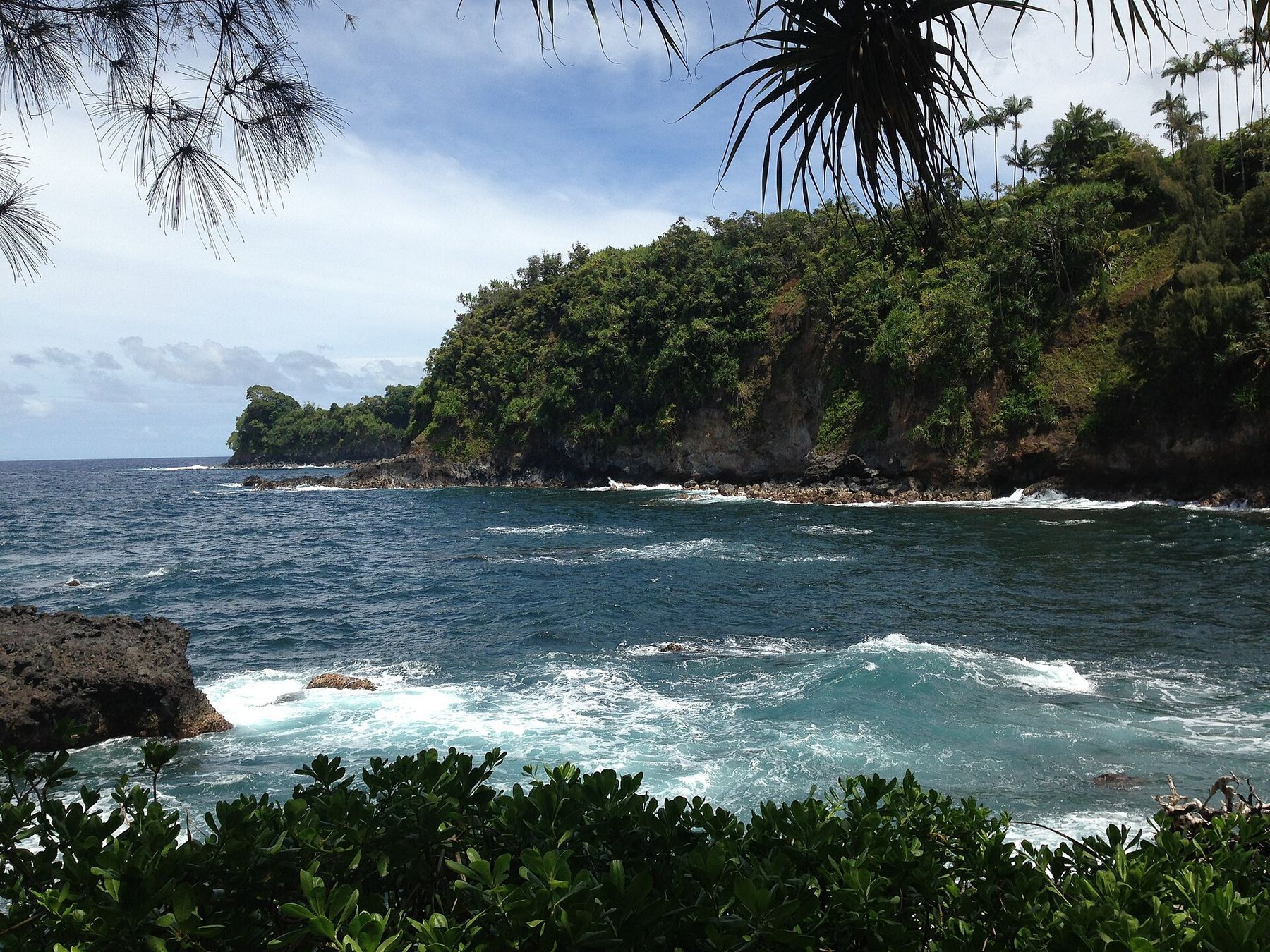
Blue water and white surf in Onomea Bay, with a forested lava headland framed by pandanus leaves.
Onomea Bay from the lower garden. Photo: AlaskaDave · CC BY-SA 3.0
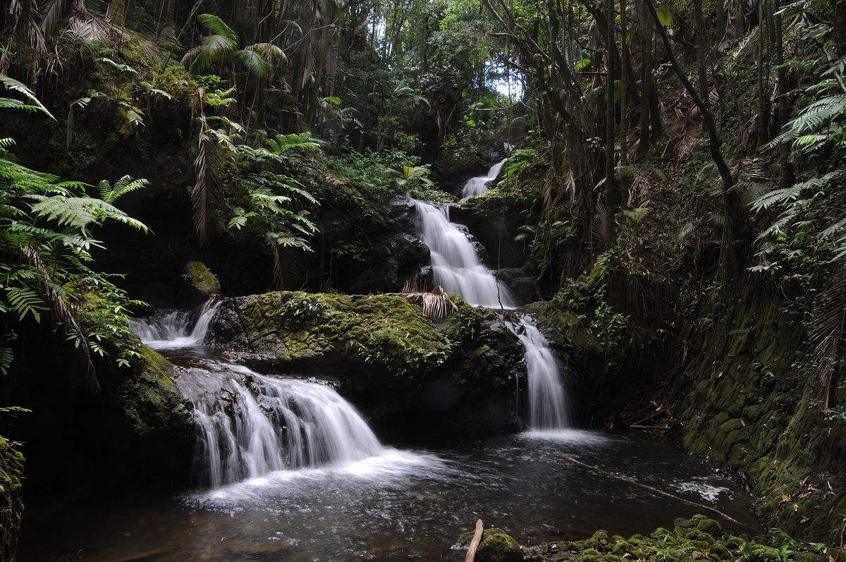
Onomea Falls tumbling over mossy black rock in several tiers, surrounded by ferns.
Onomea Falls, inside the botanical garden. Photo: Eric Marshall · CC BY 3.0
13mi from Hilo

Honomū · Route 220

Honomū & ʻAkaka Falls

Turn mauka (inland) on Route 220 through Honomū; the state park is at the end of the road, 3.6 miles past Honomū

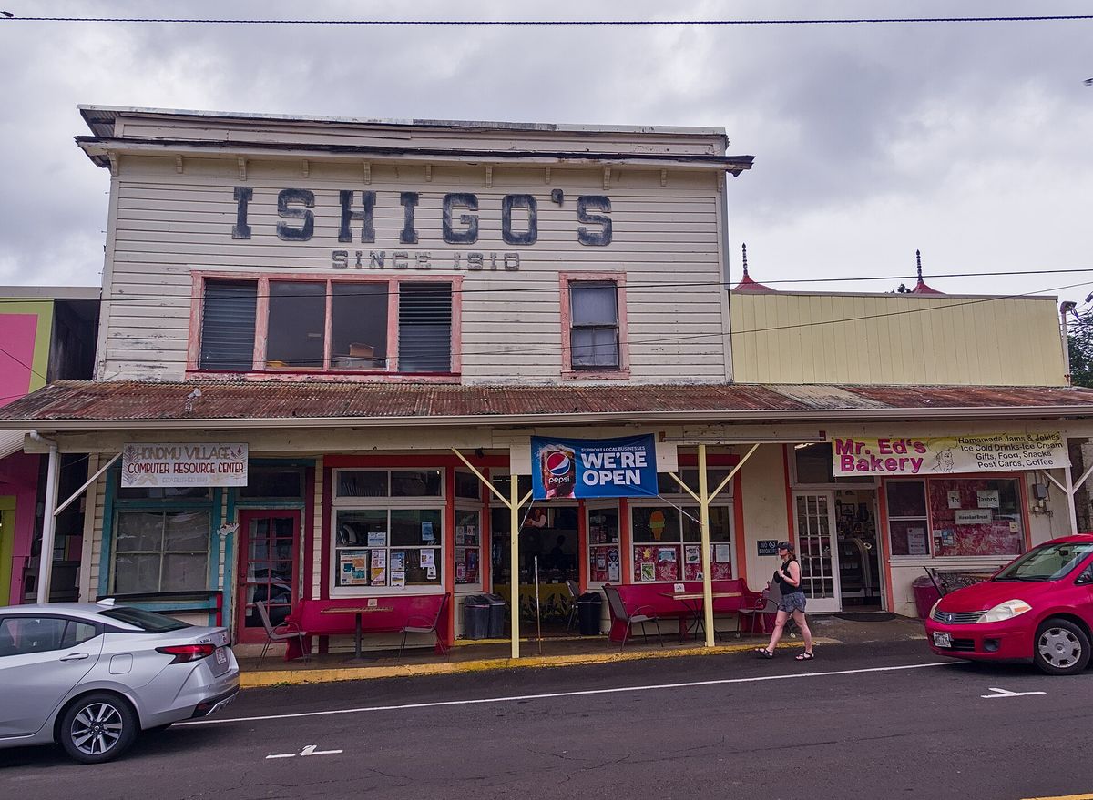
Honomū is a small old plantation town with a one-block main street of false-front wooden buildings. Ishigo’s, with its “Since 1910” sign, is one of them. Most people stop on the way up to the falls for a snack or a look around.

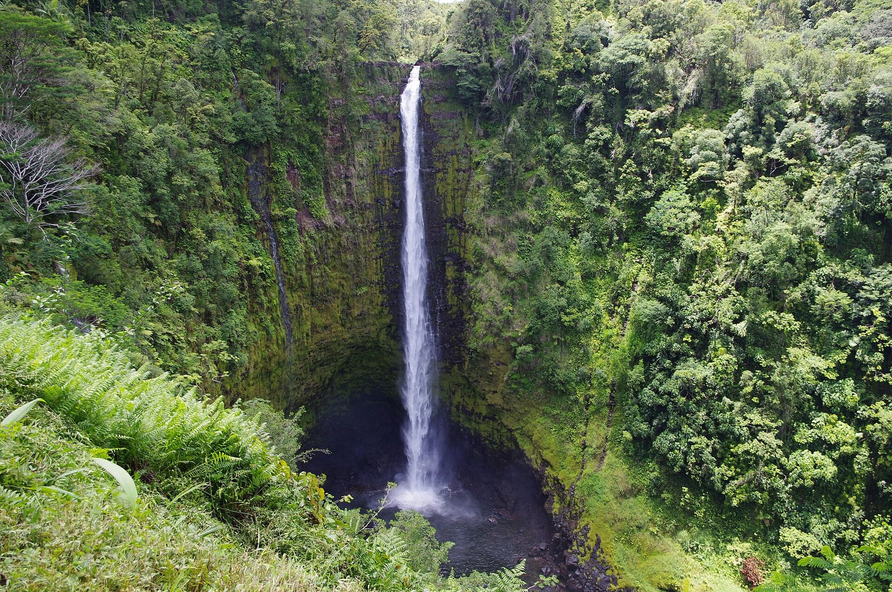
At the top of the road, ʻAkaka Falls State Park has a paved loop trail of about 0.4 mile through lush tropical vegetation. It passes Kahūnā Falls and reaches a viewpoint across the gorge to ʻAkaka Falls, which drops 442 feet in one unbroken plunge on Kolekole Stream. If you only stop once on this coast, this is the stop to make.

  • Fees (2026): non-residents pay $5 per person and $10 per car to park. Hawaiʻi residents with ID get in free. Payment is by card, and cell service is weak, so consider paying ahead online.
  • Hours & trail: open daily 8:30 a.m.–5 p.m. The loop is paved but has many steps, so it isn’t wheelchair accessible. For ʻAkaka only, bear left at the first junction.
  • Timing: mornings are usually quieter and clearer. Rain makes the falls fuller and the steps slick.
ʻAkaka Falls, a thin white ribbon of water falling hundreds of feet into a dark pool in a gorge thick with green vegetation.
ʻAkaka Falls. Photo: Ken and Nyetta · CC BY 2.0
The two-story wooden Ishigo’s General Store building on Honomū’s main street, with shop fronts and parked cars.
Main street, Honomū. Photo: Šarūnas Burdulis · CC BY-SA 2.0
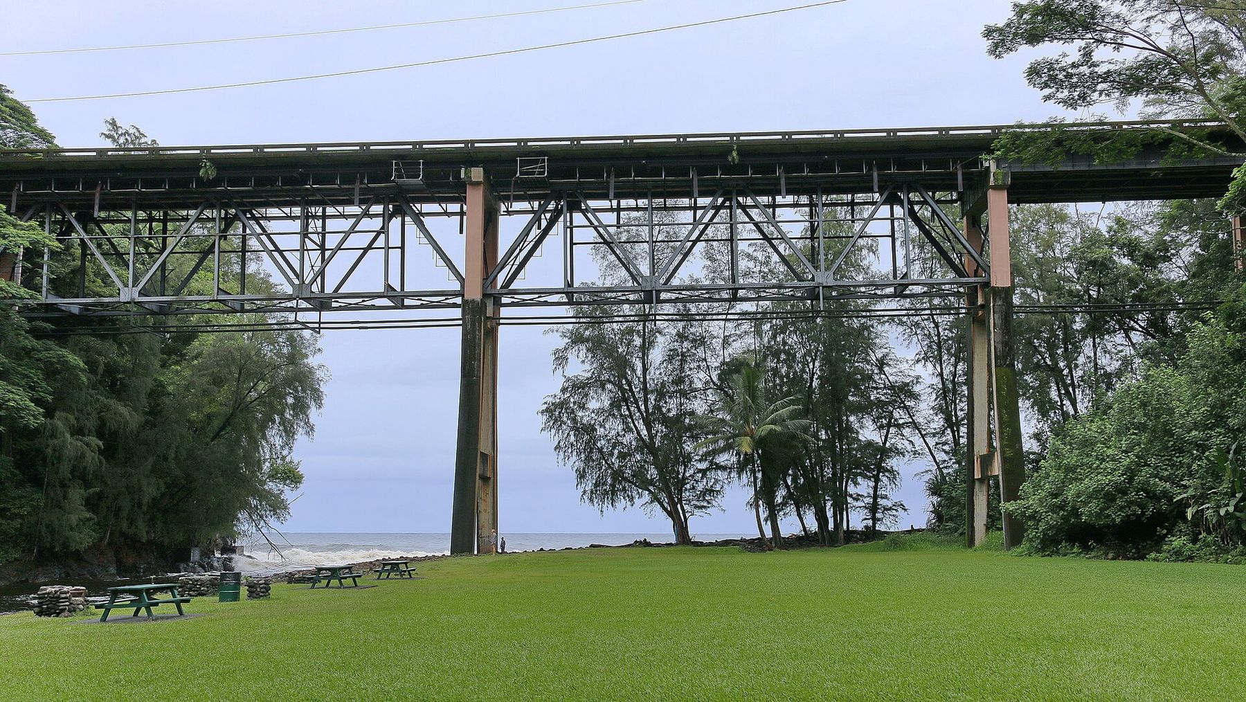
The tall steel trestle of the Highway 19 bridge spanning Kolekole Beach Park, with lawn and picnic tables below and the ocean beyond.
Highway 19 crossing over Kolekole Beach Park. Photo: Robert Linsdell · CC BY 2.0
14mi

Kolekole Beach Park

About 14 mi · steep side road down from the highway, just past Honomū

This county park sits in the gulch below the Route 19 bridge, where Kolekole Stream (the same stream that goes over ʻAkaka Falls) reaches the ocean. It has grassy lawns, pavilions and a small waterfall, and local families use it for picnics. The park was closed for most of 2017–2024, first because of lead contamination from old bridge paint and then for bridge repairs and park upgrades. It reopened in April 2024 after a $6.3 million renovation.

Ocean & water caution: the river mouth faces open ocean with rough shorebreak and strong currents, so it isn’t a swimming beach. Health advisories for high bacteria in the stream have been issued after heavy rain. Stay out of the water during and after storms. A final phase of lead cleanup, combined with more bridge work, is expected to close the park again for a time. As of 2024 that work was not scheduled to start before summer 2027.
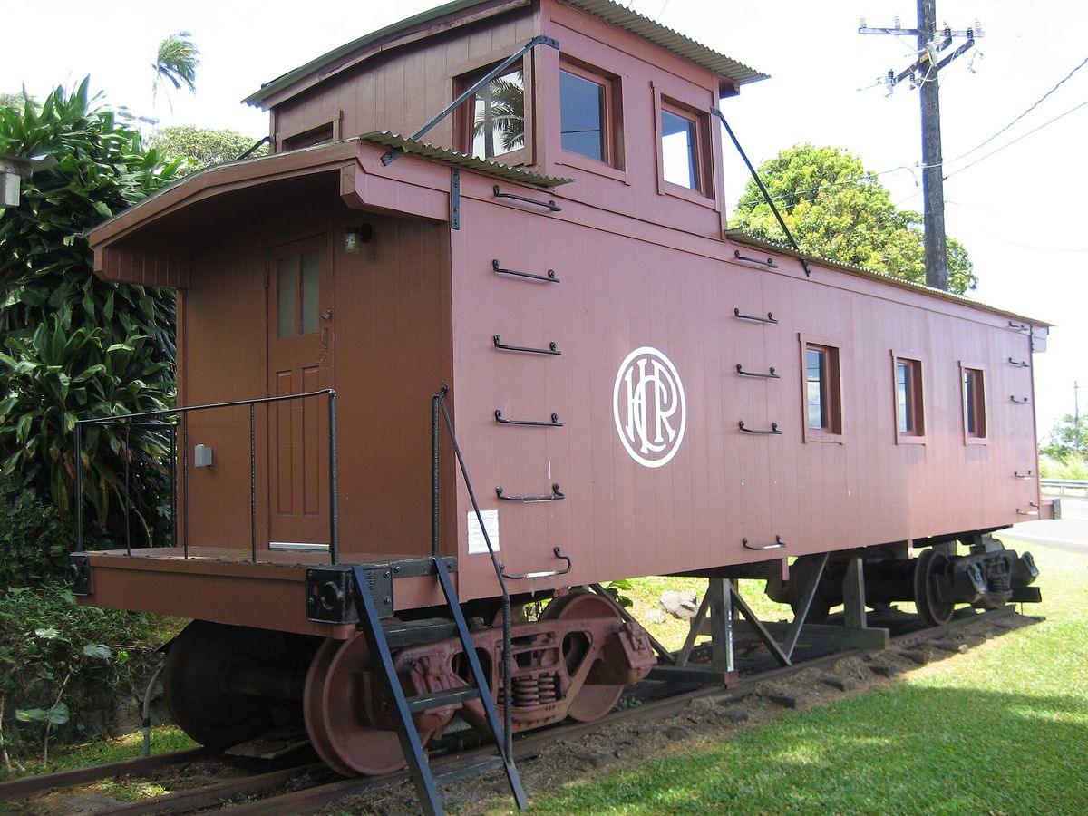
A restored maroon wooden railroad caboose displayed on a short track beside tropical plants.
Caboose at the Laupāhoehoe Train Museum (2011). Photo: Danny Howard · CC BY-SA 2.0
25mi

Laupāhoehoe Train Museum

About 25 mi · on the highway in Laupāhoehoe, before the turnoff to the Point

From the early 1900s, the Hawaii Consolidated Railway carried sugar and passengers along this coast on a line of trestles over the gulches. The 1946 tsunami wrecked the line and it never reopened. Much of today’s Highway 19 was later built on the old railroad grade and bridges. The small museum, in a former station agent’s house, tells the railroad’s story with photographs and artifacts, and has a caboose outside.

Hours are limited, so check before you plan around a visit.

27mi from Hilo

North Hilo district

Laupāhoehoe Point

A steep, winding paved road drops makai (seaward) from the highway to a county beach park

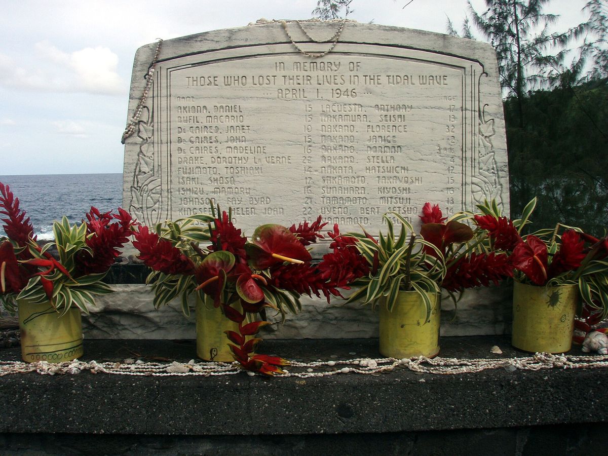
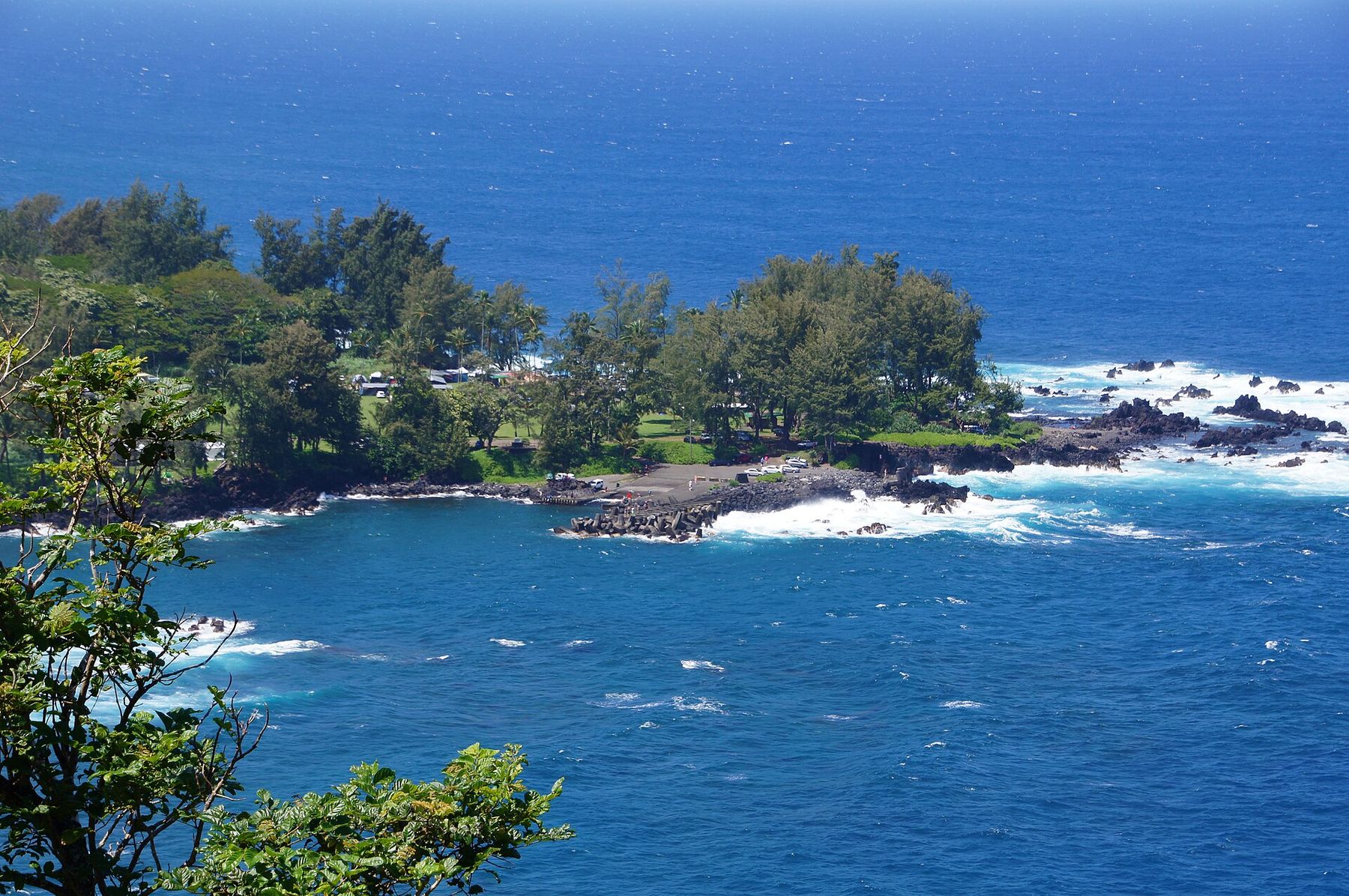
Laupāhoehoe is a low, flat point of lava that sticks out into the Pacific below high green cliffs. It was once a village and landing, and later the site of the community’s school. On the morning of April 1, 1946, a tsunami from an Aleutian Islands earthquake swept across the point. Twenty-four people died, most of them children and teachers at the school. A stone monument near the shore lists their names and ages.

Today the point is a quiet county park with lawns, ironwood trees, a boat ramp and waves breaking on black lava. People come here to watch the surf, fish, and see the sunrise.

  • Not a swimming spot: strong surf, currents and sharp lava rock, and no lifeguards. Keep well back from the edge when the surf is up, and never turn your back on the ocean.
  • Camping: allowed only with an advance County of Hawaiʻi permit. The pavilions are for day use.
  • At the memorial: this is a place of mourning for local families. Please be quiet and respectful, and leave any offerings alone.
Laupāhoehoe Point seen from above: a low wooded lava peninsula edged with white surf in deep blue water.
Laupāhoehoe Point from the highway above. Photo: Madereugeneandrew · CC BY-SA 4.0
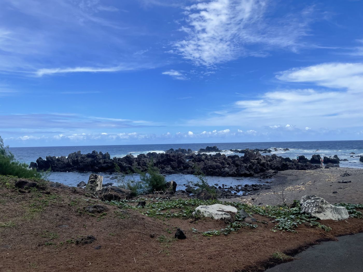
Black lava boulders and a tide pool along the shoreline at Laupāhoehoe Point under a bright blue sky with white clouds.
The shoreline at the point.
A stone memorial inscribed ‘In memory of those who lost their lives in the tidal wave, April 1, 1946’, with red flower offerings along its base.
1946 tsunami memorial. Photo: Brocken Inaglory · CC BY-SA 3.0
40mi from Hilo

Near Honokaʻa

Kalōpā State Recreation Area

Turn mauka between mile markers 39 and 40 and follow the signs about 3 miles uphill

Kalōpā is a detour that many visitors skip. It is a 100-acre state park at about 2,000 feet elevation, in native ʻōhiʻa lehua rainforest on the slope of Maunakea, and it adjoins a larger forest reserve. The easy 0.7-mile nature loop (allow about an hour at a slow pace) passes some two dozen native tree, shrub and vine species. The park also has an arboretum of native plants. Longer trails go into the forest reserve, including a horse loop.

  • Hours: daily 7 a.m.–8 p.m. There is no entrance fee.
  • Stay: tent camping by advance state permit. The park’s cabins are listed by State Parks as closed through 12/31/2026.
  • Weather: it is often cool, misty and damp up here, so bring a layer.
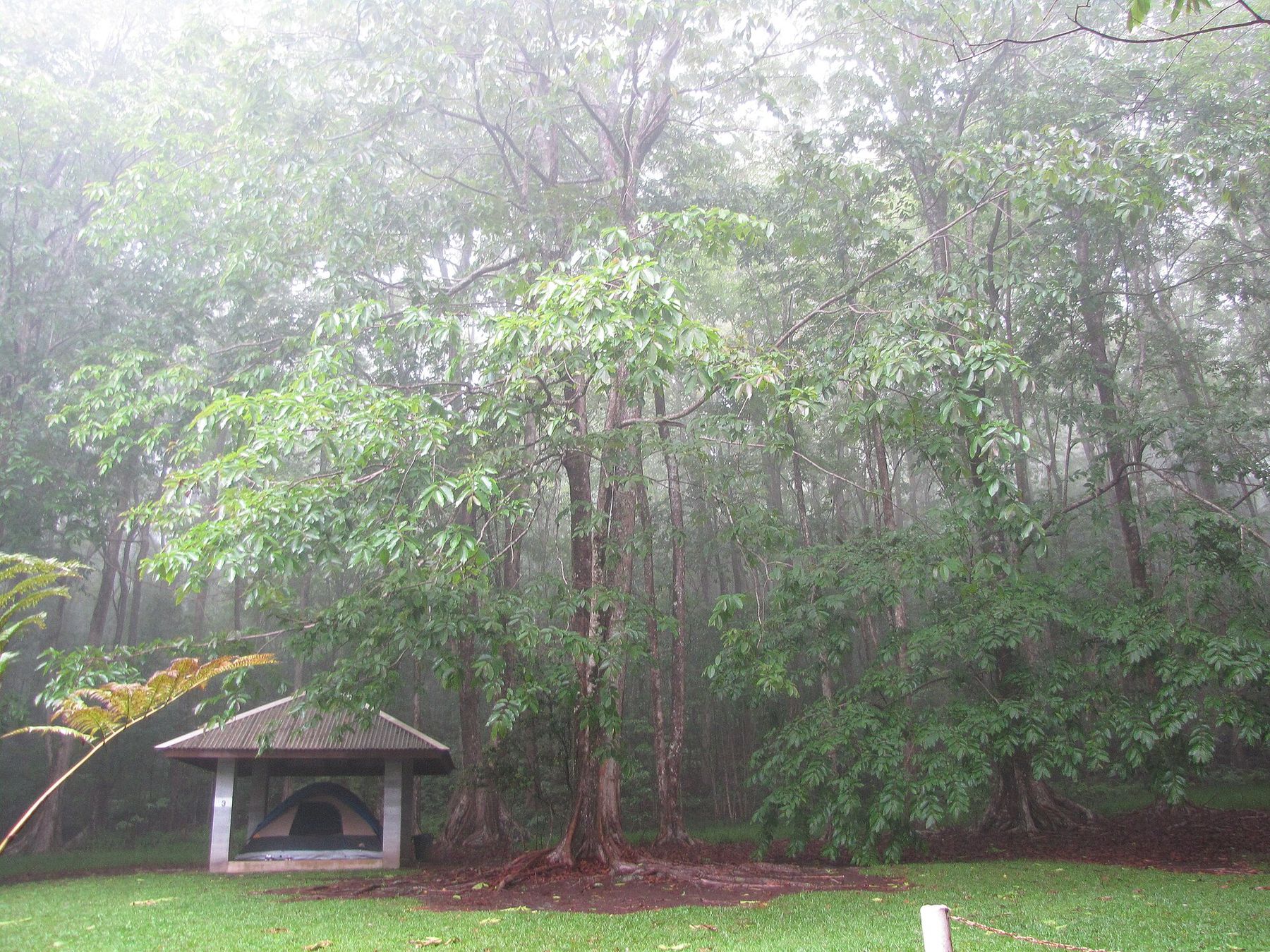
Tall trees in misty rainforest at Kalōpā, with a small open-sided shelter on a green lawn.
Misty forest and campground shelter at Kalōpā. Photo: Forest and Kim Starr · CC BY 2.0
43mi from Hilo

The town of the coast

Honokaʻa

Route 240 branches off Highway 19 and becomes Māmane Street, the town’s main street · about 14 mi east of Waimea

Honokaʻa is the largest town on the Hāmākua Coast (population 2,699 in 2020) and the last real town before Waipiʻo. Its main street, Māmane Street, is lined with wooden two-story buildings from the 1920s and ’30s that have covered sidewalks and painted signs. It is a good place to walk, get lunch and fill the tank.

The town grew up around sugar. From 1873 until 1994, the economy was built on sugar production that ended with the Hāmākua Sugar Company. Workers came from Japan, Portugal, the Philippines, China and elsewhere, and their family names are still on the storefronts. Since the mill closed, the district has turned to ranching and smaller-scale farming (coffee, macadamia nuts, tea, fruit and vegetables), and many residents now commute to jobs in Hilo.

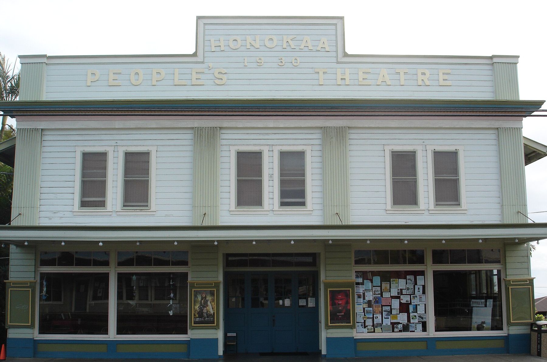
The pale green and white false-front facade of the Honokaa People’s Theatre, with ‘1930’ and the theater’s name at the top and poster cases beside the doors.
Honokaʻa People’s Theatre on Māmane Street. Photo: Ross Stephenson · CC BY-SA 3.0 (cropped)

Honokaʻa People’s Theatre

The Tanimoto family built the theatre on Māmane Street in 1930, and it showed films for the plantation town for decades. The family ran it until 1990, when Dr. Tawn Keeney took over. It hosted the Hāmākua Music Festival from 1993 to 2006, with jazz, classical and Hawaiian musicians, and it held the world premiere of the 2009 Japanese film Honokaa Boy, which was set in the town. Movies and live events still take place here; check the theatre’s schedule.

Māmane Street

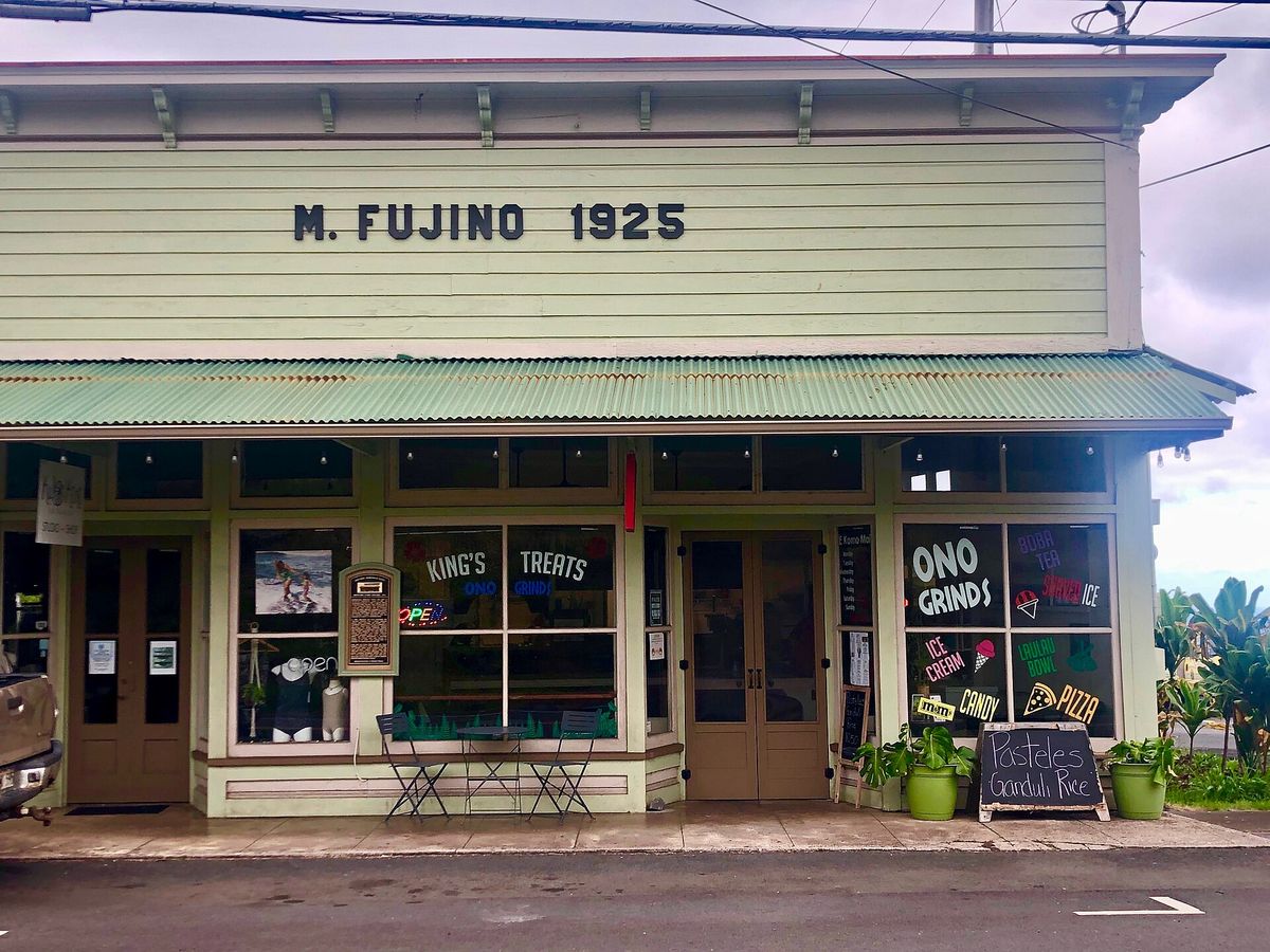
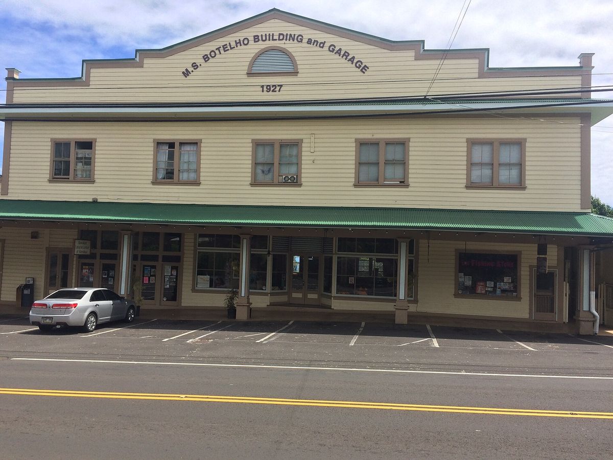
Walk the few blocks and look up at the dates on the buildings. The M. Fujino store opened in 1925 and was built by Matsujiro Fujino, an immigrant from Hiroshima, to sell general merchandise. The M.S. Botelho Building and Garage dates from 1927. Today the storefronts hold antique and secondhand shops, galleries, small cafés and plate-lunch counters. Hours are local and some places close early, so lunch is a safer bet than dinner.

Malasadas at Tex Drive In

On Highway 19 at the edge of town, Tex Drive In has been making Portuguese-style malasadas since 1969. They are made fresh daily and come plain or filled. In 2018 it was named to the Hawaii Restaurant Association Hall of Fame. It is a favorite stop for people driving between Hilo and Waimea.

A base for Waipiʻo

From Honokaʻa, Route 240 runs about 8–9 miles northwest through ranch and farm country and the small village of Kukuihaele to the Waipiʻo Valley Lookout, where the road ends. Small inns and rentals in and around Honokaʻa make it easy to be at the rim early, before the parking lot fills. Get gas and groceries in Honokaʻa before heading out to the valley.

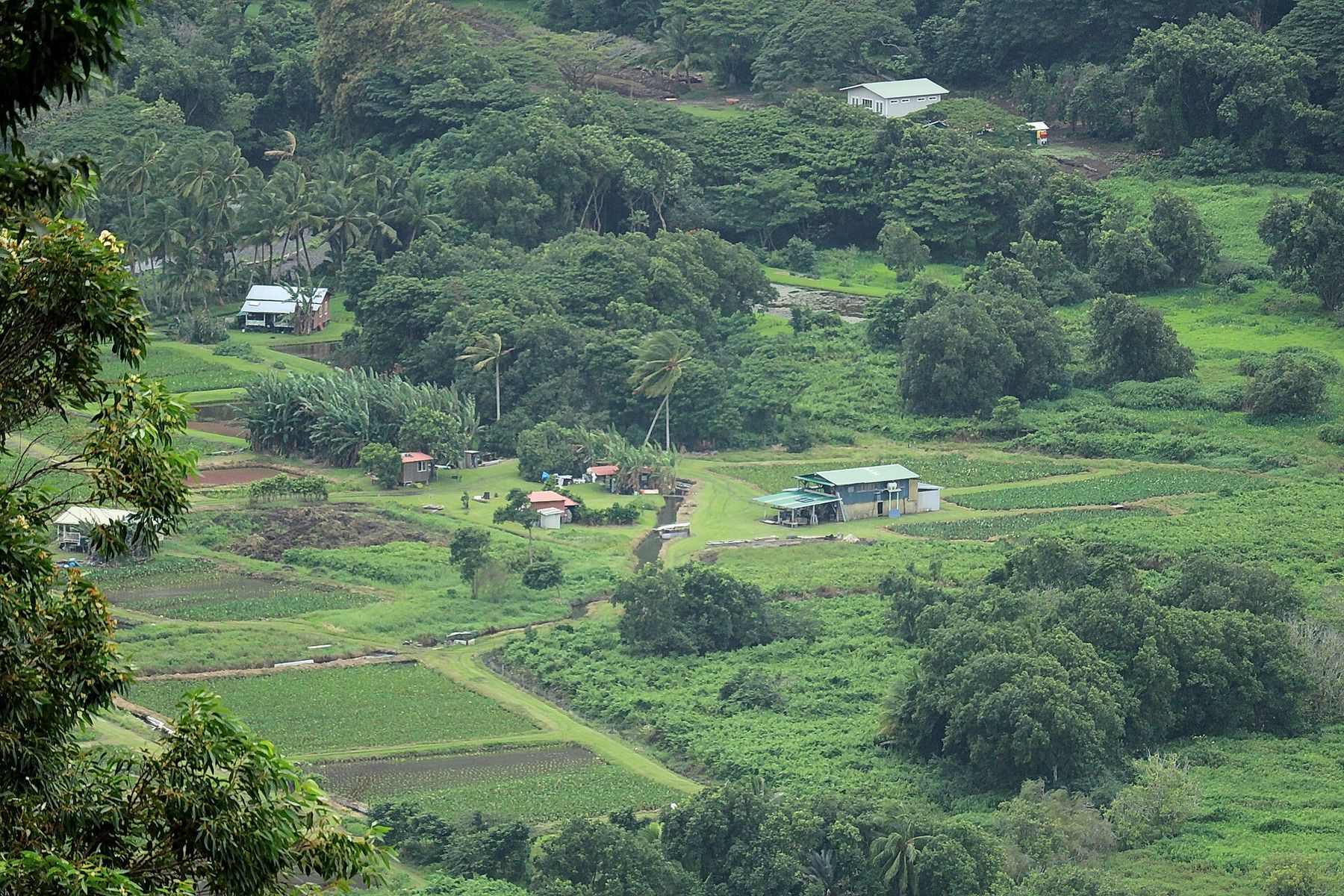
Looking down on the floor of Waipiʻo Valley: patchwork taro fields, scattered homes and farm roads among dense green trees.
≈ 51mi from Hilo

End of the road · Hāmākua district

Waipiʻo Valley

About 51 miles from Hilo: ~43 on Hwy 19 to Honokaʻa, then ~8–9 on Hwy 240 to the lookout at Kukuihaele

Taro patches and homes on the valley floor. Photo: Robert Linsdell · CC BY 2.0
Access status · checked September 2026

The road into the valley is closed to visitors

Since February 2022, Waipiʻo Valley Road has been under a County of Hawaiʻi emergency rule, renewed about every 60 days. The rule closes the road to all pedestrians, to uncovered vehicles (including ATVs), and to horseback riders. The only exceptions are vehicles driven by Hawaiʻi County residents, county-permitted, licensed and insured tour operators, and Native Hawaiians exercising traditional and customary rights. Even those vehicles must be low-range four-wheel drive (the rule says all-wheel drive doesn’t count), stay in 4WD the whole way, and carry passengers seated and belted in an enclosed cab. Downhill traffic yields to uphill traffic. The County can close the road completely during significant weather and during repair work.

What visitors can do

  • Enjoy the view from the Waipiʻo Valley Lookout. It is free, and no permit is needed.
  • See the valley floor on a guided ride with a county-permitted tour operator. Book ahead and ask the operator to confirm its current permit.
  • Learn about the valley from local guides, and at museums and cultural centers around the island.

What visitors can’t do right now

  • Walk or hike down the road. Pedestrians are prohibited, including hikers heading for the beach or the Muliwai Trail.
  • Drive down yourself, even in a rented 4WD. The resident exception is for Hawaiʻi County residents, and rental agreements commonly forbid this road anyway.
  • Ride horses or take ATVs or other open vehicles on the road.
  • Wander onto private land or into taro patches on the valley floor.

Sources: the County of Hawaiʻi’s “Mayor’s Waipiʻo Valley Road Continued Emergency Rule No. 2 and Emergency Rule No. 1” (24th renewal, posted July 1, 2026); Big Island Now reporting (Sept. 4, 2026) that the traffic emergency zone was extended into November 2026; the underlying declaration runs to February 25, 2027 unless changed. Rules change: check the County of Hawaiʻi news page and Public Works bulletins before you go, and call ahead on the day. For permit questions, the rule lists the Mayor’s Office at (808) 961-8211.

Waipiʻo means “curved water.” It is the largest and southernmost of the seven big valleys on the windward side of the Kohala Mountains, carved by streams into the old Kohala volcano. Its walls rise up to about 2,000 feet above a valley floor of taro patches, streams and a wide black-sand beach.

The Valley of the Kings

In Hawaiian tradition, Waipiʻo was a political and religious center of Hawaiʻi Island. Early aliʻi (ruling chiefs) held court here up to the time of ʻUmi-a-Līloa. The valley was home to the sacred heiau Pākaʻalana, a place of refuge, and to the royal mausoleum Hale o Līloa. Tradition links it closely to the young Kamehameha I. By some estimates the valley once supported as many as 10,000 people farming kalo (taro) in irrigated loʻi. Legend also places a hidden entrance to Lua-o-Milu, the underworld, in the sands here.

The valley has lived through hard changes. The 1946 and 1960 tsunamis hit its low-lying floor, and the population fell sharply after the mid-20th century. A small community still lives and farms here, and Waipiʻo is still an important taro-growing valley.

At the lookout

Highway 240 ends at the Waipiʻo Valley Lookout in Kukuihaele. From the rim you look down into the mouth of the valley, over the curve of black sand at the river mouth and the northern cliffs that run on toward Waimanu and Kohala. The lookout is free and open to everyone, and it is a short walk from the parking area, which has restrooms and picnic tables. The lot fills on busy days by mid-morning, so arrive early.

The road down

From the lookout, Waipiʻo Valley Road drops about 800 feet in well under a mile. The average grade is around 25 percent, steeper in sections, making it one of the steepest paved public roads in the United States. A 2022 geotechnical evaluation for the County found rockfall, slope instability and erosion along it. The County finished a first phase of hazard removal in 2023. Further phases of rockfall mitigation are in planning and design. According to Big Island Now (February 2026), the remaining work is expected to be finished in 2027.

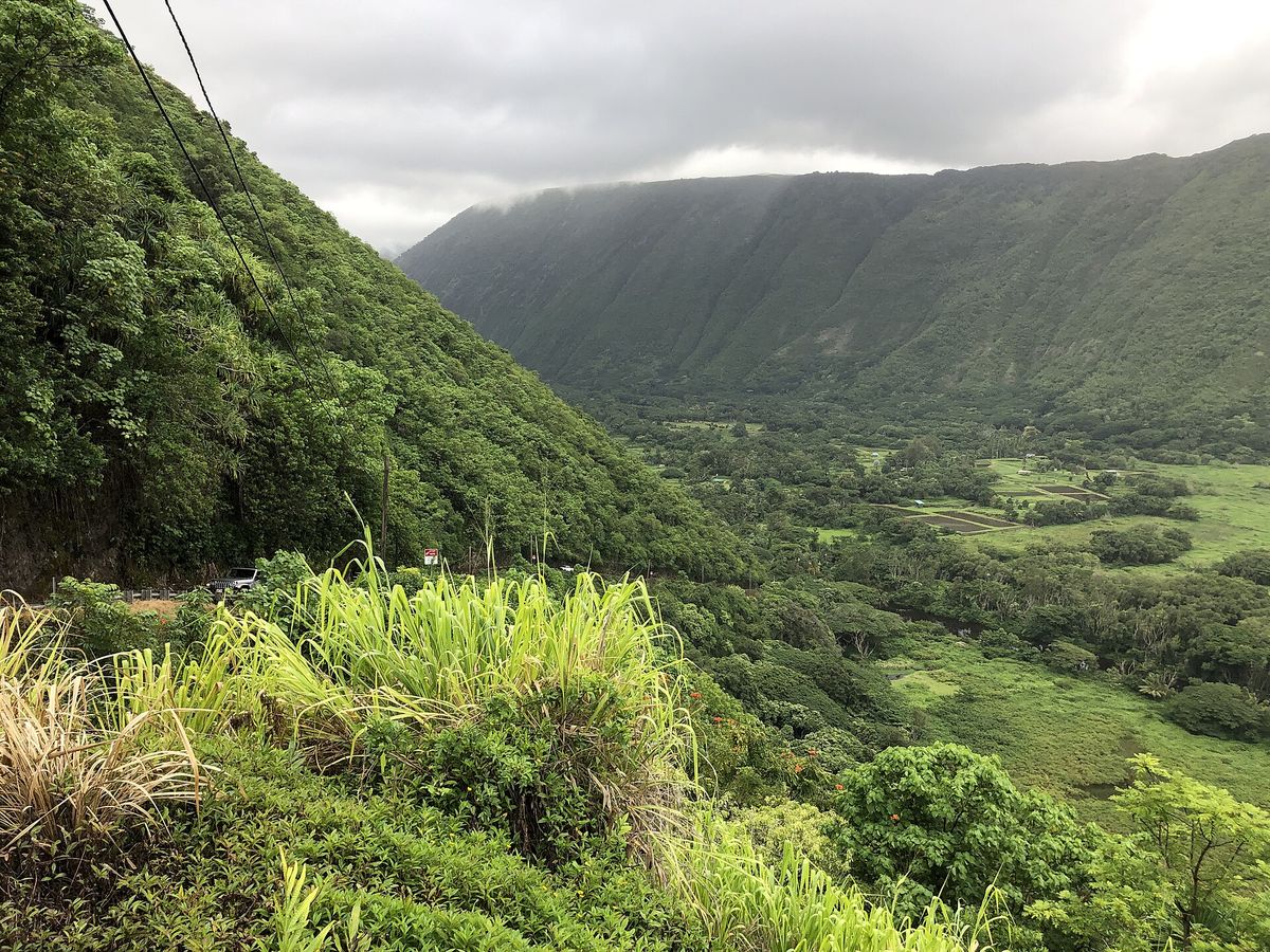
View from partway down the steep Waipiʻo Valley Road: a green valley wall on the left and the flat valley floor with fields spreading inland under cloud.
Looking across the valley from about 450 ft up Waipiʻo Valley Road (2021). Photo: Famartin · CC BY-SA 4.0

A living valley: visit with respect

Waipiʻo is not a park. It is a sacred place and a home. Families live here and farm kalo in loʻi that people have worked for generations, and much of the valley floor is private land. Hawaiians value mālama ʻāina, caring for the land, and the valley’s cultural sites and burial places are to be honored and left undisturbed.

  • Stay with your guide and on the route you are shown.
  • Don’t enter loʻi, cross fences, pick fruit or take rocks and sand.
  • Ask before photographing people or homes. Don’t fly drones over residents.
  • Treat “kapu” (keep out) and private-property signs as binding.

Safety

  • Rockfall and landslides are the reason the road is restricted. Heavy rain makes them more likely.
  • The ocean at Waipiʻo is open to the full North Pacific swell. High surf and rip currents are common, especially in winter, and there are no lifeguards. It is not a swimming beach.
  • Streams can rise suddenly and dangerously after rain upstream, even if it isn’t raining where you are. Never cross fast or rising water. Freshwater can carry leptospirosis.
  • At the rim, stay behind barriers and off crumbling edges.
  • No services are on the valley floor. Use the restrooms at the lookout.

Before you go

Practical tips for the drive

Driving

  • Hwy 19 is a two-lane highway with curves and gulch crossings. Hilo to Honokaʻa takes about an hour without stops.
  • Use marked pull-offs; don’t stop on bridges or blind curves.
  • Side roads (Onomea, Laupāhoehoe, Kolekole) are narrow and steep. Go slowly and watch for residents and cyclists.
  • Directions here use mauka (toward the mountain) and makai (toward the sea).

Weather & what to bring

  • This is the windward, rainy side of the island. Showers can come any time of day, and mornings are often clearer.
  • Bring a light rain jacket, shoes with grip for wet trails and steps, and insect repellent.
  • Upland stops like Kalōpā are cooler; a layer helps.
  • Sun still burns between showers. Use reef-safe sunscreen.

Gas, food & services

  • Leave Hilo with a full tank. Services are sparse along the coast until Honokaʻa.
  • Honomū and Honokaʻa have the most food stops. Hours are local, and many places close by mid-afternoon or on certain days.
  • Carry water and snacks. Cell coverage is patchy in the gulches and at ʻAkaka Falls.

Ocean & streams

  • Most of this coast is cliffs, boulders and open-ocean surf. Assume it isn’t safe to swim unless you know otherwise.
  • Stay off wet rocks near the water line, and watch the waves for several minutes before going near the edge.
  • Streams can flash-flood after rain upslope. If water rises or turns brown, get out and stay out.

Respect the places

  • Many sites are private land, working farms or culturally significant. Stay on marked paths and obey closure signs.
  • Park fully off the road and don’t block driveways or gates.
  • Pack out everything you bring in.

Check before you go

  • Waipiʻo Valley Road rules: County of Hawaiʻi news and Public Works bulletins.
  • ʻAkaka Falls and Kalōpā: Hawaiʻi Division of State Parks (DLNR).
  • Beach parks and camping permits: County of Hawaiʻi Parks & Recreation.
  • High-surf and flood warnings: National Weather Service Honolulu.

A few words of ʻōlelo Hawaiʻi

Hawaiian place names use the ʻokina (ʻ), a glottal stop, and the kahakō (macron, as in ā), which lengthens a vowel. They change the meaning and pronunciation, so this guide uses them throughout: Hāmākua, Honokaʻa, Laupāhoehoe, Waipiʻo.

mauka
toward the mountain, inland
makai
toward the sea
kalo
taro, the staple crop of Waipiʻo
loʻi
irrigated taro patch
ʻāina
land, that which feeds
mālama
to care for, to protect
kapu
sacred or forbidden; “keep out”
mahalo
thank you