Hawaiʻi Guide

Hawaiʻi Island

Alpine visitor guideWhere the ocean floor ends in starlight

Stargazing at 9,200 feet, a summit above the clouds, and a mountain sacred to Native Hawaiians. This guide covers what to know before you go: where to stop, how to handle the altitude, and what the summit rules require.

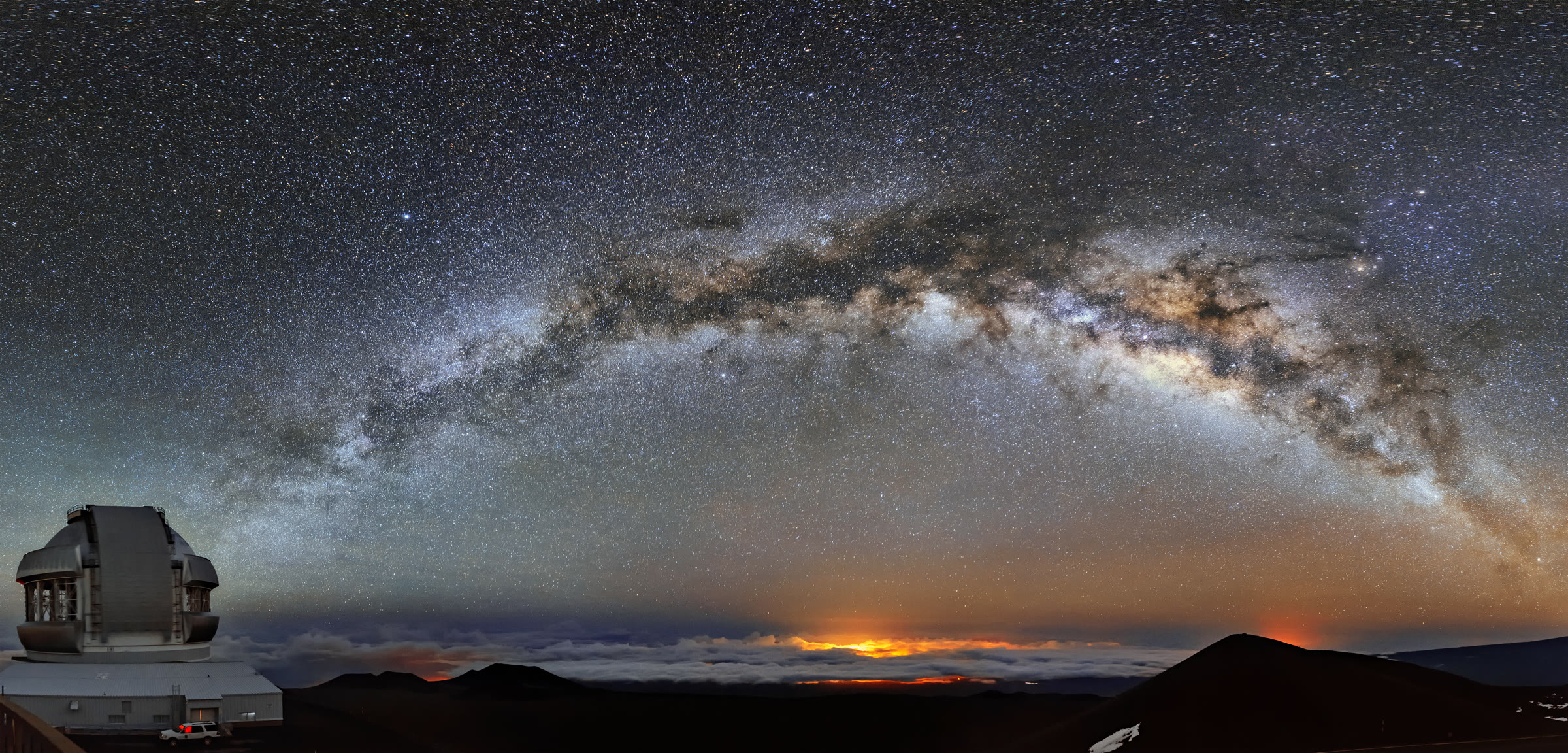
Milky Way arching over Maunakea with Gemini North under a sea of clouds

Above the clouds

World-class stargazing

Maunakea sits above much of Hawaiʻi’s weather and far from city glare. On a clear night the Milky Way can look like a bridge of light — the same dark skies that drew the world’s great telescopes to the summit.

Most visitors experience that sky from the Visitor Information Station at 9,200 ft, not from the summit after dark. Arrive before dusk, dress for alpine cold, and let your eyes adapt. The mountain’s astronomy reputation is real: the photos really aren’t much different from what you’ll see with your own eyes.

Photo: Galaxy of Dreams — International Gemini Observatory/NOIRLab/NSF/AURA/J. Chu · CC BY 4.0

13,796 ftSummit elevation · 4,205 m
9,200 ftVisitor Information Station
4WDRequired above the VIS
9–9VIS open daily, 9 a.m.–9 p.m.

Your base camp

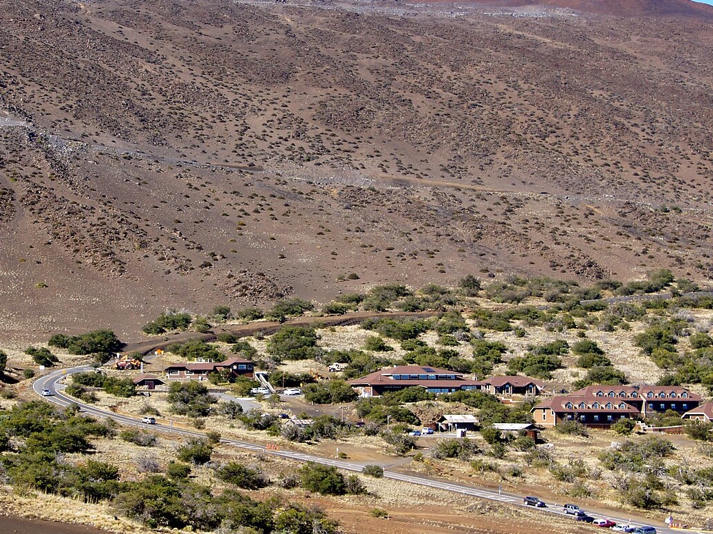
Visitor Information Station

The Onizuka Center for International Astronomy Visitor Information Station (VIS) sits at about 9,200 ft on Maunakea Access Road — turn from Saddle Road / Daniel K. Inouye Highway near milepost 28.

  • Open daily 9:00 a.m.–9:00 p.m. (every day of the year)
  • Phone: (808) 934-4550
  • No entrance or parking fee at the VIS
  • Stop here first — acclimate at least 30 minutes before going higher
  • Gift shop, exhibits, restrooms, and staff safety info when open

Drive time is roughly 1–1.5 hours from Hilo or Kona to the VIS depending on traffic and weather.

Onizuka Center Visitor Information Station on Mauna Kea
VIS / Onizuka Center — the practical hub for most visitorsPhoto: Madereugeneandrew, cropped · CC BY-SA 4.0

Above the VIS

Summit access: do’s and don’ts

Summit access is separate from stargazing. Night skies for visitors happen at the Visitor Information Station. Driving to the summit is a separate trip, with steep roads, high altitude, and a sunset curfew. It is not a way to see the stars after dark.

Beyond the VIS the road becomes steep, unpaved gravel. This is not a casual scenic loop. If you are unsure about self-driving, make the VIS your destination — it is already spectacular — or book a guided summit tour in advance.

Guided summit tours

If you want the summit without driving it yourself, guided tours run from the VIS up to the summit and also from the Kona side. Operators handle the 4WD, timing, and altitude briefing — but seats are limited.

  • Tours are available from the VIS to the summit and from Kona
  • Book in advance — same-day walk-ups are unreliable, especially in peak season
  • Confirm pickup point, vehicle rules, and cancellation policy when you reserve

Do

  • Acclimate at least 30 minutes at the VIS before going higher
  • Use a dependable, fully operable 4WD or AWD — 2WD is prohibited above the VIS
  • Engage 4WD Low on descent; downshift and tap brakes to avoid brake failure
  • Start with at least half a tank of fuel at the VIS — no public gas stations on the mountain
  • Arrive with a clean vehicle (no mud or plant matter — invasive species risk)
  • Check your rental car contract before using the summit road
  • Obey Rangers, posted limits, and road/area closures
  • Leave the summit area by 30 minutes after sunset
  • Bring real food, snacks, and water. Dining facilities are not available at the summit, the VIS, or anywhere nearby.

Don’t go above the VIS if you…

  • Are under 13 years old
  • Are pregnant
  • Have poor health, or heart / respiratory issues
  • Are intoxicated
  • Have been scuba diving within the last 24 hours

Also prohibited

  • Pets (except service animals)
  • Drones, off-road driving, off-trail travel
  • Alcohol, drugs, smoking / vaping
  • Camping, overnight sleeping, fires

Altitude sickness

The drop in atmospheric pressure and oxygen with increasing altitude can result in altitude sickness. This can lead to life-threatening conditions such as High Altitude Pulmonary Edema and High Altitude Cerebral Edema. To lessen your risk for these conditions, acclimate at least 30 minutes at the VIS.

Descend immediately and seek medical attention if you experience any of the following:

Signs and symptoms of altitude sickness include

  • Thirst
  • Shortness of breath
  • Headache
  • Nausea
  • Impaired judgment
  • Fatigue or drowsiness
  • Loss of balance and muscle coordination

Signs and symptoms of pulmonary edema and cerebral edema include

  • Breathing difficulties or coughing
  • Severe headaches
  • Vomiting
  • Blue lips and/or fingernails
  • Confusion
  • Extreme drowsiness
  • Coma

Airplane mode

Official rule: Do not use radio, cellphone, Bluetooth, Wi-Fi, or similar devices above the Visitor Information Station, except for emergencies.

Those signals can interfere with sensitive telescope instruments on the summit. Violations can bring fines of up to $2,500.

Switch phones and other wireless gear to airplane mode before you leave the VIS, and keep them that way until you are back below the station — unless you have a true emergency.

Night closure at the summit

The summit area is closed to visitors from 30 minutes after sunset until 30 minutes before sunrise. That is why summit trips and stargazing are different plans: for the night sky, descend below Park 2 / return to the VIS — do not stay on the summit after the cutoff.

Weather can flip to blizzard or hurricane-force winds even in summer. Always check current road conditions before you commit:

Mauna Kea road conditions (live) · Road status line: (808) 935-6268

Road and area status change with storms, maintenance, and safety needs. Do not rely on outdated news about temporary closures — verify the official sources the day you go.

Orientation

Access maps

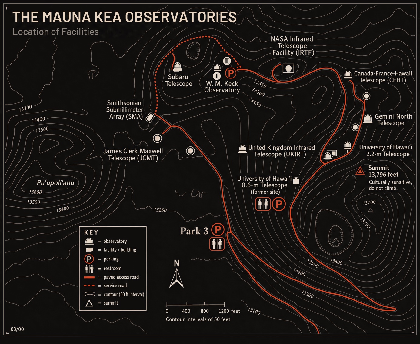
Read the mountain top-down: summit facilities first, then the upper parks and Ice Age Natural Area Reserve, then the climb from the Visitor Information Station. These maps are unofficial field sketches for orientation — always verify live road status before you drive.

Map of Maunakea observatory facilities around the summit, including Park 3 and major telescopes
Summit facilities — Observatory ridge, Park 3, and the culturally sensitive true summit (do not climb).
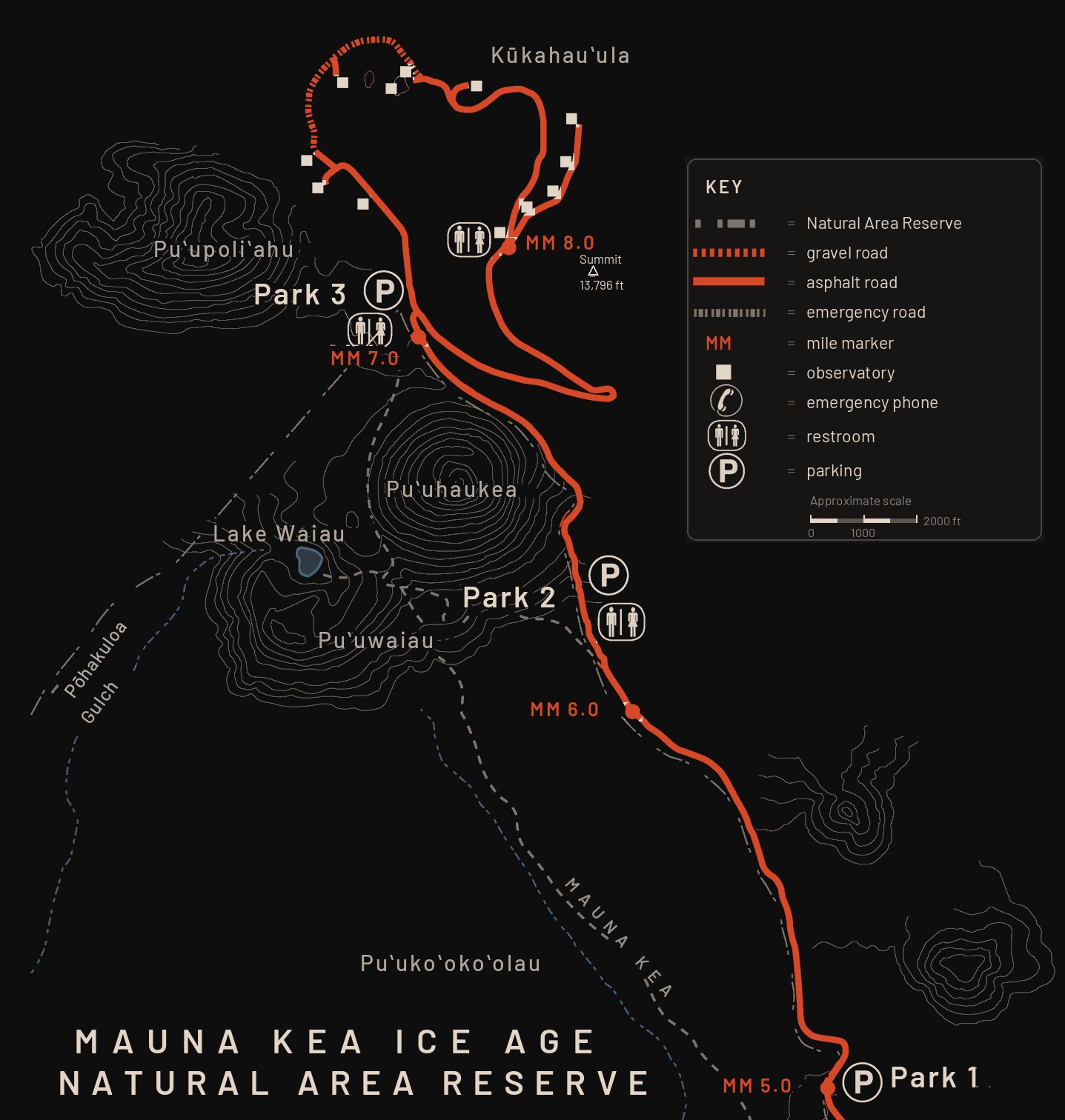
Map of Mauna Kea Ice Age Natural Area Reserve showing Parks 1–3, Lake Waiau, and the summit approach
Upper access — Parks 1–3, Lake Waiau, Humuʻula Trail, and the summit approach.

The Summit & Sacred Sites

Upper access through the Ice Age Natural Area Reserve — Parks 1–3, trails, and the summit approach.

  • Kūkahauʻula (13,796 ft) — the true summit; culturally sacred, do not climb
  • Lake Waiau (13,020 ft) — one of the highest lakes in the U.S.; stay on trail, do not enter the water
  • Park 1 — first pullout on the upper road; parking and restrooms
  • Park 2 — mid-level lot; common sunset turnaround; Humuʻula Trail access
  • Park 3 — highest visitor parking, nearest the observatory ridge
  • Humuʻula Trail — hiking approach toward the summit from near Park 2
  • Lake Waiau Trail — short spur (~0.7 mi) from the access road to the lake
  • Puʻupoliʻahu — named puʻu west of the road, associated with the snow goddess
  • Puʻuhaukea · Puʻuwaiau · Puʻukoʻokoʻolau — cones along the summit approach
  • Pōhakuloa Gulch — drainage cutting east of the upper road
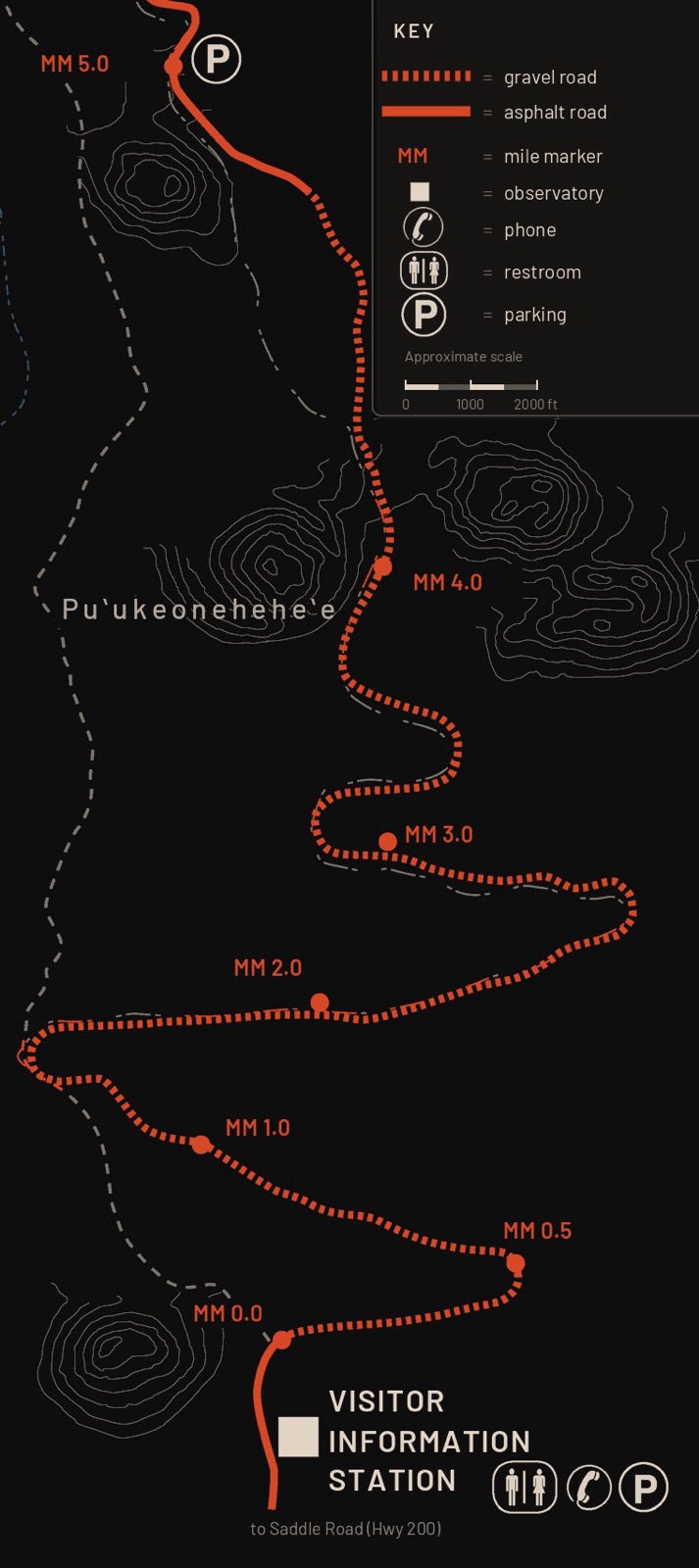
Map of Maunakea Access Road from the Visitor Information Station toward the summit, mile markers 0.0 to 5.0
VIS to Park 1 — mile markers 0.0–5.0; pavement ends just above the station.
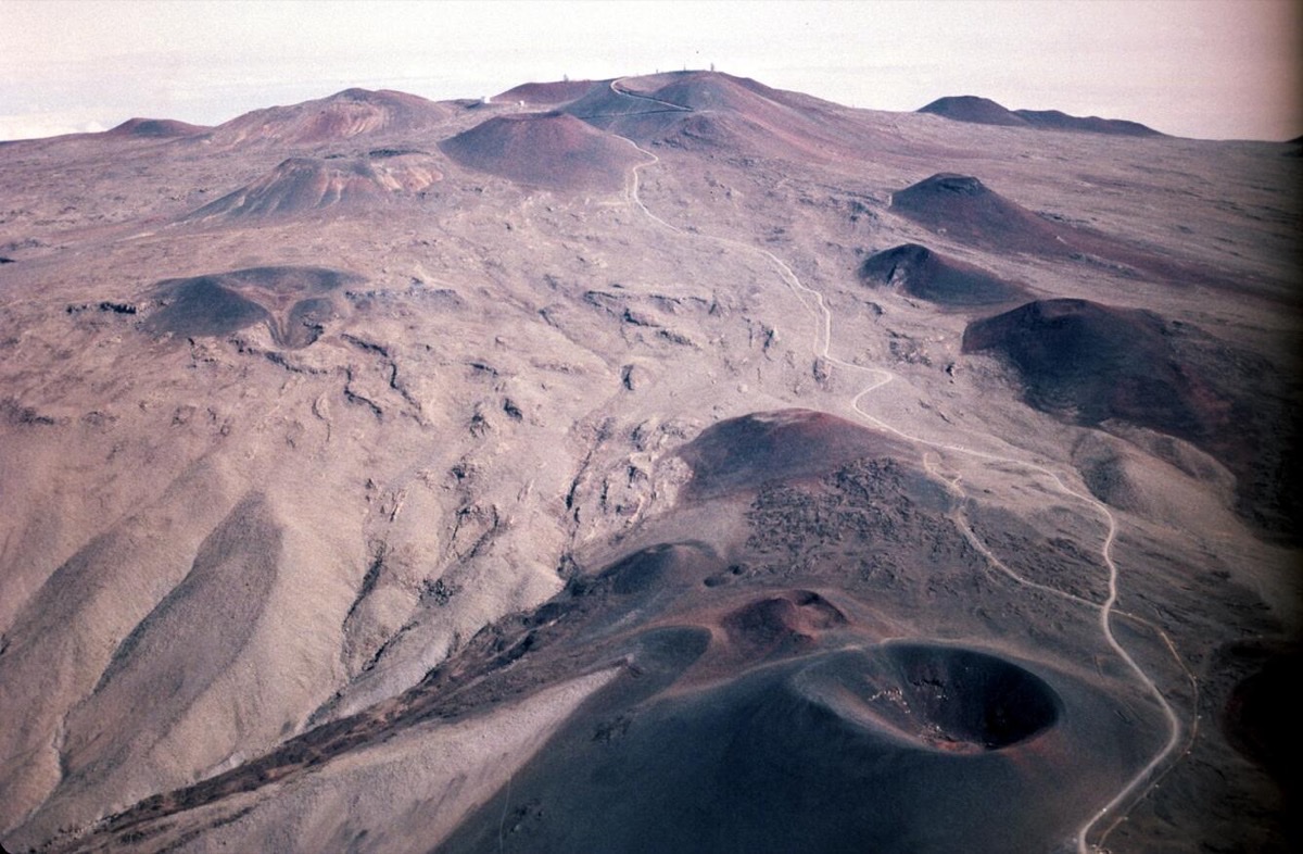
Puʻukeoneheheʻe cinder cone on the upper south flank of Maunakea
Photo: USGS — public domain

Puʻukeoneheheʻe

A prominent cinder cone on Maunakea’s upper south flank (~11,530 ft), labeled on the access-road map near the gravel climb above the VIS. USGS notes it among the volcano’s younger Laupāhoehoe cones — erupted roughly 4,000 years ago — rising from glacial deposits and older lava on the approach toward the summit ridge.

From the road it reads as one of the dark volcanic hills that give the upper mountain its rough skyline. Stay on the paved/gravel access route; do not scramble cones or leave marked areas.

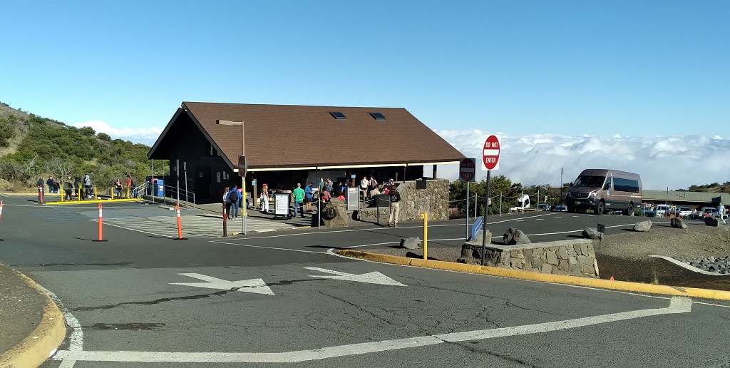
Visitor Information Station with visitors and a sea of clouds below Mauna Kea
Visitor Information Station — your base camp at 9,200 ftPhoto: Oscar Pouoa — public domain

After dark

Stargazing at the VIS

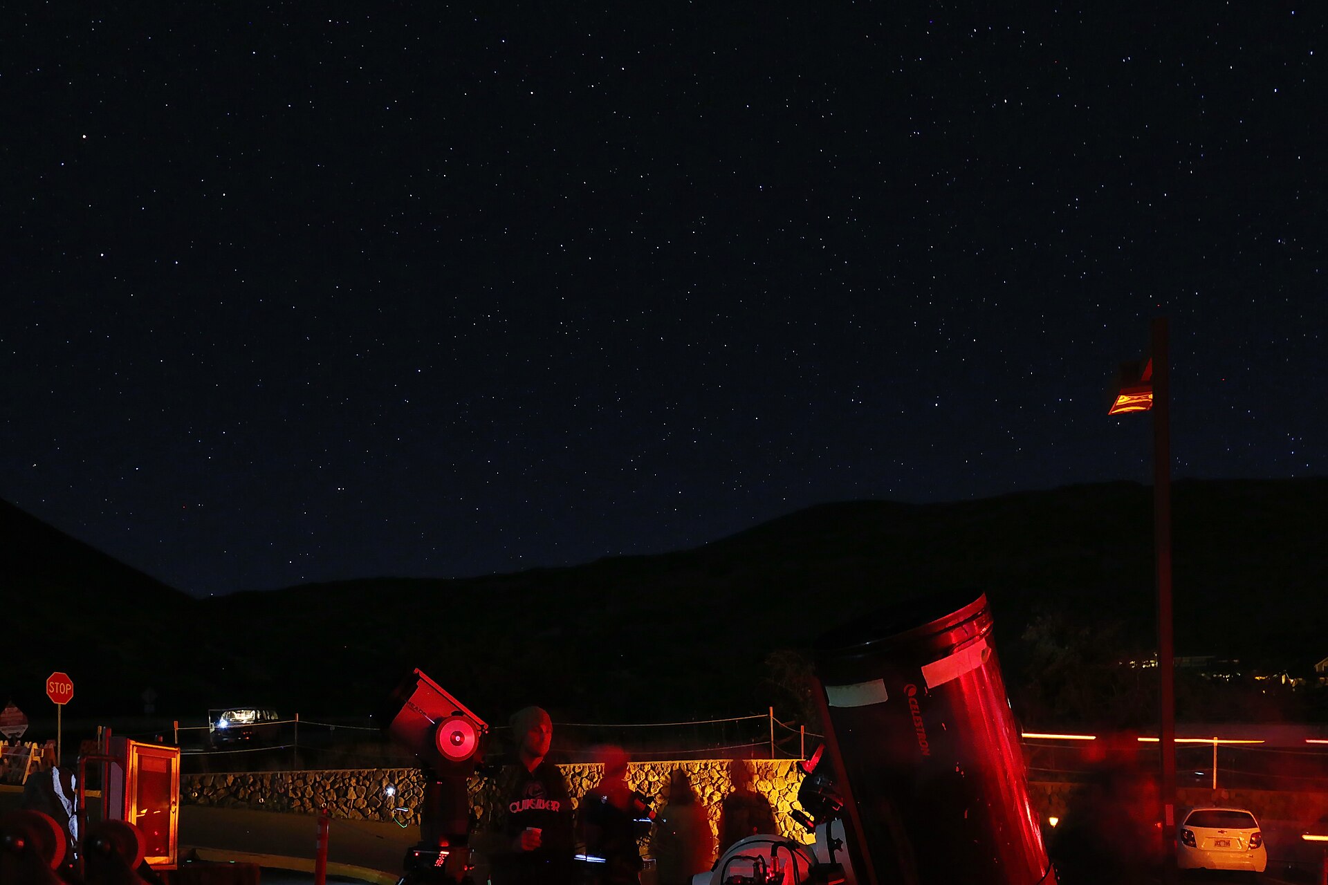
The Visitor Information Station is where visitors go for the night sky. You are above the clouds with a sky that feels close enough to touch — weather permitting. No telescope required.

  • Plan to stargaze at the VIS (~9,200 ft), not the summit — the summit closes after dusk
  • Arrive before dark so you can park, acclimate, and let your eyes adjust
  • Dress for alpine cold: wind, layers, and a hat matter more than fancy gear
  • Use a red headlamp so you keep night vision (and so do others)
  • Check the sky and road weather before you drive up — clouds and wind can erase the show
  • The VIS closes at 9:00pm. The park does not close, but camping is not allowed.
Stargazing from the Maunakea Visitor Information Station at night
Photo: Robert Linsdell · CC BY 2.0

From the summit observatories

Images from NOIRLab

Gemini North and the Maunakea sky — photographs released by NSF’s NOIRLab under Creative Commons Attribution.

Sample days

Two ways to do Maunakea well

Pick the day that matches your vehicle, your health, and how much altitude you’re comfortable with.

Most visitors

VIS-only day

High reward, lower risk — ideal for families and 2WD rentals.

  1. Drive Saddle Road / DKI Highway; turn onto Maunakea Access Road near MP 28. Fuel up in town first.
  2. Arrive VIS (~9,200 ft). Park, rest, hydrate. Spend at least 30 minutes acclimating even if you stay here.
  3. Walk to Puʻukalepeamoa (Sunset Hill) for sunset views.
  4. Stargaze at the VIS until closing (9:00 p.m.). Informal sky talks may happen — treat them as a bonus.
  5. Descend carefully to Hilo or Kona. No camping on UH-managed lands.
4WD + healthy adults

Summit day

Only if you have a 4WD vehicle, a full day, and no health conditions that rule out high altitude.

  1. Confirm road conditions. ≥½ tank. Clean 4WD/AWD. Check rental rules.
  2. Acclimate for at least 30 minutes and check current conditions. Anyone who feels unwell stays at the VIS.
  3. Gravel climb in 4WD. Short summit visit — stay on roads/trails; respect closures and Rangers.
  4. Only if you can leave the summit area by 30 minutes after sunset. Otherwise watch from Sunset Hill.
  5. 4WD Low + engine braking. Night sky back at VIS / below Park 2 — not on the closed summit.

Gear

What to bring

LayersAlpine cold even after a warm beach morning — wind shell, insulated midlayer, gloves/hat.
WaterDry air dehydrates fast. Aim for roughly 500 ml per person per hour at elevation.
Sun & altitudeHigh-SPF sunscreen and sunglasses. Descend if you get headache, nausea, or confusion.
Night kitHeadlamp (red mode preferred), full fuel tank, snacks; phone for emergencies only above VIS.

Before you leave town

Read the official public safety page, check live road conditions, and decide honestly whether the VIS alone is the better day.

UH Maunakea visitor hub
Cultural note

Visit as a guest

Maunakea is a sacred mountain. This guide is for travelers who want to see it carefully.

  • Leave rocks, plants, and cultural sites undisturbed
  • Stay on designated roads and trails
  • Follow Ranger guidance and posted advisories
  • Keep noise down, lights dim, and your footprint small

Photo: Forest & Kim Starr · CC BY 3.0

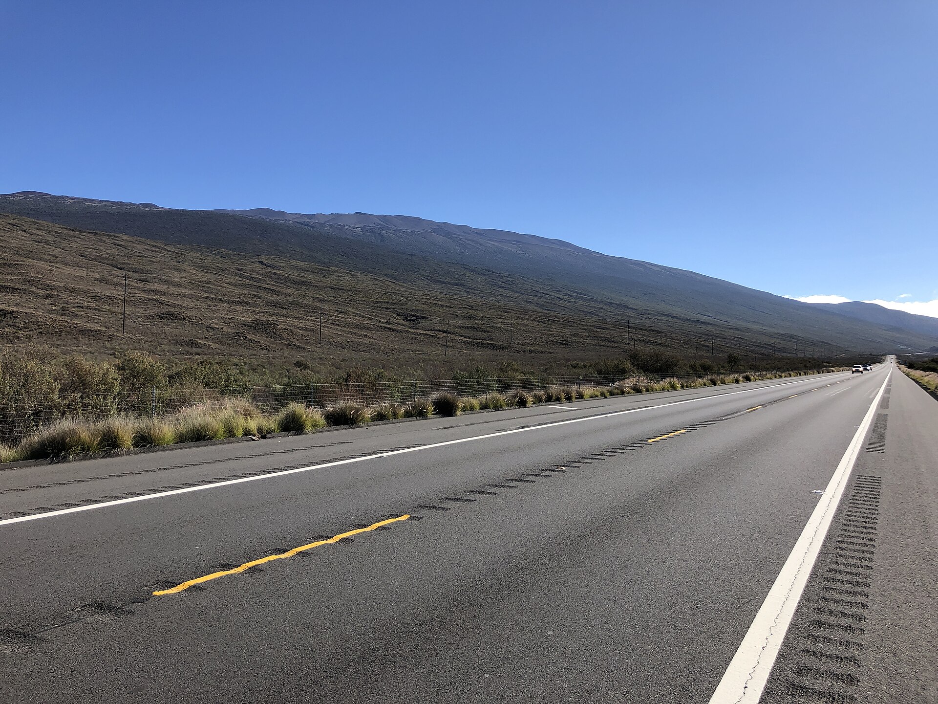
Daniel K. Inouye Highway Saddle Road with Mauna Kea ahead
Approach via Saddle Road / Daniel K. Inouye HighwayPhoto: Famartin · CC BY-SA 4.0
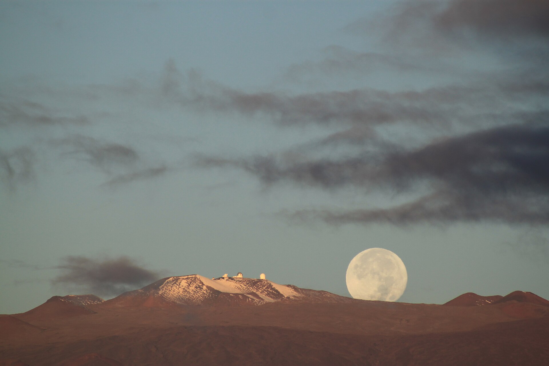
Snow and moonlight on Mauna Kea observatories
Snow can appear any season — alpine rules apply year-roundPhoto: Avc0002 · CC BY 4.0