Hawaiʻi Guide
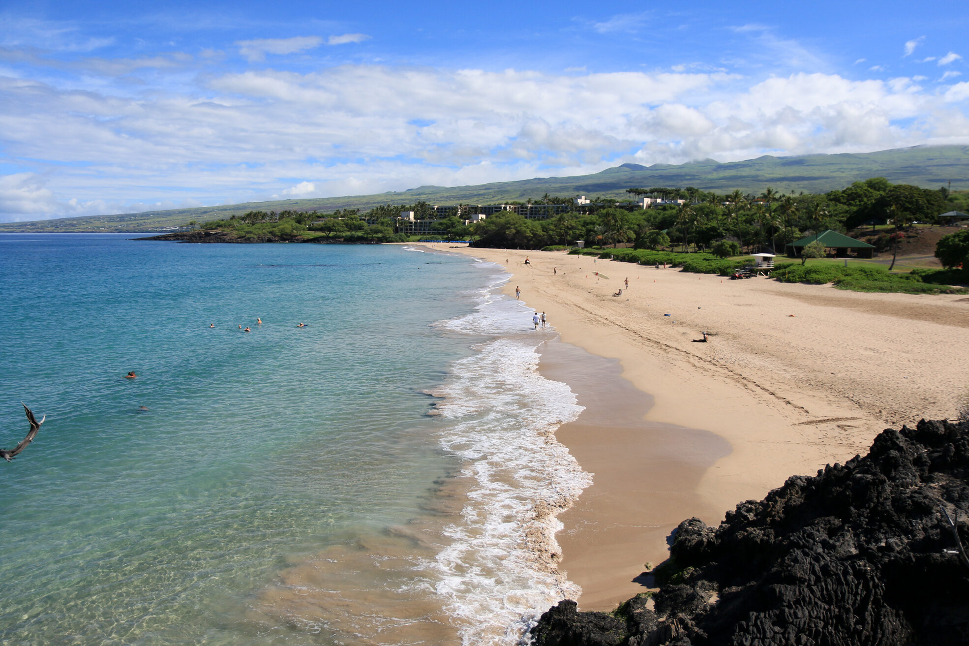
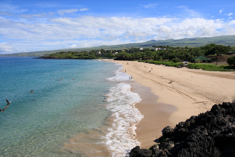
Hāpuna Beach from a black lava outcrop: a long curve of white sand and surf, swimmers in clear turquoise water, and green slopes under a blue sky
Island of Hawaiʻi · South and North Kohala

Kohala Coastsun, lava and white sand

The dry, sunny leeward shore of Hawaiʻi Island: white-sand beaches set against black lava, the temple of Puʻukoholā, ancient fishponds, and the green cliffs of North Kohala.

See the beachesPlan your visit
Hāpuna Beach State Recreation Area Photo: Island of Hawaii Visitors Bureau (IHVB) / Kirk Lee Aeder
Overview

A dry, bright coast where lava meets the sea

The Kohala Coast runs along the northwest shore of Hawaiʻi Island, from Kīholo and Kekaha Kai in the south to Kawaihae, with North Kohala continuing to Hāwī and Pololū.

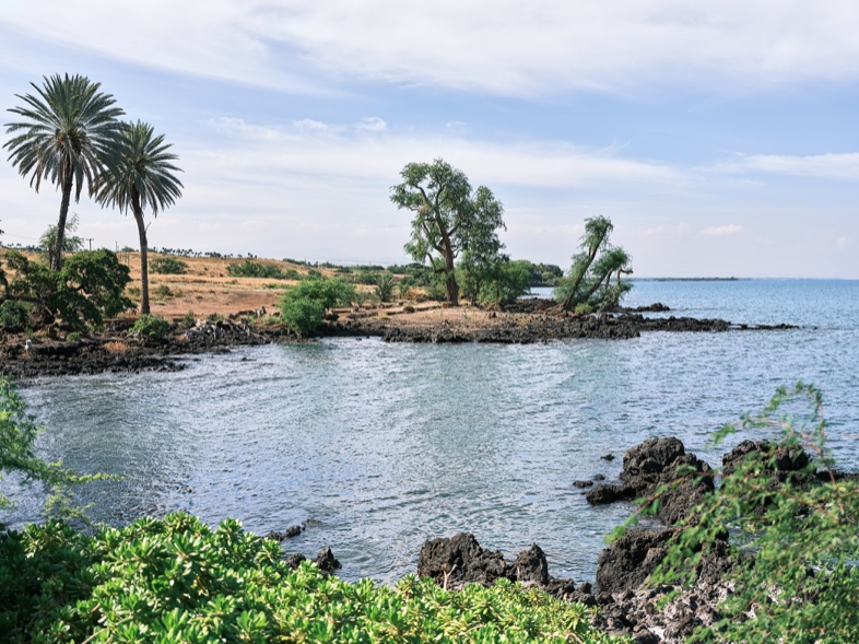
It lies leeward of Maunakea and the Kohala Mountains, which hold back most of the trade-wind rain. Waikoloa, near the middle of the coast, averages only about nine inches of rain a year, so the days are usually clear. Lava flows reach the shoreline almost everywhere, and the white-sand beaches fill the bays between them.

The result is a coast of strong contrasts: black rock and turquoise water, resort lawns and open lava fields, and Hawaiian heiau, trails, house sites and fishponds that are still visited and cared for today.

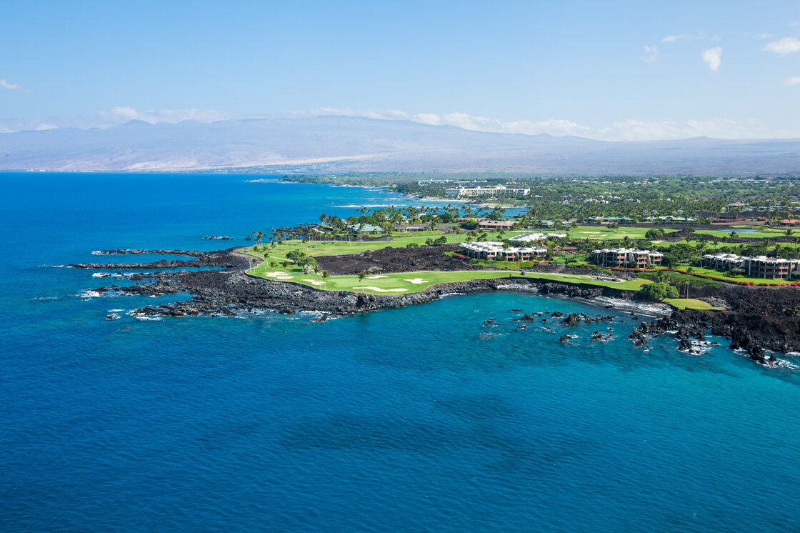
Aerial view of the Kohala Coast: vacation rentals and a golf course on a black lava point above deep blue water, with mountains on the horizon
Hawaii Tourism Authority (HTA) / Cameron Brooks
~30 minDrive from Kona airport (KOA) to Hāpuna Beach
1791Year Kamehameha I dedicated Puʻukoholā Heiau at Kawaihae
175 miLength of the Ala Kahakai National Historic Trail corridor on Hawaiʻi Island
Nov–AprHumpback whale season in Hawaiʻi, peaking January to March

Sun

Leeward position means clear skies on most days. Winter brings occasional rain and larger surf; summer is the driest season.

Lava

Old flows form the shoreline, the trails and the fields between the highway and the sea. The ground is hot and sharp, so wear closed shoes.

Sand

Hāpuna, Kaunaʻoa, Spencer, Kua Bay and Anaehoʻomalu give the coast several distinct beach days within a short drive.

Beaches

Five beaches, five different days

From the long crescent at Hāpuna to the lava-framed cove at Kua Bay. Always verify fees and hours.

Hapuna Beach from above, with a long white-sand shore, turquoise water and white surf
Island of Hawaii Visitors Bureau (IHVB) / Kirk Lee Aeder
South Kohala · State park

Hāpuna Beach State Recreation Area

The largest white-sand beach on Hawaiʻi Island, set below the highway south of Kawaihae. The 62-acre state park has lifeguards and picnic areas. In calm seas it is a swimming and bodyboarding beach; in high surf it has a pounding shore break.

Good to knowOpen 7:00 a.m. to 7:30 p.m. Nonresidents pay $5 per person and $10 per vehicle, by credit card only.
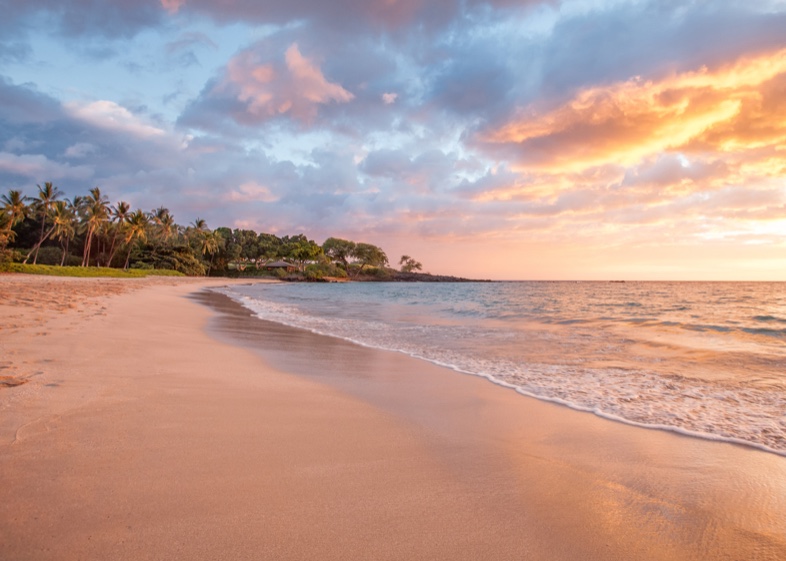
Kaunaʻoa Beach at sunset, with orange and pink clouds reflected in the wet sand and palms on the left
Hawaii Tourism Authority (HTA) / Anna Pacheco
South Kohala · Resort beach

Kaunaʻoa (Mauna Kea Beach)

A white-sand crescent in front of the Mauna Kea Beach Hotel, north of Hāpuna. The beach is public, reached through the resort entrance gate, where only a limited number of spaces are set aside for visitors.

Good to knowAsk the gate attendant about public parking, and arrive early. If it is full, Hāpuna is a few minutes south.
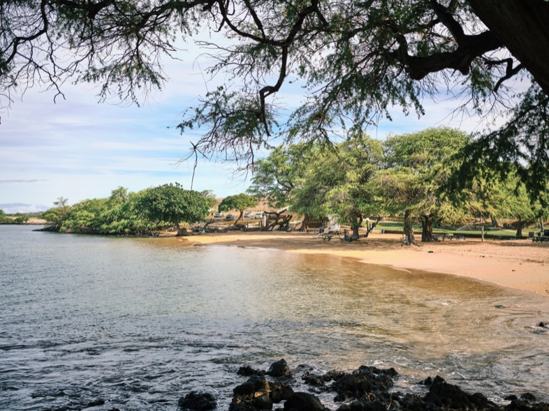
Sandy beach and blue water at Spencer Beach Park, framed by large shade trees
Hawaii Tourism Authority (HTA) / Ben Ono
Kawaihae · County park

Spencer Beach Park

A Hawaiʻi County beach park (ʻŌhaʻiula) just below Puʻukoholā Heiau, with shade trees, picnic pavilions, outdoor showers and drinking water. Lifeguards are posted on weekends and holidays.

Good to knowThe gate closes at 8 p.m. and reopens at 7 a.m. Camping needs a county permit.
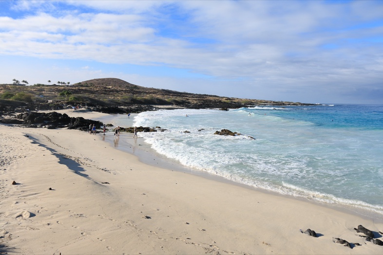
Kua Bay with white sand, turquoise water and dark lava rock in the foreground
Island of Hawaii Visitors Bureau (IHVB) / Kirk Lee Aeder
Kekaha Kai State Park · Kona side of the coast

Kua Bay and Kekaha Kai

Kua Bay (Maniniʻōwali) is the northern, paved-access section of Kekaha Kai State Park: white sand and clear water against black lava. Mahaiʻula, to the south, has its own access road, and a 4.5-mile stretch of the Ala Kahakai trail links the two.

Good to knowOpen 8:00 a.m. to 6:30 p.m. Nonresidents pay $5 per person and $10 per vehicle at Kua Bay (card only). No lifeguards.
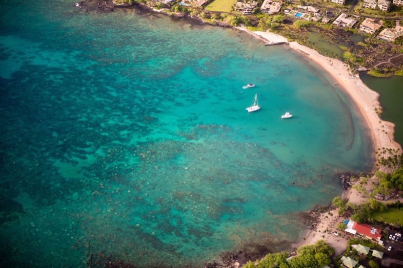
Aerial view of Anaehoʻomalu Bay, its curved beach and the Kuʻualiʻi Fishpond behind it
Island of Hawaii Visitors Bureau (IHVB) / Tyler Schmitt
Waikoloa · Resort beach

Anaehoʻomalu Bay (A-Bay)

A curved public beach at Waikoloa Beach Resort, popular for swimming, paddling and sunsets. Behind it lie the historic Kuʻualiʻi and Kahapapa fishponds, which are protected and are for viewing only.

Good to knowThe Ala Kahakai trail passes through here on its way to Puʻukoholā Heiau.
Which beach?

Choosing quickly

Hāpuna for space, facilities and lifeguards. Kua Bay for scenery and clear water on calm days. Spencer for shade and a short stop after the heiau. A-Bay for a beach beside the resort area. Kaunaʻoa for a quieter crescent if parking is available.

Quick comparison
BeachSettingAccessLifeguards
HāpunaWide white-sand crescent, state parkState lot; nonresident feeYes
KaunaʻoaWhite-sand crescent at a resortThrough the hotel gate; limited public parkingAsk at the gate
SpencerCounty park with shade and pavilionsPark entrance off Kawaihae Road; gate 7 a.m. to 8 p.m.Weekends and holidays
Kua BayWhite sand framed by black lavaPaved road off Hwy 19; nonresident feeNone
A-BayCurved beach beside fishponds and resortPublic beach access at Waikoloa Beach ResortAsk locally
History & culture

A coast with deep Hawaiian history

Kohala was a center of Hawaiian political and spiritual life. These places are still cared for as sacred and historic sites.

Visiting with respect. Heiau, house sites and petroglyphs are sacred and fragile. Stay on marked paths, do not climb walls or move stones, and never touch or make rubbings of carvings. Follow signs and the guidance of park staff.

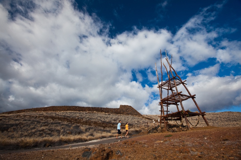
Visitors walking toward Puʻukoholā Heiau across dry ground, with a tall wooden anuʻu tower beside the path
Puʻukoholā Heiau National Historic SiteHawaii Tourism Authority (HTA) / Tor Johnson
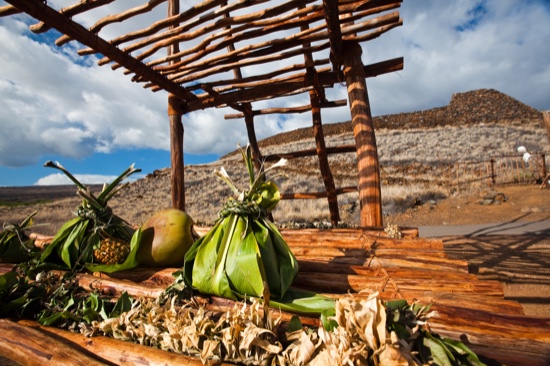
Hoʻokupu offerings wrapped in green ti leaves resting on a wooden platform at a heiau
Hoʻokupu (offerings) at a heiauHawaii Tourism Authority (HTA) / Tor Johnson
Kawaihae · National Park Service

Puʻukoholā Heiau National Historic Site

Kamehameha I had this large temple to the war god Kū built on the hill above Kawaihae around 1790. According to the National Park Service, the kahuna Kapoukahi prophesied that war would end if Kamehameha built a heiau to Kū at Puʻukoholā. Keōua Kuʻahuʻula, his rival, was killed here in 1791, and Kamehameha went on to unite the islands.

The park also protects the John Young homestead and the shoreline below. A short trail leads from the visitor center to the heiau, and the Ala Kahakai trail begins nearby.

Good to knowOpen daily 8:30 a.m. to 4:30 p.m.; the parking lot gate closes at 4:00 p.m. There is no entrance fee and no pass is required.
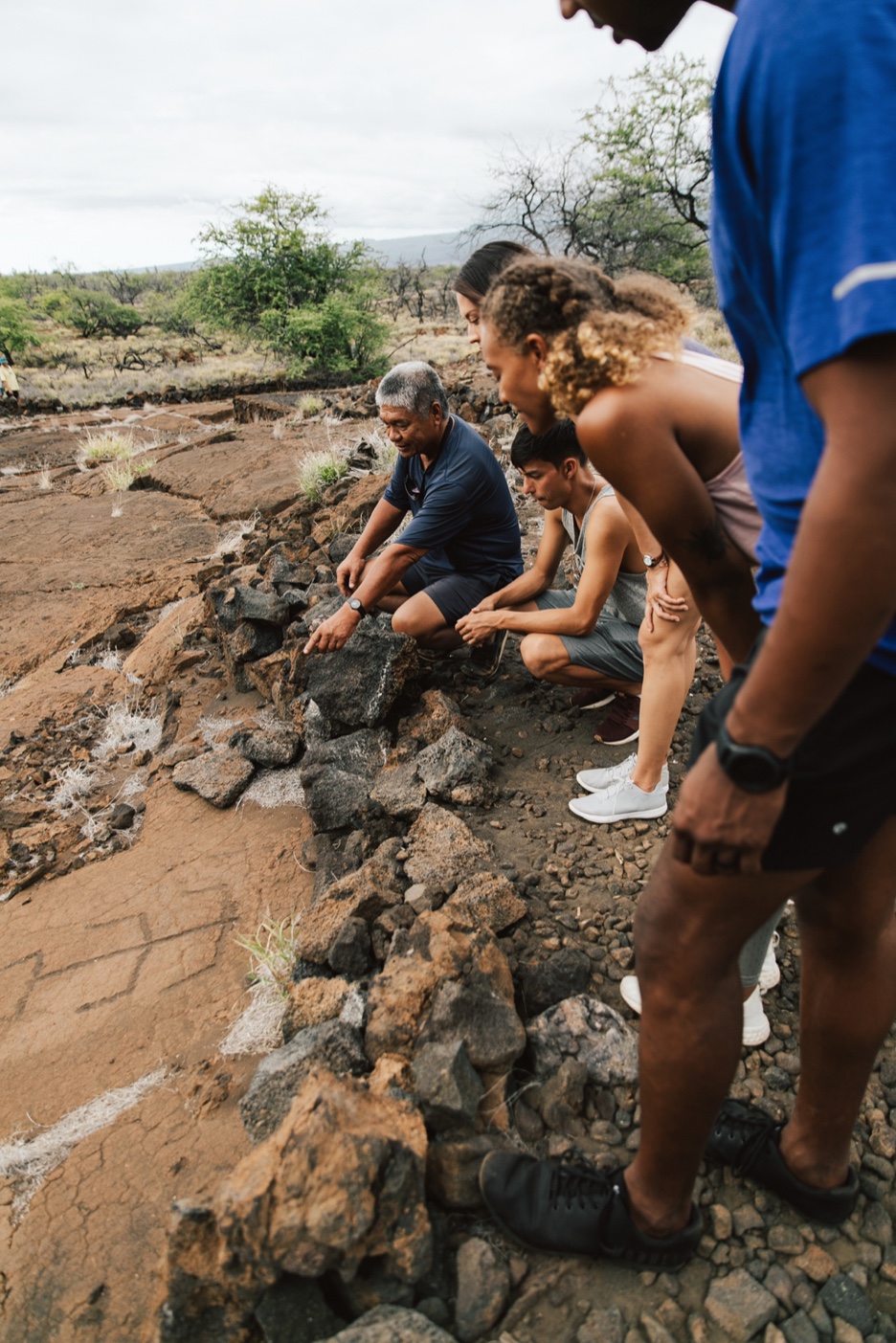
Visitors looking down at petroglyphs carved into lava rock at the Puakō petroglyph preserve
Hawaii Tourism Authority (HTA) / Heather Goodman
Mauna Lani

Puakō petroglyphs

A large field of carvings in the lava, reached from Holoholokai Beach Park by the Malama Trail, about 1.2 to 1.4 miles round trip over uneven lava with little shade. Go early or late, and stay behind the fence.

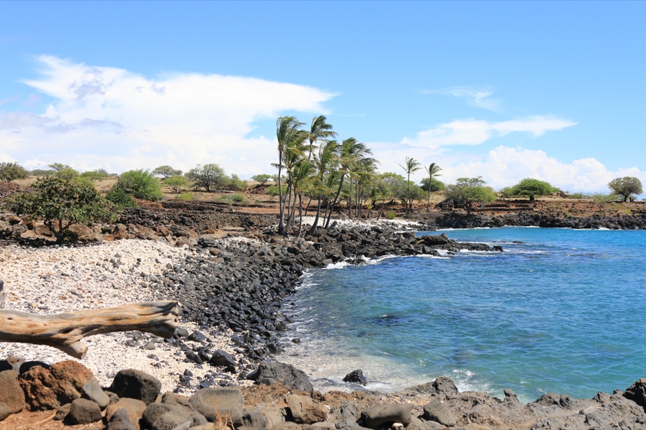
The Lapakahi shoreline with dark lava rock, palm trees, blue sea and sky
Hawaii Tourism Authority (HTA) / Kirk Aeder
North Kohala · State park

Lapakahi

Stone remains of an ancient coastal Hawaiian settlement, with a self-guided village trail. The offshore waters are a marine preserve where activities are regulated.

Good to knowOpen daily 8:00 a.m. to 3:30 p.m., with no entrance fee.
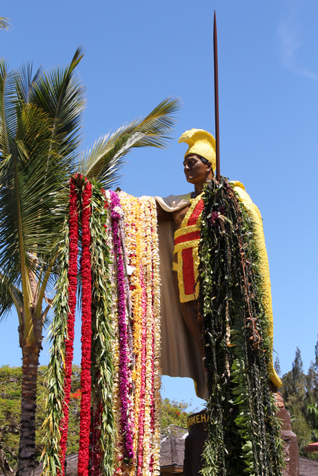
The Kamehameha I statue at Kapaʻau
Island of Hawaii Visitors Bureau (IHVB) / Kirk Lee Aeder
North Kohala

Kamehameha's birthplace

Kamehameha I was born in North Kohala. Kohala Historical Sites State Monument protects Moʻokini Heiau, a National Historic Landmark, and the birth site nearby. In Kapaʻau, the original Kamehameha statue, cast in Paris and lost at sea before it was recovered, has stood at the North Kohala Civic Center since 1912.

Good to knowThe monument is open daily in daylight hours, free. The road is rough dirt; the NPS recommends four-wheel drive.
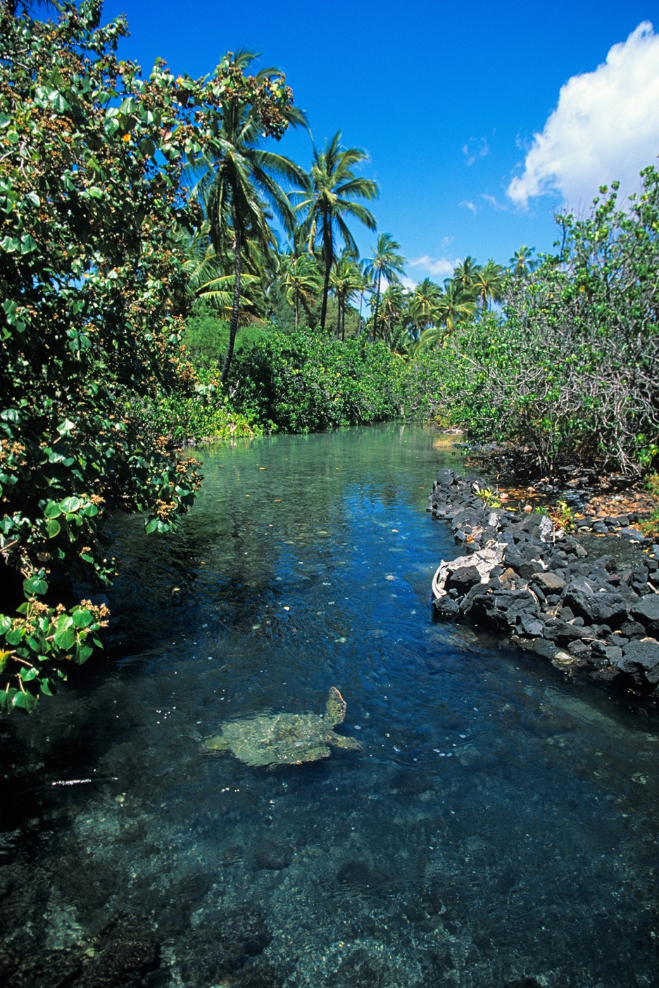
A honu, or green sea turtle, swimming in a clear tide pool surrounded by dark lava rock at Kīholo
Hawaii Tourism Authority (HTA) / Kirk Lee Aeder
Kīholo · Waikoloa · Mauna Lani

Fishponds

Hawaiians built walled loko iʻa (fishponds) along this coast. Kīholo has one attributed to Kamehameha I; Kuʻualiʻi and Kahapapa sit behind Anaehoʻomalu Bay, and Kalahuipuaʻa is at Mauna Lani. Look from the shore and do not enter the ponds.

Good to knowKīholo State Park Reserve is open 7 a.m. to 7 p.m. with no entrance fee. Camping there is closed after the storms.
Things to do

In the water, on the trail, up the mountain

The coast works well as a base for beaches, short hikes and day trips north to Pololū and inland to Waimea.

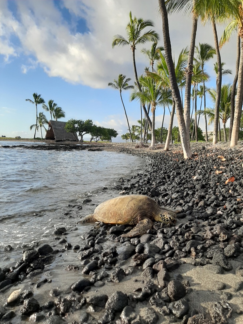
A honu resting on a dark stony shore with palm trees and a thatched hale behind it
Hawaii Tourism Authority (HTA) / Kirk Aeder
Swim · Snorkel

Snorkel and watch honu

Snorkel on calm days at Hāpuna, Kua Bay and Anaehoʻomalu Bay, and check conditions first: the state advises that waves over three feet are for experts. Green sea turtles (honu) rest on shores and in tide pools such as Kīholo. Keep at least 10 feet away.

A coastal hiking trail over black lava rock toward the blue ocean on the Ala Kahakai National Historic Trail
Hawaii Tourism Authority (HTA) / Ben Ono
Hike

Ala Kahakai Trail

The Ala Kahakai National Historic Trail is a 175-mile coastal corridor around Hawaiʻi Island. Local sections include Kawaihae to Anaehoʻomalu Bay and the 4.5-mile route between Mahaiʻula and Kua Bay, which is dry and hot with no drinking water. A side hike up Puʻu Kuʻili, a 342-foot cinder cone, gives a view of the coastline.

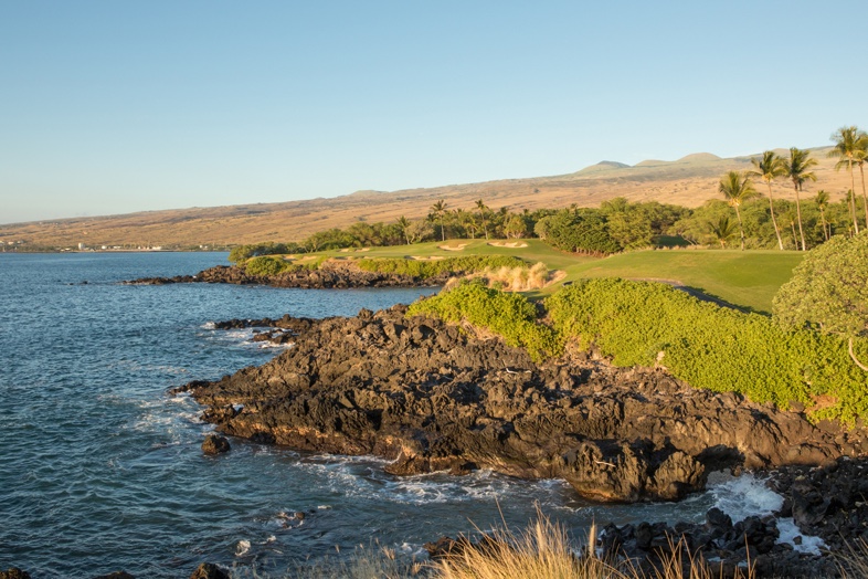
A green golf fairway beside a rocky shoreline and deep blue sea on the Kohala Coast
Hawaii Tourism Authority (HTA) / Anna Pacheco
Golf

Golf on the lava

Resort courses along the coast are cut through the lava fields with views of the ocean and, on clear days, Maunakea. Book tee times directly with each course.

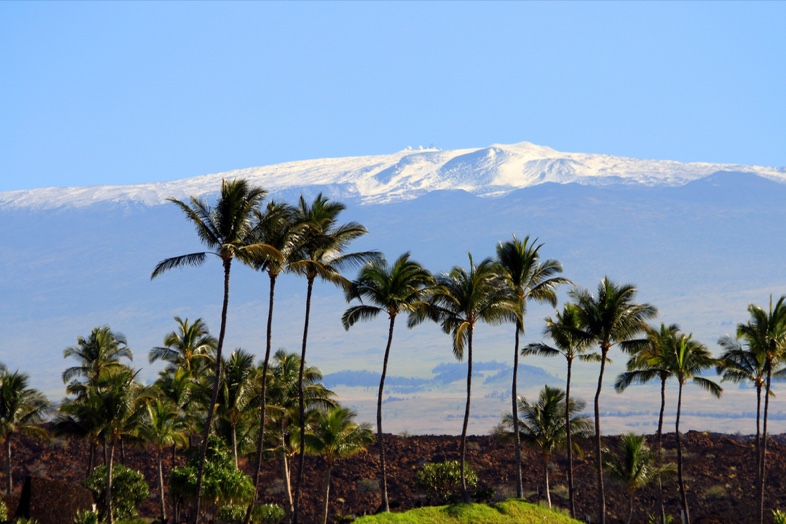
Palm trees and a dark lava shore with snow-topped Maunakea in the distance
Island of Hawaii Visitors Bureau (IHVB) / Kirk Lee Aeder
Day trip · Stargazing

Maunakea side trip

The Maunakea Visitor Information Station sits at about 9,200 feet and is a well-known place for stargazing. It is cold and thin-aired; bring warm layers and check the University of Hawaiʻi at Hilo's Maunakea site for current hours, conditions and programs before you drive up.

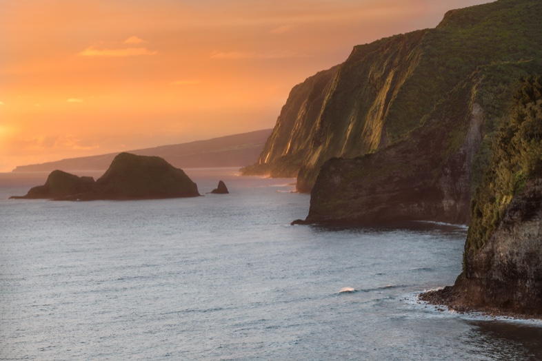
Steep green sea cliffs meeting the ocean at Pololū Valley Lookout
Island of Hawaii Visitors Bureau (IHVB) / Larry Marshall
Day trip · North Kohala

Hāwī and Pololū

Highway 270 runs north past Lapakahi through Hāwī and Kapaʻau to the Pololū Valley Lookout at the road's end. The trail to the valley floor is about half a mile each way and drops 420 feet; it is steep and slippery after rain. Swimming at the beach is discouraged because of strong currents.

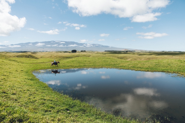
Green rolling hills at Waimea with a pond, a horse and Mauna Kea on the horizon
Waimea pasture land with Mauna KeaHawaii Tourism Authority (HTA) / Heather Goodman
Side trip · Upcountry

Waimea

Waimea (Kamuela) is a ranching town in cooler green uplands, about 12 miles inland from Hāpuna. Highway 250, the Kohala Mountain Road, links Waimea with Hāwī, so the two day trips combine into a loop.

Whale watching

Humpbacks, November to April

Humpback whales are generally seen in Hawaiʻi from November through April, with the peak from January through March, according to NOAA's Hawaiian Islands Humpback Whale National Marine Sanctuary. Whales can sometimes be seen from shore, including at Hāpuna.

Federal law prohibits approaching within 100 yards of a humpback whale in Hawaiʻi, by boat, kayak, drone or while swimming. Watch from land or choose an operator that follows the distance rule.

Food

Where to eat

Opening hours change often, so this section describes where to look rather than naming individual restaurants.

Resorts and beach clubs

The resort areas at Mauna Kea, Hāpuna, Mauna Lani and Waikoloa have restaurants and shops. Check each property's hours, and reserve for dinner in high season.

Kawaihae, Waimea and Hāwī

Outside the resorts, eat in Kawaihae near the harbor, in Waimea, or in the small towns of Hāwī and Kapaʻau on the way to Pololū. Plan lunch in town before a long beach or trail day.

Pack for the beach

Hāpuna's food concession is listed by the state as temporarily closed, and Kekaha Kai has no drinking water. Bring water, snacks and a cooler to the beaches.

Restaurants are deliberately not named: opening status changes often.

Getting there and around

Fly into Kona, then drive north

Ellison Onizuka Kona International Airport (KOA) is the closest airport. Hāpuna Beach is about 30 minutes north by car, and Kua Bay is just up the highway.

A rental car is the practical way to reach the beaches, trailheads and historic sites, which are spread along the highway.

Queen Kaʻahumanu Highway (Hwy 19)The main road along the coast from the airport to Kawaihae, then on to Waimea.
Akoni Pule Highway (Hwy 270)Continues north from Kawaihae through Lapakahi, Hāwī and Kapaʻau to Pololū.
Kohala Mountain Road (Hwy 250)Links Hāwī and Waimea across the Kohala Mountains.
Approximate road distance from KOA
PlaceMiles
Kua Bay~7
Anaehoʻomalu Bay~20
Hāpuna Beach~26
Kawaihae and Puʻukoholā~29
Waimea~38
Hāwī~47
Pololū Valley Lookout~55

Distances are rounded routing estimates (OpenStreetMap-based routing). Allow extra time for traffic and stops. Payments at Hāpuna and Kua Bay use QR codes, so a phone with data and a credit card are needed.

Ocean and sun safety

Respect the water, the sun and the land

Shore break and currents

Hāpuna and Kua Bay both carry state warnings about dangerous rip currents and pounding shore breaks during high surf, which is most common in winter. Swim where there are lifeguards when you can, and stay out when waves are over three feet. Kua Bay has no lifeguard.

Sun and heat

Lava and sand get very hot and there is little shade on the trails. Wear closed shoes on lava, a hat and sunscreen, and bring more water than you expect to need.

Reef-safe sunscreen

Hawaiʻi law (Act 104, in effect since January 1, 2021) bars the sale of sunscreens containing oxybenzone or octinoxate without a prescription. Choose a mineral sunscreen and apply it before entering the water.

Wildlife and places

Stay at least 10 feet from honu, 50 feet from monk seals and 100 yards from humpback whales. Do not take sand, rocks or coral from state parks, and leave heiau stones and petroglyphs untouched.

Practical info

Hours, fees and current conditions

Always verify fees and hours with the official pages linked in the footer.

Storm recovery notice

Hawaiʻi Division of State Parks notices have listed Lapakahi State Historical Park and the Waialea section of Hāpuna as closed after storm damage, and camping and cabins at Hāpuna and camping at Kīholo as closed. Read the latest notice at dlnr.hawaii.gov/dsp/important-park-notices before you travel.

Parks and sites
PlaceHoursFeesNotes
Hāpuna Beach State Recreation Area7:00 a.m. to 7:30 p.m.; gates close 8:00 p.m.Nonresidents: $5 per person (age 3 and under free) and $10 per vehicle; card only. Hawaiʻi residents free with ID.Lifeguards. Day use needs no reservation.
Kekaha Kai State Park (Kua Bay)8:00 a.m. to 6:30 p.m.; gates close 7:00 p.m.Nonresidents: $5 per person and $10 per vehicle at Kua Bay, card only.No lifeguards. Mahaiʻula section has no drinking water.
Puʻukoholā Heiau National Historic Site8:30 a.m. to 4:30 p.m. daily; parking gate closes 4:00 p.m.Free; no entrance pass required.Guided tours for groups of 10 or more cost $2 per person.
Lapakahi State Historical Park8:00 a.m. to 3:30 p.m.; gates lock 4:00 p.m.None.Self-guided village trail.
Kīholo State Park Reserve7:00 a.m. to 7:00 p.m.No entrance fee.Camping closed. No drinking water at campsites.
Spencer Beach ParkGate closes 8:00 p.m., reopens 7:00 a.m.Camping requires a county permit.Lifeguards on weekends and holidays.
Kohala Historical Sites State MonumentDaily, daylight hoursNone.Rough dirt access road; four-wheel drive recommended.

Reservations are not required for day use at Hāpuna or Kua Bay; the state charges entry and parking fees there instead. State park camping is booked through Explore Outdoor Hawaiʻi. Fees and rules change; the official park pages are the final word.

Map

Places on the Kohala Coast

Select a pin for details and directions in Google Maps. The numbered list below works without the map.

The interactive map needs an internet connection. Use the numbered list below for directions.

Map tiles © Esri, with data © OpenStreetMap contributors and others.

  1. Kona International Airport (KOA)The closest airport, about 30 minutes from Hāpuna Beach. Directions
  2. Kua Bay (Maniniʻōwali)North end of Kekaha Kai State Park. Fee for nonresidents; no lifeguard. Directions
  3. Kīholo BayLava coast with small bays, tide pools and a historic fishpond. Directions
  4. Anaehoʻomalu Bay (A-Bay)Public beach at Waikoloa Beach Resort, with fishponds behind. Directions
  5. Puakō petroglyphs trailhead (Holoholokai Beach Park)Start of the Malama Trail to the petroglyph field. Directions
  6. Hāpuna Beach State Recreation AreaThe island's largest white-sand beach. Lifeguards; nonresident fee. Directions
  7. Kaunaʻoa (Mauna Kea Beach)Public beach reached through the Mauna Kea Beach Hotel gate. Directions
  8. Spencer Beach Park (ʻŌhaʻiula)County beach park below Puʻukoholā Heiau. Directions
  9. Puʻukoholā Heiau National Historic SiteKamehameha I's temple at Kawaihae. Free; 8:30 a.m. to 4:30 p.m. Directions
  10. Lapakahi State Historical ParkAncient coastal settlement with a self-guided trail. Directions
  11. Waimea (Kamuela)Upland ranching town, a side trip from the coast. Directions
  12. Kamehameha I statue, KapaʻauThe original statue, at the North Kohala Civic Center. Directions
  13. Moʻokini Heiau and Kamehameha birth siteKohala Historical Sites State Monument. Rough dirt road. Directions
  14. Pololū Valley LookoutEnd of Highway 270. Steep trail to the valley floor. Directions
Plan your visit

Putting it together

Start early, keep the middle of the day for the water or shade, and check the park notices the morning you go.

One day

  1. Morning: Puakō petroglyphs while the light is low and the lava is cool.
  2. Puʻukoholā Heiau when it opens at 8:30 a.m.
  3. Afternoon swim at Hāpuna or Spencer.
  4. Sunset at Anaehoʻomalu Bay.

Two or three days

  1. Day one: Kua Bay early, then Hāpuna.
  2. Day two: Hwy 270 to Kapaʻau, the Pololū Lookout and Moʻokini.
  3. Day three: Waimea, or the Maunakea visitor station for stargazing.

Before you go

  • Read the state park notices for closures.
  • Carry a credit card and a charged phone for park payments.
  • Bring water, hats, closed shoes and mineral sunscreen.
  • Check surf and lifeguard flags at each beach.