Hawaiʻi Guide

Hawaiʻi Island · East side

Windward town guideRain, rivers, and a bayfront town with deep roots

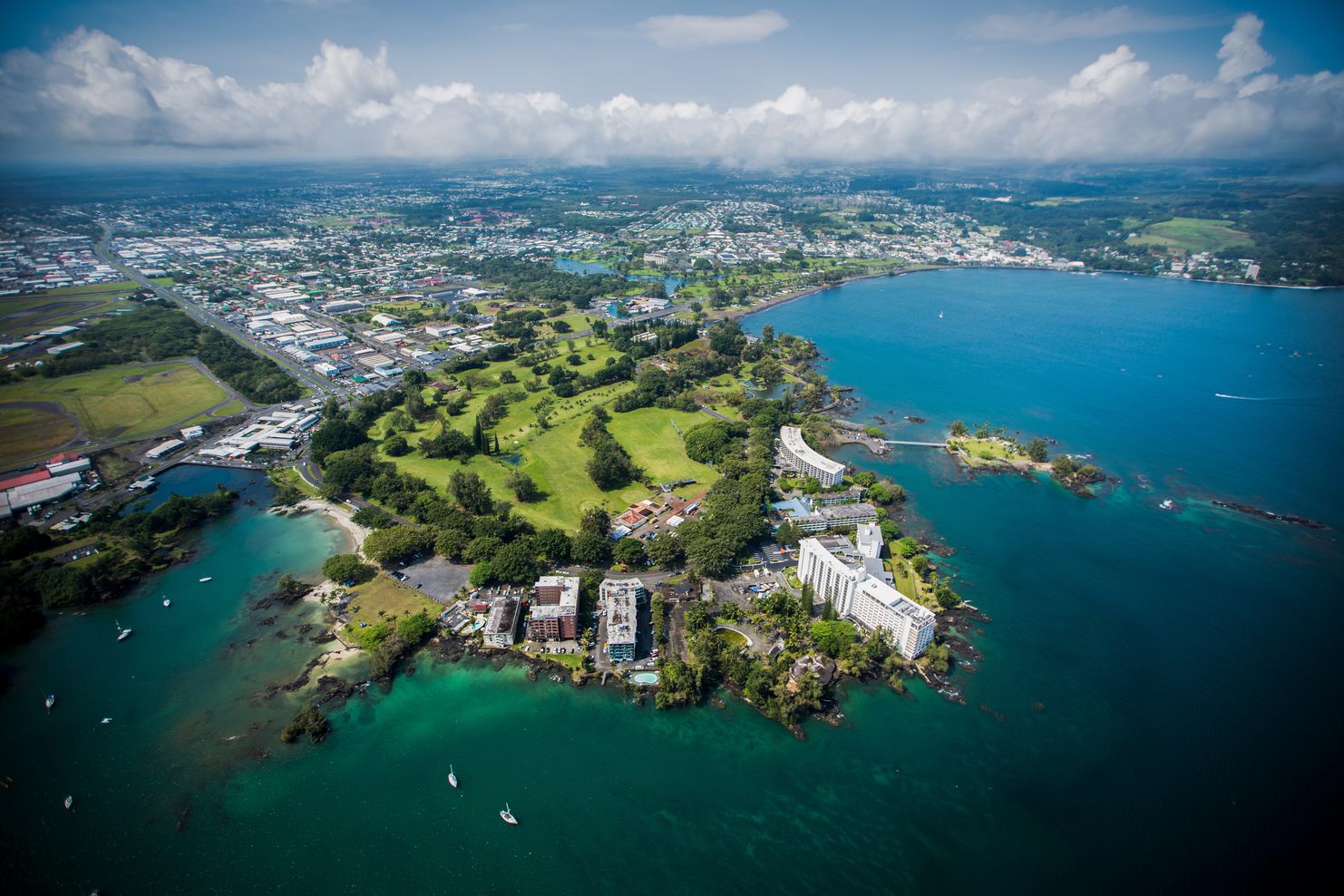
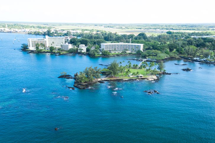
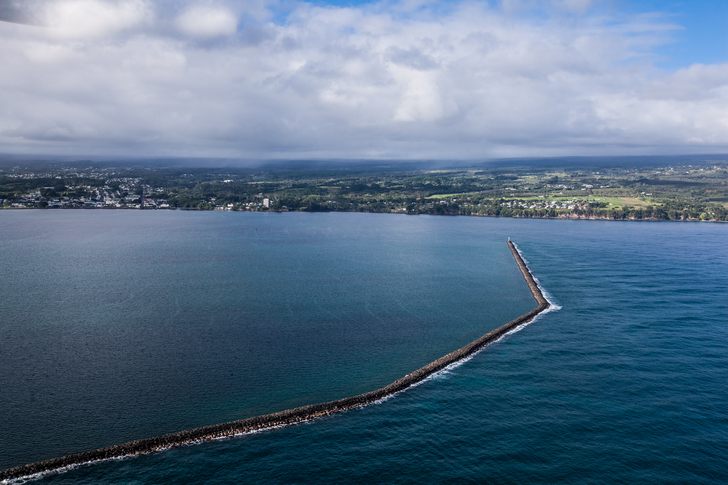
Hilo sits on the lush, windward side of Hawaiʻi Island, wrapped around a crescent bay. It is a working town rather than a resort: waterfalls minutes from downtown, a daily farmers market, Japanese gardens on the bay, and the practical base for Maunakea and Hawaiʻi Volcanoes National Park.

Photo: Hilo Bay from Liliʻuokalani Gardens, AlaskaDave · CC BY-SA 3.0

~120 inAverage yearly rainfall
273Days a year with measurable rain
74°FAverage temperature, year-round
45 minDrive to Hawaiʻi Volcanoes NP

Climate figures: NOAA 1991–2020 normals, Hilo International Airport. Drive time: National Park Service.

Meet Hilo

The island’s biggest small town

Hilo grew up as a farming and fishing area and later became a sugar-era commercial center and the seat of county government. Downtown still faces the bay along Kamehameha Avenue, with older wooden storefronts, the 1925 Palace Theatre, galleries, local shops, and the farmers market.

The bayfront itself carries history. Tsunamis in 1946 and 1960 devastated the waterfront, and the town rebuilt farther inland, leaving parkland along the shore as a buffer. That is why so much of Hilo’s bay edge today is open lawn, gardens, and ocean park.

Then there is the rain. Hilo is one of the rainiest cities in the United States, and its famous misty rain even has a name: Kanilehua, literally the rain that lehua flowers drink. The rain keeps the rivers running and the town green. Pack for it and it becomes part of the charm.

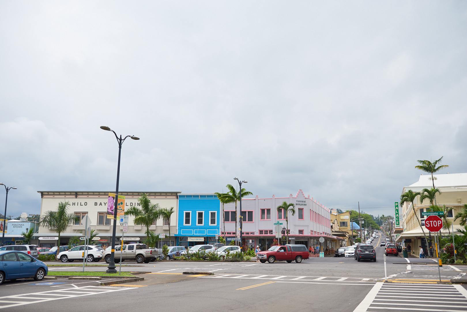
A downtown Hilo intersection under a cloudy sky, with colorful two-story storefronts, palm trees and parked cars along the street
Hilo town. Photo: Hawaii Tourism Authority (HTA) / AJ Feducia

Top things to see

In and around town

Most of these are within about 15 minutes of downtown. The farmers market and tsunami museum have their own section below, followed by Banyan Drive and a waterfall gallery. Hours and fees come from each official site. They change, so confirm before you go, especially after heavy rain or storms.

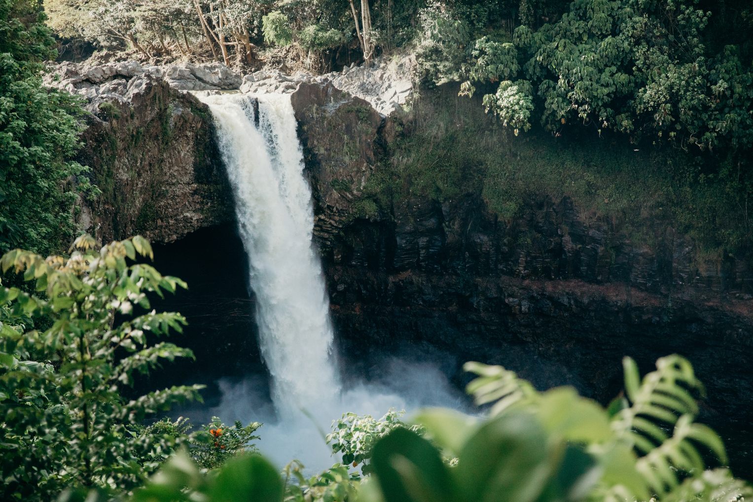
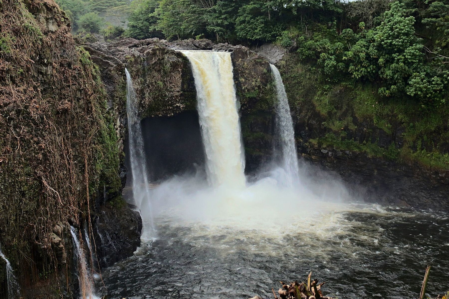
Waiānuenue (Rainbow Falls) pouring over a lava ledge into a misty pool framed by green rainforest
Robert Linsdell · CC BY 2.0
State park

Waiānuenue (Rainbow Falls) & Boiling Pots

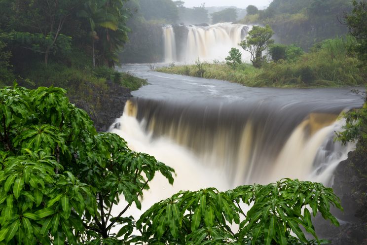
Both sit in Wailuku River State Park on Waiānuenue Avenue, a short drive from downtown. The 80-foot falls are named for the rainbows that form in the mist on many mornings. Farther upriver, the Boiling Pots are a chain of pools below Peʻepeʻe Falls that churn as if boiling, lined with columns of cooled basalt. You view both from lookouts. Neither area is safe for swimming.

  • Hours: daily 7:00 a.m.–5:30 p.m.; gates lock at 6:00 p.m.
  • Non-residents: $5 per person plus $10 per vehicle (one fee covers both areas); credit card only
  • Hawaiʻi residents: free with Hawaiʻi ID
DLNR State Parks page
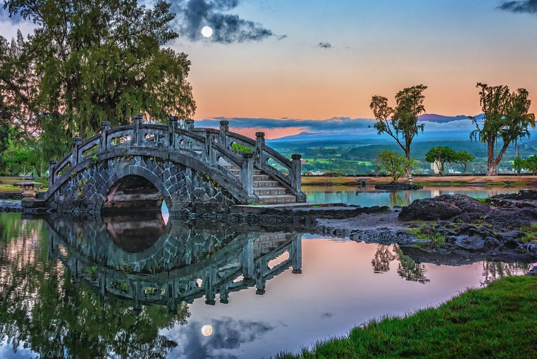
Arched bridge and trees reflected in a pond at Liliʻuokalani Gardens under a pink and blue sunset sky
Island of Hawaiʻi / Jay Takaaze
Free · County park

Liliʻuokalani Gardens

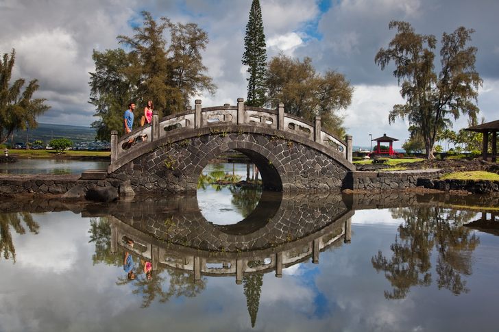
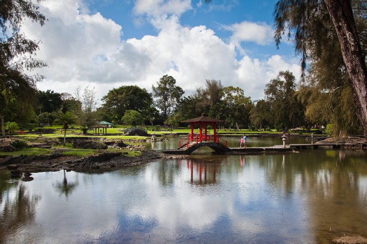
A 24.67-acre, Japanese-style garden on Banyan Drive with fishponds, arched bridges, stone lanterns, and a teahouse beside Hilo Bay. It was dedicated in 1917, is named for Queen Liliʻuokalani, and honors the island’s first Japanese immigrants who worked in the sugar fields. Try an early-morning walk, when the ponds are still.

The gardens sit at the end of Banyan Drive. Moku Ola (Coconut Island), just offshore, is closed while the County repairs its footbridge (details below).

  • Admission: free, open 24 hours
Friends of Liliʻuokalani Gardens
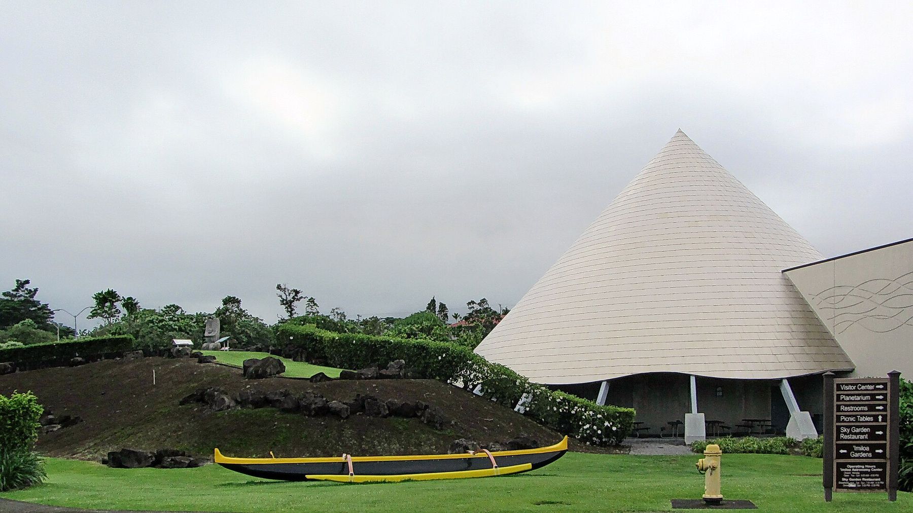
The white cone-shaped roofs of ʻImiloa Astronomy Center beyond a lawn and a native garden
Robert Linsdell · CC BY 2.0
Rainy-day pick

ʻImiloa Astronomy Center

At the University of Hawaiʻi at Hilo, ʻImiloa links Polynesian wayfinding with the astronomy done on Maunakea. It has Hawaiʻi Island’s only planetarium. Its three titanium-clad cones represent Maunakea, Maunaloa, and Hualālai. It is a good way to prepare for a Maunakea trip.

  • Hours: Tuesday–Sunday 9:00 a.m.–4:30 p.m.; closed Monday
  • Address: 600 ʻImiloa Place
ʻImiloa official site
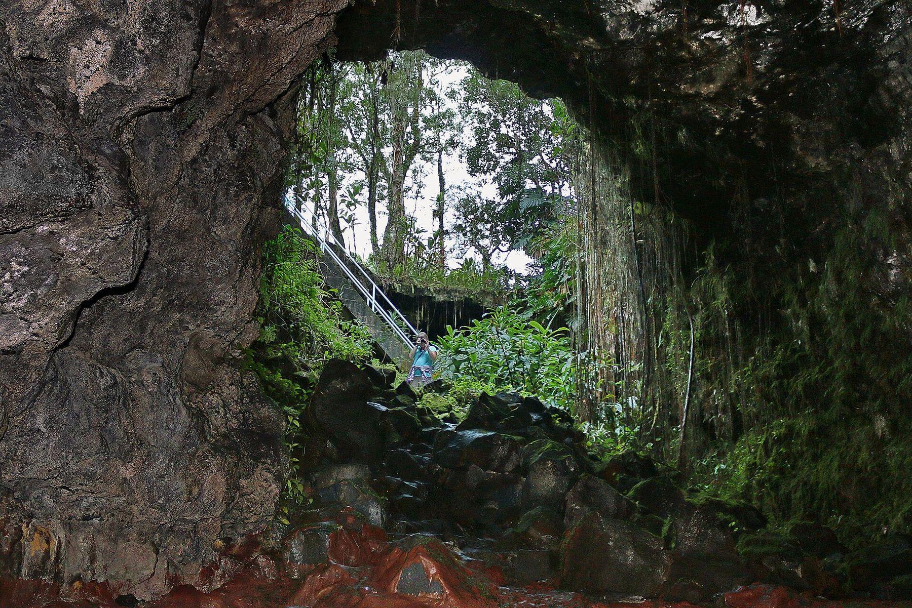
Looking out from inside the dark Kaūmana lava tube toward a skylight entrance draped in ferns and a stairway
Robert Linsdell · CC BY 2.0
Free · County park

Kaūmana Caves

A county park at 1568 Kaumana Drive (the road toward Saddle Road). Stairs lead down into a fern-filled skylight of a lava tube formed by Mauna Loa’s 1880–81 eruption, whose flow stopped short of downtown Hilo. It is unlit and has no walkway. Bring a flashlight, wear sturdy closed-toe shoes, and expect wet, uneven rock.

  • Facilities: restrooms, pavilion
County park listing

Downtown & the bayfront

Walk Kamehameha Avenue from the farmers market past galleries, aloha-wear shops, and the 1925 Palace Theatre. Nearby, the Lyman Museum includes a mission house built in 1839, and the East Hawaiʻi Cultural Center anchors Hilo’s art scene.

Panaʻewa Rainforest Zoo & Gardens

A 12-acre county zoo south of town, described as the only zoo in the U.S. set in a tropical rainforest. Open daily 10 a.m.–4 p.m. (last entry 3:30). It is closed the first Thursday of each month, Christmas, and New Year’s Day. Non-county residents: $13 adults, $5 ages 3–17. Zoo site

Hawaiʻi Tropical Botanical Garden

A botanical garden on the 4-mile Onomea Scenic Drive north of Hilo. It has more than a mile of trails and over 2,500 plant species, with streams, waterfalls, and views of Onomea Bay. Paths can be steep and slick, so wear good shoes and bring insect repellent. Tickets & hours

Downtown on the bayfront

The market and the museum

Two stops a few blocks apart on Kamehameha Avenue. Browse the market in the morning, then spend an hour learning why Hilo’s bayfront looks the way it does.

Daily · Downtown

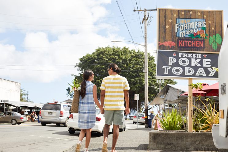
Hilo Farmers Market

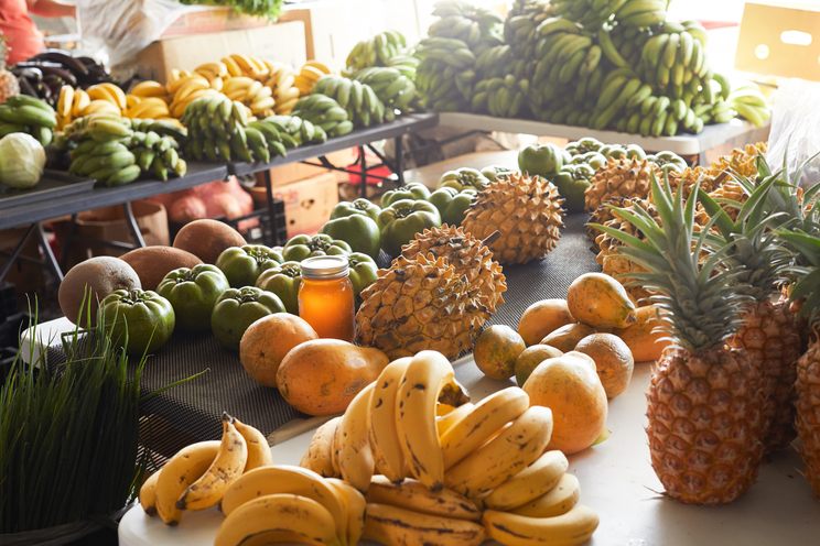
At the corner of Kamehameha Avenue and Mamo Street, stalls fill with tropical fruit, orchids and anthuriums, local coffee, baked treats, lei, and crafts. Wednesdays and Saturdays are the big market days, with the most vendors. Other days are smaller but still worth a stroll.

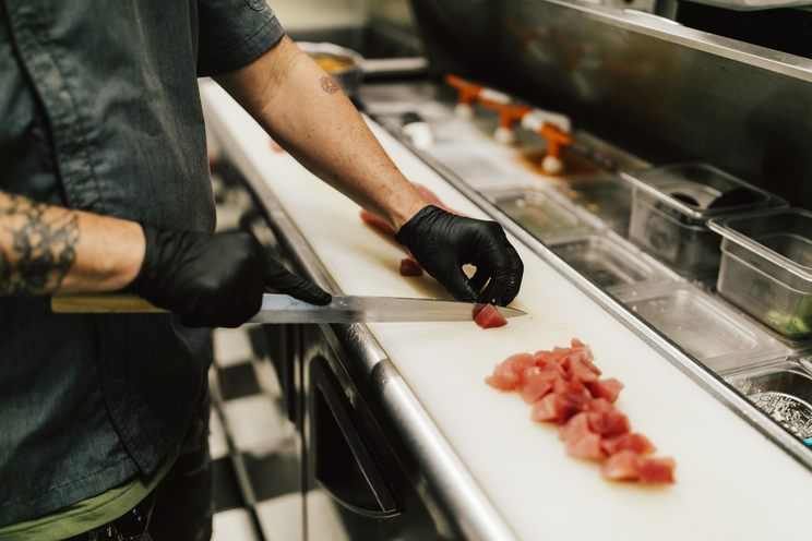
Poke is a Hilo staple, and ready-to-eat food is part of the fun: look for poke bowls and cut fruit to take down to the bayfront. Come early for the best choice, and bring small bills and a reusable bag.

  • Hours: daily 7:00 a.m.–3:00 p.m.
  • Big days: Wednesday & Saturday
Official market site
Glass deli case filled with trays of colorful poke and prepared foods
Poke and sides
Museum · Bayfront

Pacific Tsunami Museum

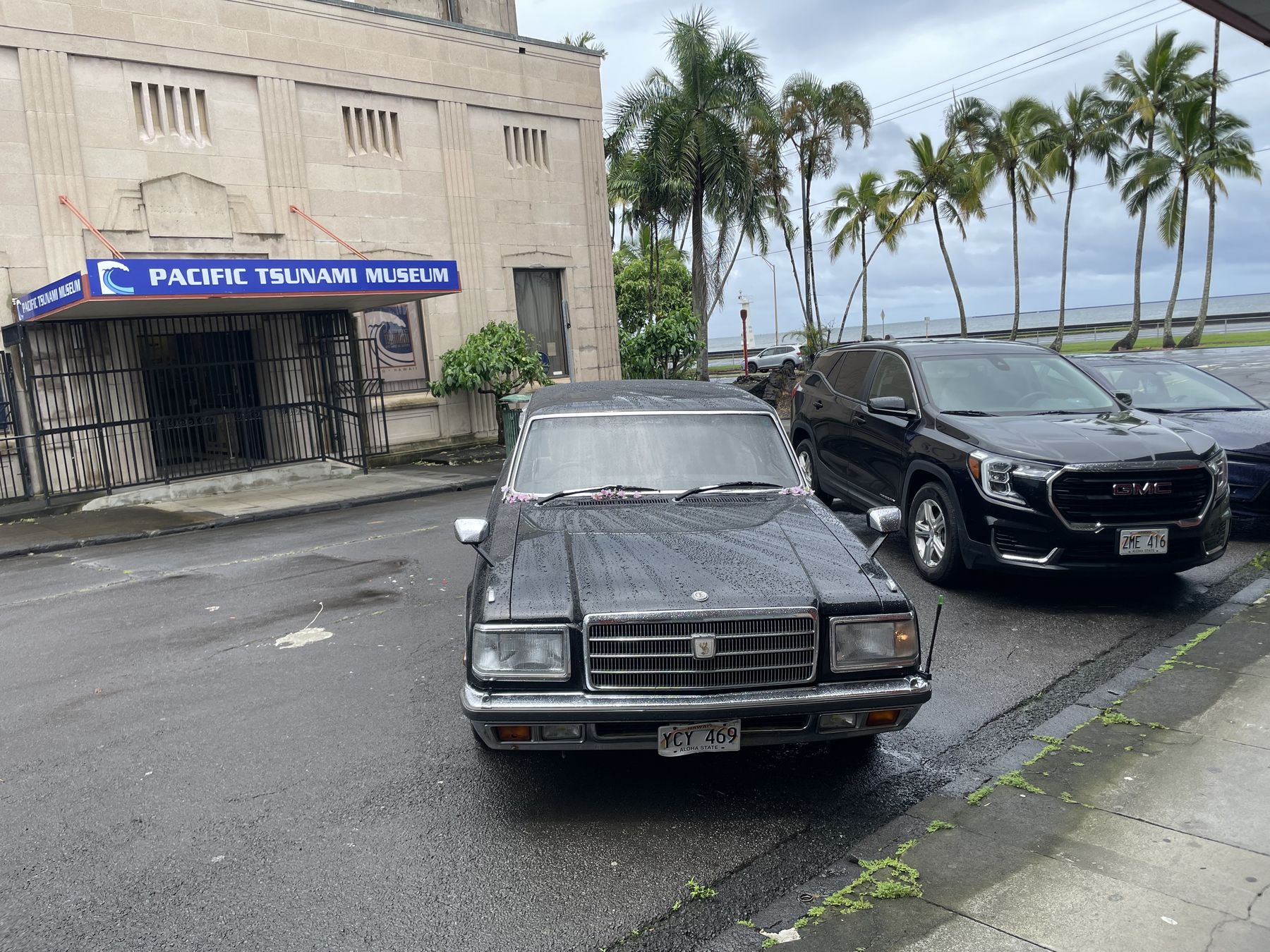
At 130 Kamehameha Avenue, this museum tells the story of the 1946 and 1960 tsunamis that devastated Hilo’s waterfront, through historic photos, archives, and survivor accounts. It also explains how tsunami warnings work and how to stay safe if one sounds. Its mission is simple: no one should die in a tsunami.

After a visit, the open lawns and parks along the bay make sense. They are what the town left as a buffer when it rebuilt farther inland.

From the museum’s site

Pacific Tsunami Museum hours and admission
Current hoursWeekends only, 10:00 a.m.–2:00 p.m. (limited schedule during museum revitalization)
General$15
Seniors 65+ / military$10
Youth 6–17$5
Kamaʻāina$5; kamaʻāina youth 17 and under free

Hours are reduced during the revitalization. Check tsunami.org before you go.

The stone facade of the Pacific Tsunami Museum with its blue sign, cars parked out front, and palm trees behind

Waiākea Peninsula

Banyan Drive: Hilo’s living walk of fame

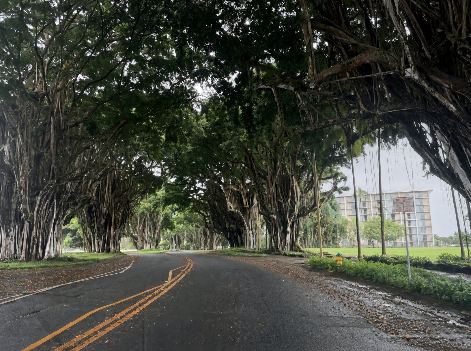
Banyan Drive loops around the Waiākea Peninsula on the east side of Hilo Bay, between the airport road and Liliʻuokalani Gardens. It is lined with about 50 banyan trees, most planted in the 1930s by famous visitors and local notables, and each marked with a small plaque naming who planted it. The trees have grown into a deep, shady canopy that is best seen on foot.

The tradition began in October 1933, when director Cecil B. DeMille and his cast, in Hilo to film Four Frightened People, planted the first trees. Planting continued through the 1930s, with a few more in later decades. Several of the original trees were lost to tsunamis and storms, and a few were replanted.

Banyan Drive in Hilo, a two-lane road with double yellow lines curving under an arching canopy of huge banyan trees with hanging aerial roots, a hotel and green lawn to the right
  • Babe RuthOctober 1933, in town for an exhibition game
  • Amelia EarhartJanuary 1935, days before her record solo flight from Honolulu to Oakland
  • Franklin D. RooseveltThe president’s 1934 visit prompted the first road through the trees
  • Richard & Pat NixonHe planted one as a senator in 1952. Pat replanted it in 1972 after it was lost to a storm.

Other planters include Louis Armstrong, Earl Warren, and volcanologist Thomas Jaggar. Some plaques and trees have gone missing over the years, which is part of the fun of the hunt.

Hotels on Banyan Drive

Most of Hilo’s larger hotels are on this peninsula, facing Hilo Bay or Reeds Bay. These are operating as of September 2026, per each hotel’s own site. Check directly for current rates and any storm-related changes.

Grand Naniloa Hotel Hilo

93 Banyan Drive · DoubleTree by Hilton

An oceanfront high-rise on Hilo Bay with bay-view rooms, a lobby bar, event spaces including the Crown Room, and live hula Wednesday–Sunday evenings. It is part of Hilton Honors.

Hilo Hawaiian Hotel

71 Banyan Drive · Castle Resorts

Managed by Castle Resorts. It has 286 rooms and suites, a pool, Bull Shed Restaurant, and Waiʻoli Lounge. It is the last hotel on the drive before Liliʻuokalani Gardens, across the water from Moku Ola.

SCP Hilo Hotel

126 Banyan Way

Formerly the Hilo Seaside Hotel, and before that the Hilo Hukilau. It has 128 rooms set around gardens, a pool, and a koi pond by Reeds Bay, with an eco-focused approach and complimentary bikes and paddleboards.

Hilo Reeds Bay Hotel

175 Banyan Drive

A modest oceanfront hotel on Reeds Bay with a pool, rooms with kitchenettes, and free parking, looking out toward the harbor. Its state land lease has expired, so confirm its status when you book.

What’s changing on the peninsula

Two former hotels are gone or going. Uncle Billy’s Hilo Bay Hotel was demolished, and its lot is now grass but still closed to the public. The shuttered Country Club Condominium Hotel is fenced off. In 2026 the state set aside funds to tear it down, and the Hawaiʻi Community Development Authority is leading a master-planning process for the peninsula.

Moku Ola (Coconut Island) is closed

The footbridge from Liliʻuokalani Gardens to Moku Ola partly collapsed in November 2025, and the island has been closed since. The County plans a temporary span first. The mayor has said he hopes to reopen it by mid-2027. A permanent replacement bridge would follow, with construction expected to start around 2029. Enjoy the view from shore and check County news for reopening.

Around the peninsula

Worth the short drive north

ʻAkaka Falls State Park

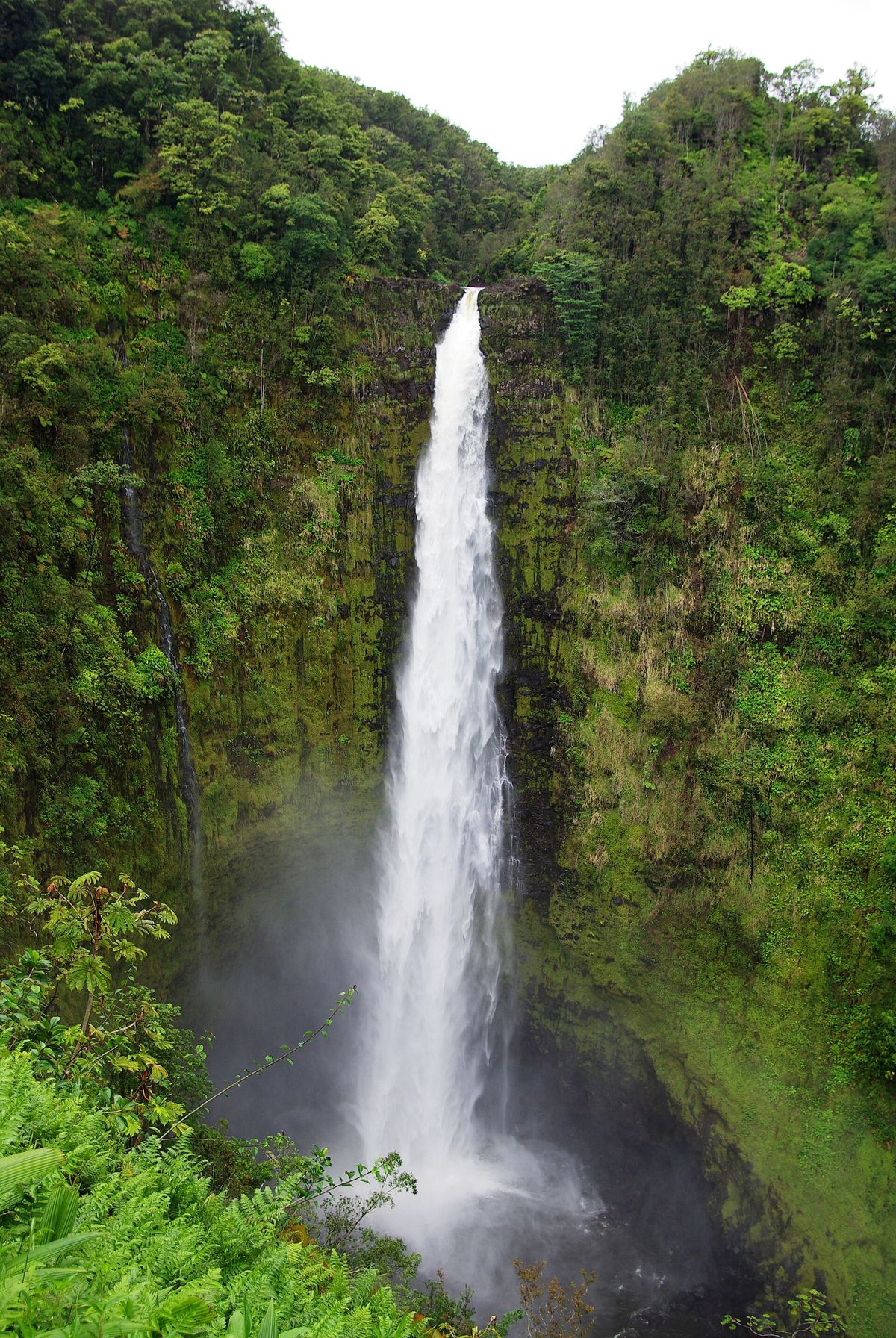
North of Hilo near Honomū, at the end of ʻAkaka Falls Road (Highway 220), a paved 0.4-mile loop winds through rainforest to lookouts over Kahuna Falls and ʻAkaka Falls, which drops 442 feet into a stream-cut gorge. The loop has steps and is not wheelchair accessible. To see ʻAkaka only, go left at the first junction.

Current DLNR details

ʻAkaka Falls State Park hours and fees
HoursDaily 8:30 a.m.–5:00 p.m.
Entry (non-residents)$5 per person; children 3 and under free
Parking (non-residents)$10 per non-commercial vehicle
Hawaiʻi residentsFree with Hawaiʻi ID or driver’s license
PaymentCredit card only. DLNR suggests paying before you arrive because cell reception at the park is limited.

Stay on the paved trail and behind railings. Check the DLNR ʻAkaka Falls page for closures before driving up.

ʻAkaka Falls, a tall ribbon of white water plunging down a sheer green cliff into a misty gorge
ʻAkaka Falls. Photo: Kate Ure · CC BY 2.0

Waterfall gallery

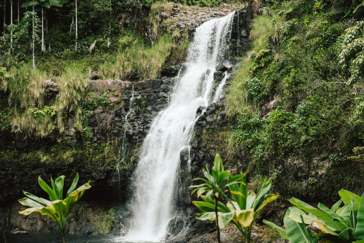
More falls around Hilo

Rain keeps Hilo’s rivers running year-round. The falls are at their fullest after wet spells, and that is exactly when the water is most dangerous. View from lookouts and stay out of streams after rain.

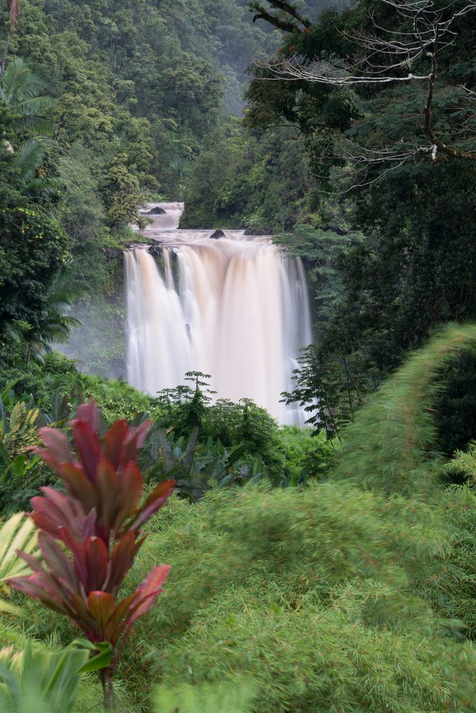
Kulaniapia Falls drops more than 120 feet on about 42 acres of private land, roughly 15 minutes from town. There is no access without an advance reservation, either a day pass or an overnight stay. Swimming is allowed only when staff say river conditions are safe.

Also in this guide: Waiānuenue and the Boiling Pots in Sights, and ʻAkaka and Kahuna Falls above. Gallery photos are from the Hawaiʻi Tourism Authority / Island of Hawaiʻi Visitors Bureau media library. Credits are in each caption.

Ocean time, Hilo style

Beach parks along Keaukaha

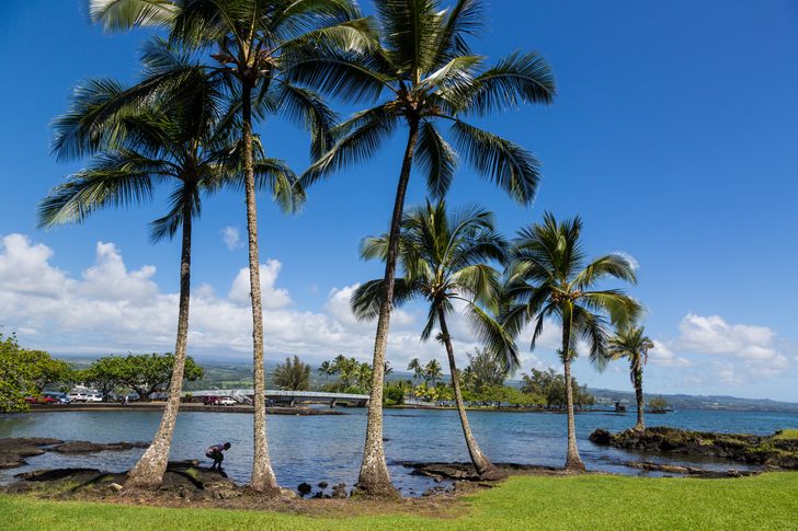
Hilo doesn’t have long, wide sandy beaches. It has lava-rock coves, spring-fed lagoons, and grassy beach parks strung along Kalanianaʻole Avenue east of the airport. Honu (green sea turtles) are often seen here. Give them space.

Conditions change quickly, and runoff after heavy rain can cloud the water. Swim near lifeguards, never turn your back on the ocean, and check hioceansafety.com before you go.

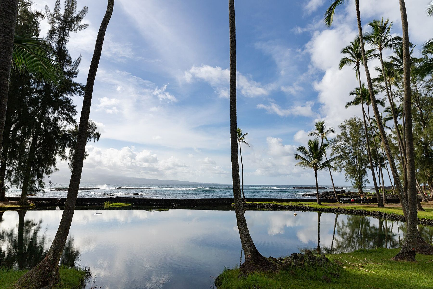
Calm lagoon with reflected palm trees and a grassy shore at Richardson Ocean Park
Richardson Ocean Park. Photo: dronepicr · CC BY 2.0
Richardson Ocean Park

The east side’s most popular snorkeling spot: a shallow, spring-fed bay with tide pools and black sand flecked with green olivine.

Restrooms, showers, picnic tables, lifeguard.
Carlsmith Beach Park

Locals call it “Four Mile.” It has large calm lagoons with a mostly smooth, sandy bottom, a lawn for picnics, and frequent honu sightings.

Restrooms, showers; lifeguard on weekends and holidays.
Onekahakaha Beach Park

A small, shallow, sand-bottomed pool protected by rocks. It is a family favorite and one of the safest places for keiki (kids) to swim on the Hilo coast.

Restrooms, showers, playground, lifeguard.

Hilo as a base

Three classic day trips

Hilo is the closest town to Kīlauea and a practical start for Maunakea. Our sister guides cover the national park and Maunakea in depth.

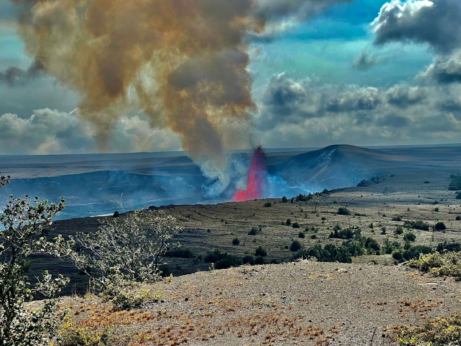
A red lava fountain erupting in Kīlauea’s summit caldera under a tall plume of brown volcanic gas, seen across scrubby rim terrain
~45 min · Hwy 11

Hawaiʻi Volcanoes National Park

About 30 miles southwest of Hilo. The park is open 24 hours, year-round. It has entry fees, and there is no public transportation inside the park.

  1. StartKīlauea Visitor Center for current eruption, trail, and air-quality updates.
  2. ExploreCrater Rim viewpoints over Halemaʻumaʻu, steam vents, and lava-tube and crater hikes.
  3. PackLayers and rain gear. The summit area sits well above Hilo and is usually cooler.
Volcano region guide
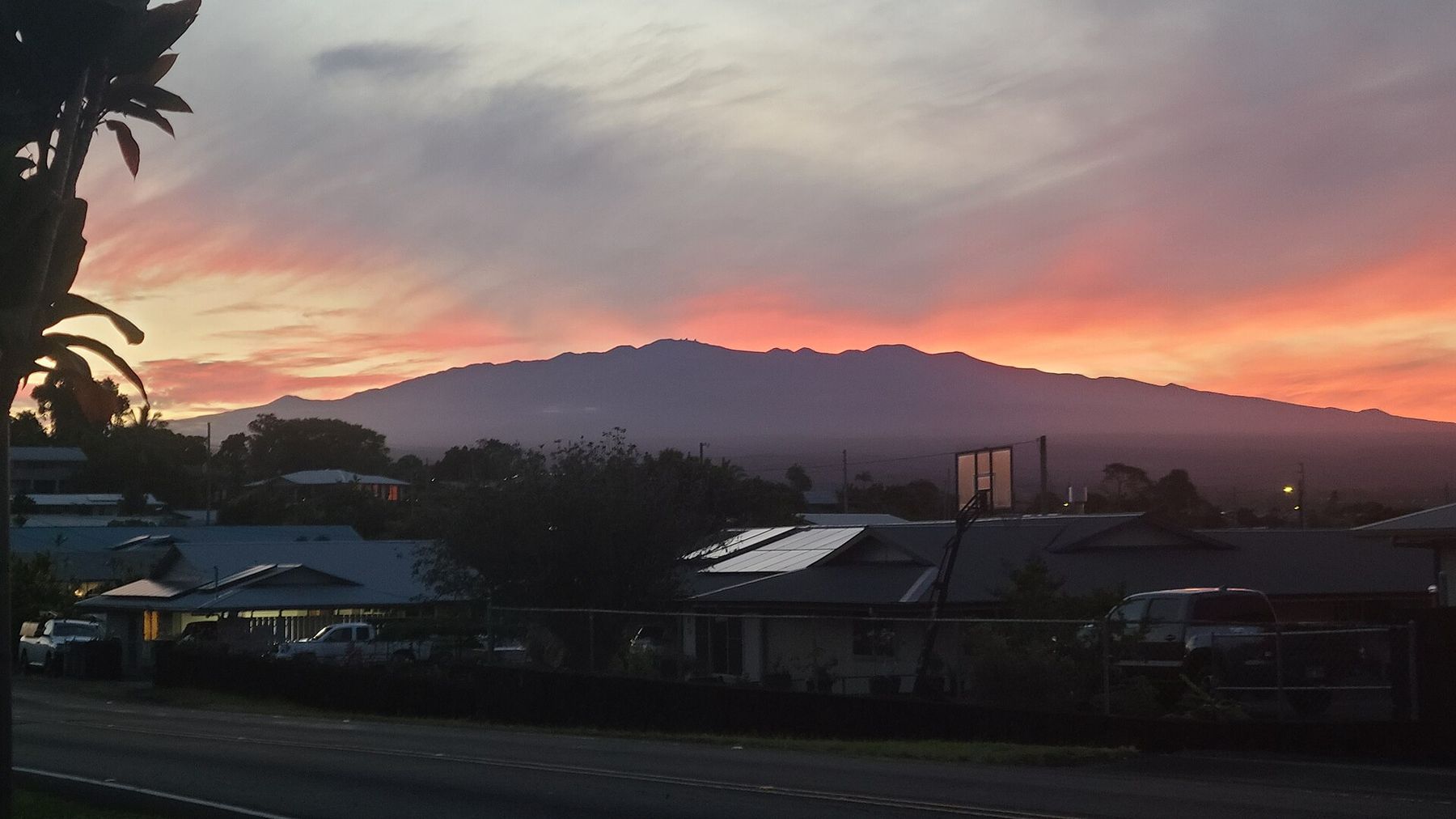
Maunakea silhouetted against an orange and pink sunset sky above Hilo rooftops
Maunakea at sunset from Hilo. Photo: Maplemoths · CC BY 4.0
Saddle Road · 9,200 ft

Maunakea Visitor Information Station

Take the Daniel K. Inouye Highway (Saddle Road) and turn onto Maunakea Access Road at milepost 28. The VIS is open daily 9 a.m.–9 p.m. when not closed for weather.

  1. AcclimateStop at the VIS first. Altitude is serious. Children under 13, pregnant visitors, and people in poor health should not go higher.
  2. Summit4WD is required above the VIS. The summit area closes 30 minutes after sunset.
  3. DressBring warm layers. It can be near freezing up there while Hilo is warm.
Maunakea region guide
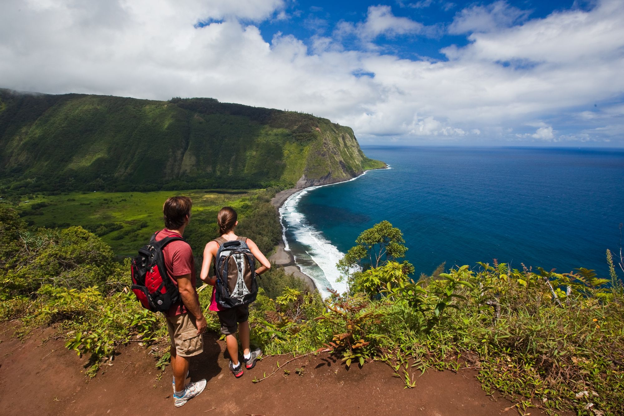
Two hikers at the Waipiʻo Valley lookout above the black-sand bay and sea cliffs
Waipiʻo Valley Lookout. Photo: HTA / Tor Johnson
Heading north · Hwy 19

Hāmākua Heritage Corridor

A scenic drive from Hilo toward the Waipiʻo Valley Lookout. It passes sea cliffs, gulches, waterfalls, and old plantation towns.

  1. OnomeaThe 4-mile Onomea Scenic Drive and the Hawaiʻi Tropical Botanical Garden.
  2. FallsʻAkaka Falls State Park near Honomū. There are also Umauma Falls views at World Botanical Gardens.
  3. CoastLaupāhoehoe Point, hit hard by the 1946 tsunami, and the Laupāhoehoe Train Museum (Mon–Sat 10 a.m.–2 p.m., Hwy 19 near mile marker 25), set in the old station agent’s house. Then Honokaʻa town and the Waipiʻo Valley Lookout. Check County notices for current access.
Hāmākua region guide

Practical info

Plan a Hilo trip that works

Plan for warm, wet weather, bring a car if you can, and leave slack in your schedule for showers.

Weather & rain

Hilo averages about 120 inches of rain a year, with measurable rain on roughly three days out of four. Every month gets substantial rain, often as passing showers, so build flexibility into outdoor plans. It stays warm year-round: average highs run about 78–83°F and lows about 64–70°F.

Average monthly rainfall (inches), NOAA NCEI 1991–2020 normals, Hilo International Airport.

When to go

Any time of year works. There is no truly dry season, so plan around your interests rather than the forecast. On NOAA averages, late spring and early summer are a bit less rainy, and November is the wettest month.

Merrie Monarch Festival: Hilo’s week-long celebration of hula begins on Easter Sunday. The 2027 festival runs March 28 – April 3. It includes a free exhibition night, the Miss Aloha Hula competition, group kahiko and ʻauana nights at Edith Kanakaʻole Stadium, a craft fair, and a Saturday parade downtown. Tickets for competition nights are limited, and rooms and rental cars fill up far ahead, so book early.

Merrie Monarch official site

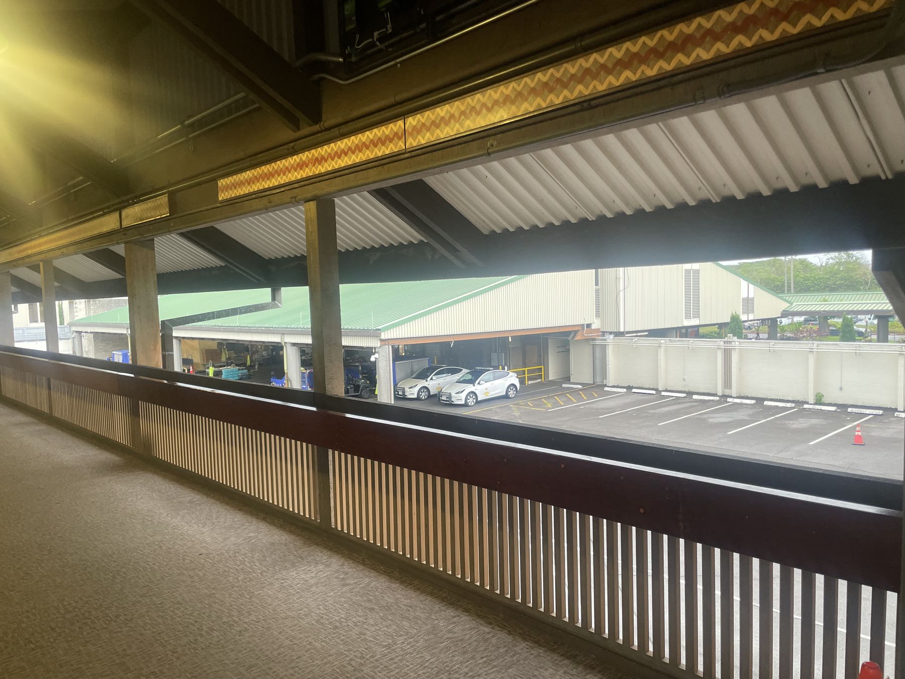
Covered open-air walkway at Hilo International Airport with wooden railings, looking out to a parking lot and green hills
Hilo International Airport’s open-air walkways
Getting thereHilo International Airport (ITO) is just east of downtown, close to Banyan Drive, and is served by interisland airlines. Many trans-Pacific flights land at Kona (KOA) on the west side, a cross-island drive away.
Getting aroundA rental car is the practical choice for waterfalls, beaches, and day trips. Pick one up at ITO or KOA. Rideshare is scarce in rural areas and inside the national park.
By busThe County’s Hele-On bus runs island-wide from Hilo, including a route that stops at Hawaiʻi Volcanoes National Park. Schedules change, so check the Hele-On site.
What to packA light rain jacket or umbrella, quick-dry clothes, shoes with grip for wet trails, mineral sunscreen, insect repellent, and a warm layer for Maunakea or the volcano.
Respect & safety

Visit as a guest

Hilo is home to a close-knit community, and its rivers, shoreline, and gardens are cared for by people who live here. Slow down, say aloha, and leave places better than you found them.

  • Streams can rise within minutes when it rains upslope, even under blue sky in town
  • Wildlife is protected. Give sea turtles (honu) at least 10 feet.
  • Parks and trails close for a reason. Please honor the signs.

Background: Carol M. Highsmith, Library of Congress · Public domain

Storms and flooding: heavy rain can close parks, roads, and attractions with little notice. During watches and warnings, follow Hawaiʻi County Civil Defense and the National Weather Service Honolulu. In an emergency, call 911.

Orientation

Hilo at a glance

Downtown and the bayfront sit at the center of the crescent. The Wailuku River runs west up Waiānuenue Avenue, and Banyan Drive and the Keaukaha beach parks sit to the east past the airport. ʻAkaka Falls and the Hāmākua Coast lie north.

The interactive map couldn’t load. Use the numbered list to open each stop in Google Maps.

Map data © OpenStreetMap contributors · Open larger map

Open each stop in maps

  1. Hilo Farmers MarketDowntown · Kamehameha Ave & Mamo St
  2. Pacific Tsunami MuseumDowntown bayfront
  3. Waiānuenue (Rainbow Falls)Wailuku River State Park
  4. Boiling PotsUpriver section, end of Peʻepeʻe Falls Dr
  5. Banyan DriveWaiākea Peninsula · celebrity banyans & hotels
  6. Liliʻuokalani GardensEnd of Banyan Drive
  7. ʻImiloa Astronomy CenterUH Hilo campus
  8. Richardson Ocean ParkKeaukaha · Kalanianaʻole Ave
  9. Kaūmana CavesKaumana Drive, upslope
  10. Panaʻewa Rainforest ZooSouth of town, Stainback Hwy
  11. ʻAkaka Falls State ParkNorth, near Honomū

Before you head out

Hours, fees, and access in Hilo can change with the weather. Check each official site on the day, and keep a flexible plan B. There’s always a museum, market, or garden nearby.

Hawaiʻi Island state parks